
Previsão:

Previsão de curto prazoprincipalmente seco. Warm (máx. 20°C no Domingo à tarde, mín 14°C no Domingo de manhã). o vento será geralmente fraco. | ||||||||||||||||||||||||
Domingo 2 | Segunda-feira 3 | Terça-feira 4 | ||||||||||||||||||||||
2 AM | 5 AM | 8 AM | 11 AM | 2 PM | 5 PM | 8 PM | 11 PM | 2 AM | 5 AM | 8 AM | 11 AM | 2 PM | 5 PM | 8 PM | 11 PM | 2 AM | 5 AM | 8 AM | 11 AM | 2 PM | 5 PM | 8 PM | 11 PM | |
Mapa da altura do Swell |  |  |  |  | 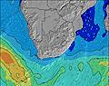 |  |  |  |  | |||||||||||||||
Swell Altura (m) Direção Período (s) | SE 11 | SE 12 | SE 12 | SE 12 | SE 12 | SE 12 | SE 12 | SE 11 | SE 11 | SE 11 | SE 11 | SE 11 | ESE 10 | SE 10 | SE 10 | ESE 10 | ESE 10 | ESE 10 | ESE 10 | ESE 10 | ESE 10 | ESE 10 | ESE 10 | ESE 10 |
Onda Gráfico | ||||||||||||||||||||||||
1518 | 2153 | 2327 | 2373 | 2389 | 2257 | 2080 | 1882 | 1654 | 1552 | 1388 | 1051 | 886 | 769 | 650 | 543 | 532 | 565 | 551 | 520 | 480 | 402 | 407 | 325 | |
Vento (km/h) | ||||||||||||||||||||||||
Estado do Vento maral cruzado-maral Cruzado cruzado-terral terral cristalino | cross-on | on | on | on | cross-on | cross-on | on | cross-on | cross-on | cross-on | cross-on | cross-on | cross-off | cross-off | glassy | cross-off | cross-off | cross-off | cross-off | off | off | off | cross-off | cross-off |
Maré Alta | 5:40AM1.84m | 6:02PM1.94m | 6:10AM1.79m | 6:34PM1.88m | 6:42AM1.71m | 7:10PM1.78m | ||||||||||||||||||
Maré Baixa | 11:41PM0.32m | 11:47AM0.23m | 00:11AM0.36m | 12:17PM0.28m | 00:44AM0.43m | 12:50PM0.37m | ||||||||||||||||||
— | 6:39 | — | — | — | — | — | — | — | 6:39 | — | — | — | — | — | — | — | 6:39 | — | — | — | — | — | — | |
— | — | — | — | — | 5:22 | — | — | — | — | — | — | — | 5:23 | — | — | — | — | — | — | — | 5:23 | — | — | |
mm | — | — | — | — | — | — | — | — | — | — | — | — | — | — | — | — | — | — | — | — | — | — | — | — |
Temp. °C | 14 | 13 | 14 | 19 | 20 | 19 | 18 | 17 | 17 | 16 | 16 | 20 | 20 | 19 | 18 | 17 | 17 | 16 | 16 | 20 | 20 | 20 | 19 | 18 |
Ressent. °C | 9 | 9 | 9 | 14 | 16 | 16 | 17 | 16 | 16 | 15 | 15 | 19 | 19 | 19 | 19 | 17 | 16 | 15 | 14 | 18 | 18 | 19 | 19 | 18 |
Swell 1 Altura (m) Direção Período (s) | SE 11 | SE 12 | SE 12 | SE 12 | SE 12 | SE 12 | SE 12 | SE 11 | SE 11 | SE 11 | SE 11 | SE 11 | ESE 10 | SE 10 | SE 10 | ESE 10 | ESE 10 | ESE 10 | ESE 10 | ESE 10 | ESE 10 | ESE 10 | ESE 10 | ESE 10 |
1518 | 2153 | 2327 | 2373 | 2389 | 2257 | 2080 | 1882 | 1654 | 1552 | 1388 | 1051 | 886 | 769 | 650 | 543 | 532 | 565 | 551 | 520 | 480 | 402 | 407 | 325 | |
Swell 2 Altura (m) Direção Período (s) | SSW 12 | S 16 | — | SSW 11 | SSW 11 | S 10 | S 10 | S 10 | S 10 | S 10 | S 10 | S 10 | S 10 | S 10 | S 10 | S 10 | SSW 14 | SSW 14 | SSW 13 | SSW 13 | SSW 13 | SSW 12 | SW 12 | ENE 5 |
30 | 5 | — | 12 | 46 | 19 | 18 | 18 | 17 | 31 | 17 | 17 | 31 | 16 | 17 | 8 | 21 | 18 | 17 | 17 | 17 | 15 | 6 | 24 | |
Swell 3 Altura (m) Direção Período (s) | — | — | — | — | SW 18 | S 14 | S 13 | S 13 | S 12 | S 13 | S 15 | SSW 16 | SSW 16 | SSW 16 | SSW 15 | SSW 15 | S 10 | — | S 10 | S 11 | S 11 | — | S 12 | SW 12 |
— | — | — | — | 12 | 15 | 14 | 13 | 12 | 3 | 4 | 26 | 25 | 25 | 21 | 21 | 8 | — | 2 | 2 | 2 | — | 3 | 6 | |
Ondas de vento Altura (m) Direção Período (s) | SW 4 | WSW 4 | SSW 11 | — | SSW 5 | — | — | — | — | — | — | — | — | — | — | — | — | — | — | NNE 3 | NE 3 | ENE 4 | ENE 4 | NE 5 |
45 | 24 | 13 | — | 74 | — | — | — | — | — | — | — | — | — | — | — | — | — | — | 3 | 2 | 12 | 32 | 55 | |
Terral ou glassy mais perto | ||||||||||||||||||||||||
Distância (km) | 1 | 3 | 3 | 3 | 712 | 216 | 2 | 2 | 1 | 1 | 1 | 3 | 0 | 0 | 0 | 0 | 0 | 0 | 0 | 0 | 0 | 0 | 5 | 0 |
Melhor previsões de ondas em Durban/KwaZulu-Natal South Coast | ||||||||||||||||||||||||
Melhor previsões de ondas em South Africa | ||||||||||||||||||||||||
Buscador de Ondas Global | ||||||||||||||||||||||||
- Map Icons:
 Break
Break Live Wave Height (m)
 Live Wind Speed (km/h)
 Surf Rating (10 Max)
 Ocean Swells (m)
- Wind Speed (km/h)
widget de graça do Surf-Forecast.com para o seu site
O relatório de surf / widget do tempo abaixo está disponível para incorporar em sites de terceiros gratuitamente e fornece um resumo das nossas Reunion surf tempo. Simplesmente pegar o trecho de código html que fornecemos e colá-lo em seu próprio site. Você pode escolher seu idioma preferido e unidades métrico/imperial para o surf tempo de alimentação para atender aos usuários do seu site.... Clique aqui para adquirir o código.
 Nearest