
Previsão:

Previsão de curto prazoprincipalmente seco. Warm (máx. 24°C na Quarta de manhã, mín 21°C na Qui à noite). principalmente ventos frescos. | ||||||||||||||||||||||||
Quar 15 | Quinta-feira 16 | Sexta-feira 17 | Sáb 18 | |||||||||||||||||||||
10 AM | 1 PM | 4 PM | 7 PM | 10 PM | 1 AM | 4 AM | 7 AM | 10 AM | 1 PM | 4 PM | 7 PM | 10 PM | 1 AM | 4 AM | 7 AM | 10 AM | 1 PM | 4 PM | 7 PM | 10 PM | 1 AM | 4 AM | 7 AM | |
Mapa da altura do Swell | 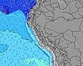 |  | 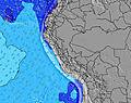 | 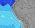 |  | 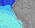 | 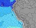 | 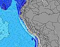 | 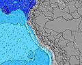 | |||||||||||||||
Swell Altura (m) Direção Período (s) | WNW 12 | SW 20 | SW 20 | SW 20 | NW 11 | SW 12 | NW 11 | NW 11 | NW 11 | NW 11 | SW 22 | SW 22 | SW 21 | SW 21 | SW 21 | SW 21 | SW 16 | SSW 13 | SSW 4 | SSW 12 | SW 19 | SW 18 | NW 10 | SW 19 |
Onda Gráfico | ||||||||||||||||||||||||
17 | 16 | 16 | 16 | 5 | 169 | 5 | 5 | 5 | 5 | 18 | 18 | 18 | 18 | 18 | 17 | 41 | 0 | 17 | 0 | 57 | 53 | 4 | 55 | |
Vento (km/h) | ||||||||||||||||||||||||
Estado do Vento maral cruzado-maral Cruzado cruzado-terral terral cristalino | cross-off | cross | cross | cross-off | cross-off | cross-off | cross-off | cross-off | cross-off | cross | cross | cross-off | cross-off | cross-off | cross-off | cross-off | cross-off | cross | cross | cross-off | cross-off | cross-off | cross-off | cross-off |
Maré Alta | 4:31PM1.53m | 5:20AM1.74m | 5:21PM1.52m | 6:06AM1.74m | 6:11PM1.48m | 6:50AM1.69m | ||||||||||||||||||
Maré Baixa | 10:39AM0.15m | 10:49PM-0.21m | 11:29AM0.11m | 11:36PM-0.18m | 12:18PM0.10m | 00:22AM-0.10m | ||||||||||||||||||
6:33 | — | — | — | — | — | 6:33 | — | — | — | — | — | — | — | 6:33 | — | — | — | — | — | — | — | 6:33 | — | |
— | — | 6:27 | — | — | — | — | — | — | — | 6:27 | — | — | — | — | — | — | — | 6:27 | — | — | — | — | 6:27 | |
mm | — | — | — | — | — | — | — | — | — | — | — | — | — | — | — | — | — | — | — | — | — | — | — | — |
Temp. °C | 24 | 24 | 23 | 22 | 22 | 23 | 22 | 22 | 24 | 24 | 23 | 22 | 22 | 22 | 21 | 21 | 24 | 23 | 23 | 22 | 21 | 22 | 21 | 21 |
Ressent. °C | 23 | 22 | 21 | 22 | 22 | 23 | 22 | 22 | 23 | 22 | 21 | 21 | 22 | 21 | 20 | 20 | 24 | 21 | 21 | 22 | 20 | 21 | 20 | 20 |
Swell 1 Altura (m) Direção Período (s) | SSW 13 | SSW 13 | SSW 13 | SSW 14 | SSW 12 | SSW 14 | SSW 13 | SSW 13 | SSW 13 | SSW 13 | SSW 13 | SSW 13 | SSW 13 | SSW 13 | SSW 13 | SSW 13 | SSW 13 | SSW 13 | SSW 13 | SSW 12 | SSW 12 | SSW 12 | SSW 12 | SSW 12 |
700 | 659 | 680 | 731 | 247 | 633 | 734 | 781 | 793 | 892 | 690 | 669 | 669 | 679 | 690 | 769 | 643 | 633 | 534 | 405 | 426 | 419 | 467 | 482 | |
Swell 2 Altura (m) Direção Período (s) | WNW 12 | NW 11 | NW 11 | NW 11 | SSW 14 | SW 12 | NW 11 | NW 11 | NW 11 | NW 11 | NW 11 | NW 11 | NW 11 | NW 11 | NW 11 | NW 10 | S 16 | S 16 | S 16 | S 14 | S 15 | S 15 | SW 18 | SW 19 |
13 | 5 | 5 | 5 | 362 | 169 | 5 | 5 | 5 | 5 | 5 | 5 | 4 | 4 | 4 | 4 | 81 | 81 | 119 | 250 | 157 | 106 | 86 | 55 | |
Swell 3 Altura (m) Direção Período (s) | SW 21 | SW 20 | SW 20 | SW 20 | NW 11 | NW 11 | SSW 19 | — | — | — | SW 22 | SW 22 | SW 21 | SW 21 | SW 21 | SW 21 | SW 16 | SSW 20 | SSW 20 | SSW 20 | SW 19 | SW 18 | NW 10 | NW 10 |
17 | 16 | 16 | 16 | 5 | 5 | 37 | — | — | — | 18 | 18 | 18 | 18 | 18 | 17 | 41 | 37 | 38 | 38 | 57 | 53 | 4 | 4 | |
Ondas de vento Altura (m) Direção Período (s) | — | S 4 | SSW 4 | SSW 4 | S 4 | — | — | — | — | — | SSW 4 | SSW 4 | S 4 | S 5 | S 5 | S 5 | S 5 | SSW 5 | SSW 4 | SSW 4 | SSW 5 | S 5 | S 5 | S 5 |
— | 9 | 10 | 16 | 16 | — | — | — | — | — | 22 | 31 | 33 | 27 | 27 | 21 | 15 | 17 | 17 | 33 | 35 | 37 | 31 | 25 | |
Terral ou glassy mais perto | ||||||||||||||||||||||||
Distância (km) | 60 | 947 | 659 | 659 | 581 | 49 | 49 | 14 | 51 | 942 | 965 | 659 | 456 | 51 | 51 | 49 | 51 | 965 | 965 | 267 | 267 | 51 | 49 | 49 |
Melhor previsões de ondas em Piura | ||||||||||||||||||||||||
Melhor previsões de ondas em Peru | ||||||||||||||||||||||||
Buscador de Ondas Global | ||||||||||||||||||||||||
- Map Icons:
 Break
Break Live Wave Height (m)
 Live Wind Speed (km/h)
 Surf Rating (10 Max)
 Ocean Swells (m)
- Wind Speed (km/h)
widget de graça do Surf-Forecast.com para o seu site
O relatório de surf / widget do tempo abaixo está disponível para incorporar em sites de terceiros gratuitamente e fornece um resumo das nossas Punta Arena surf tempo. Simplesmente pegar o trecho de código html que fornecemos e colá-lo em seu próprio site. Você pode escolher seu idioma preferido e unidades métrico/imperial para o surf tempo de alimentação para atender aos usuários do seu site.... Clique aqui para adquirir o código.
 Nearest