
Previsão:

Previsão de curto prazochuviscos (total 4mm), principalmente caindo na Terça de manhã. Warm (máx. 30°C na Qui de manhã, mín 26°C na Terça à noite). o vento será geralmente fraco. | ||||||||||||||||||||||||
Ter 14 | Quarta-feira 15 | Quinta-feira 16 | Sex 17 | |||||||||||||||||||||
10 AM | 1 PM | 4 PM | 7 PM | 10 PM | 1 AM | 4 AM | 7 AM | 10 AM | 1 PM | 4 PM | 7 PM | 10 PM | 1 AM | 4 AM | 7 AM | 10 AM | 1 PM | 4 PM | 7 PM | 10 PM | 1 AM | 4 AM | 7 AM | |
Mapa da altura do Swell | 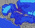 | 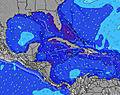 | 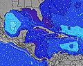 | 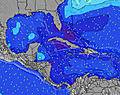 | 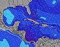 | 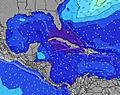 | 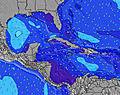 | 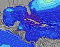 | 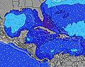 | |||||||||||||||
Swell Altura (m) Direção Período (s) | NE 7 | ESE 8 | ESE 8 | ESE 8 | ESE 8 | ESE 8 | ESE 8 | ESE 8 | ESE 8 | ESE 8 | ESE 8 | ESE 9 | ESE 9 | ESE 9 | ESE 9 | ESE 9 | ESE 9 | ESE 9 | ESE 9 | ESE 9 | ESE 8 | ESE 8 | ESE 8 | ESE 8 |
Onda Gráfico | ||||||||||||||||||||||||
91 | 67 | 85 | 71 | 75 | 75 | 235 | 267 | 125 | 149 | 134 | 141 | 144 | 144 | 106 | 106 | 116 | 354 | 141 | 168 | 164 | 137 | 103 | 127 | |
Vento (km/h) | ||||||||||||||||||||||||
Estado do Vento maral cruzado-maral Cruzado cruzado-terral terral cristalino | cross-on | cross-on | cross-on | cross | cross | cross | cross | cross | cross-on | cross-on | cross-on | cross | cross | cross | cross | cross | cross | cross | cross | cross | cross | cross | cross-on | cross-on |
Maré Alta | 8:44AM0.21m | 9:47PM0.41m | 9:42AM0.22m | 10:30PM0.39m | 10:40AM0.23m | 11:12PM0.37m | ||||||||||||||||||
Maré Baixa | 2:36PM-0.01m | 4:33AM0.08m | 3:29PM0.02m | 5:17AM0.08m | 4:22PM0.06m | 5:59AM0.08m | ||||||||||||||||||
5:37 | — | — | — | — | — | 5:37 | — | — | — | — | — | — | — | 5:37 | — | — | — | — | — | — | — | 5:37 | — | |
— | — | 6:45 | — | — | — | — | — | — | — | 6:45 | — | — | — | — | — | — | — | 6:45 | — | — | — | — | 6:45 | |
mm | 1 | 1 | 1 | — | — | — | — | — | — | — | — | — | — | — | — | — | — | — | — | — | — | — | — | 1 |
Temp. °C | 29 | 29 | 29 | 27 | 27 | 27 | 26 | 27 | 29 | 29 | 29 | 27 | 26 | 26 | 26 | 27 | 29 | 30 | 29 | 27 | 26 | 26 | 26 | 27 |
Ressent. °C | 31 | 32 | 33 | 30 | 31 | 30 | 28 | 29 | 30 | 31 | 31 | 31 | 29 | 28 | 28 | 30 | 31 | 31 | 30 | 29 | 28 | 28 | 28 | 29 |
Swell 1 Altura (m) Direção Período (s) | NE 7 | NE 7 | ESE 8 | ESE 8 | NE 6 | NE 6 | NE 7 | NE 7 | NE 7 | ESE 8 | ESE 8 | ESE 9 | ESE 9 | ESE 9 | ESE 9 | ESE 9 | NE 7 | NE 6 | NE 6 | ESE 9 | ESE 8 | ESE 8 | ESE 8 | ESE 8 |
91 | 63 | 85 | 71 | 43 | 68 | 99 | 91 | 88 | 149 | 134 | 141 | 144 | 144 | 106 | 106 | 63 | 70 | 66 | 168 | 164 | 137 | 103 | 127 | |
Swell 2 Altura (m) Direção Período (s) | ESE 8 | ESE 8 | — | NE 6 | ESE 8 | ESE 8 | ESE 8 | ESE 8 | — | NE 7 | NE 6 | NE 6 | NE 6 | NE 6 | NE 6 | NE 6 | ESE 9 | ESE 9 | — | NE 6 | NE 6 | NE 6 | NE 6 | NE 6 |
69 | 67 | — | 45 | 75 | 75 | 76 | 96 | — | 63 | 39 | 29 | 27 | 26 | 29 | 51 | 116 | 116 | — | 64 | 45 | 45 | 31 | 31 | |
Swell 3 Altura (m) Direção Período (s) | — | — | — | — | — | — | — | — | — | — | — | — | — | — | — | — | — | — | — | — | — | — | — | — |
— | — | — | — | — | — | — | — | — | — | — | — | — | — | — | — | — | — | — | — | — | — | — | — | |
Ondas de vento Altura (m) Direção Período (s) | — | — | NE 6 | — | — | — | ESE 8 | ESE 8 | ESE 8 | — | — | — | — | — | — | — | — | ESE 9 | ESE 9 | — | — | — | — | — |
— | — | 47 | — | — | — | 235 | 267 | 125 | — | — | — | — | — | — | — | — | 354 | 141 | — | — | — | — | — | |
Terral ou glassy mais perto | ||||||||||||||||||||||||
Distância (km) | 413 | 1073 | 1073 | 1073 | 413 | 20 | 20 | 413 | 854 | 799 | 927 | 798 | 413 | 413 | 20 | 413 | 978 | 927 | 830 | 1073 | 20 | 20 | 413 | 413 |
Melhor previsões de ondas em Jamaica | ||||||||||||||||||||||||
Melhor previsões de ondas em Jamaica | ||||||||||||||||||||||||
Buscador de Ondas Global | ||||||||||||||||||||||||
- Map Icons:
 Break
Break Live Wave Height (m)
 Live Wind Speed (km/h)
 Surf Rating (10 Max)
 Ocean Swells (m)
- Wind Speed (km/h)
widget de graça do Surf-Forecast.com para o seu site
O relatório de surf / widget do tempo abaixo está disponível para incorporar em sites de terceiros gratuitamente e fornece um resumo das nossas Navy Island surf tempo. Simplesmente pegar o trecho de código html que fornecemos e colá-lo em seu próprio site. Você pode escolher seu idioma preferido e unidades métrico/imperial para o surf tempo de alimentação para atender aos usuários do seu site.... Clique aqui para adquirir o código.
 Nearest