

- Forecast
- Maps
- Live
- Weather State
- Spot Information

Surf Forecasts
Reef
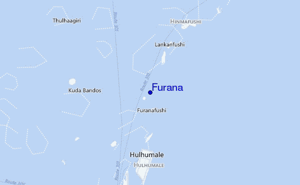
Furana surf Forecast / North Male Atoll / Maldives
48hr Weather and Surf, issued 10 pm Saturday 04 May 2024 +05
Forecast update in hr min s Update imminent
Furana surf forecast is for near shore open water. Breaking waves will often be smaller at less exposed spots.
Today's Furana sea temperature is 30.8°C (Statistics for 04 May 1981-2005 - mean: 29.7 °C max: 31.2 °C min: 28.6 °C)
- Map Icons:
 Break
Break Live Wave Height (m)
 Live Wind Speed (km/h)
 Surf Rating (10 Max)
 Ocean Swells (m)
- Wind Speed (km/h)
Furana surf forecast is for near shore open water. Breaking waves will often be smaller at less exposed spots.
Today's Furana sea temperature is 30.8°C (Statistics for 04 May 1981-2005 - mean: 29.7 °C max: 31.2 °C min: 28.6 °C)
How big are the waves at Furana today?
The current surf forecast for Furana at 12AM is: 2.0m 18s primary swell from a South-southwest direction and 0.7m 8s secondary swell from a South-southeast direction (forecast issued at 10:00pm May 04). The wind direction is predicted to be cross-offshore and the swell rating is 5.
| Time (+05) & Date | Wave Height | Wave Period |
|---|---|---|
| Morning (05 May) | 6ft (1.9m) | 17s |
| Afternoon (05 May) | 5.5ft (1.7m) | 16s |
| Evening (05 May) | 5.5ft (1.7m) | 16s |
Table - waves today at Furana. (Swell directed towards the surf break)
Updates in hr min s Update imminent
Sat 04 | Sunday 05 | Monday 06 | Tuesday 07 | Wednesday 08 | Thursday 09 | Friday 10 | Saturday 11 | Sun 12 | ||||||||||||||||||||||||||||||||||||||||||||||||||||
| 8 PM | 11 PM | 2 AM | 5 AM | 8 AM | 11 AM | 2 PM | 5 PM | 8 PM | 11 PM | 2 AM | 5 AM | 8 AM | 11 AM | 2 PM | 5 PM | 8 PM | 11 PM | 2 AM | 5 AM | 8 AM | 11 AM | 2 PM | 5 PM | 8 PM | 11 PM | 2 AM | 5 AM | 8 AM | 11 AM | 2 PM | 5 PM | 8 PM | 11 PM | 2 AM | 5 AM | 8 AM | 11 AM | 2 PM | 5 PM | 8 PM | 11 PM | 2 AM | 5 AM | 8 AM | 11 AM | 2 PM | 5 PM | 8 PM | 11 PM | 2 AM | 5 AM | 8 AM | 11 AM | 2 PM | 5 PM | 8 PM | 11 PM | 2 AM | 5 AM | |
Rating (10 max) | ||||||||||||||||||||||||||||||||||||||||||||||||||||||||||||
Swell Height Map |   |   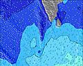 | 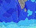 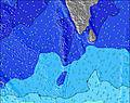 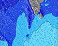 |    |  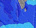 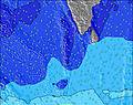 | 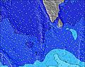 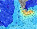  |    | 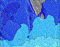 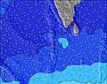 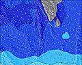 | 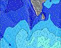 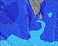 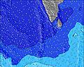 | |||||||||||||||||||||||||||||||||||||||||||||||||||
| Wave Height (m) & direction (?) | ||||||||||||||||||||||||||||||||||||||||||||||||||||||||||||
| Period(s) (?) | 18 | 18 | 18 | 17 | 17 | 16 | 16 | 16 | 16 | 16 | 15 | 15 | 14 | 14 | 14 | 14 | 14 | 14 | 14 | 14 | 13 | 13 | 13 | 13 | 13 | 13 | 13 | 13 | 16 | 16 | 15 | 15 | 15 | 15 | 15 | 14 | 14 | 14 | 14 | 14 | 14 | 14 | 13 | 13 | 13 | 13 | 13 | 13 | 13 | 13 | 13 | 13 | 13 | 12 | 12 | 12 | 12 | 12 | 12 | 9 |
Wave (?)Graph | ||||||||||||||||||||||||||||||||||||||||||||||||||||||||||||
| Energy (?) | 2522 | 2411 | 2462 | 2434 | 2040 | 1672 | 1447 | 1429 | 1411 | 1245 | 1051 | 811 | 789 | 687 | 687 | 594 | 594 | 425 | 452 | 272 | 261 | 257 | 257 | 253 | 222 | 178 | 242 | 235 | 354 | 452 | 413 | 397 | 468 | 580 | 669 | 660 | 557 | 534 | 519 | 504 | 497 | 415 | 408 | 402 | 331 | 331 | 307 | 246 | 242 | 242 | 246 | 192 | 189 | 160 | 152 | 150 | 150 | 147 | 147 | 109 |
Wind (km/h) | ||||||||||||||||||||||||||||||||||||||||||||||||||||||||||||
| Wind State (?) onshore cross-onshore cross-shore cross-offshore offshore glassy | cross- off | cross- off | cross- off | cross- off | cross- off | cross- off | cross- off | cross- off | cross- off | cross- off | cross- off | cross- off | cross- off | cross- off | cross- off | cross- off | cross- off | cross- off | cross- off | cross- off | cross- off | cross- off | cross- off | cross- off | cross- off | cross- off | cross- off | cross- off | cross- off | off | off | off | cross- off | cross- off | cross- off | cross- off | cross- off | cross- off | off | off | off | cross- off | cross- off | off | off | off | off | cross- off | cross | cross | cross- off | cross- off | cross- off | cross- off | cross- off | cross- off | cross- off | cross- off | cross- off | cross- off |
High Tide / height (m) | 10:39PM 0.73 | 11:43AM 0.82 | 11:18PM 0.75 | 12:20PM 0.93 | 11:54PM 0.76 | 12:56PM 0.99 | 12:27AM 0.76 | 1:31PM 1.02 | 1:00AM 0.75 | 2:05PM 1.01 | 1:33AM 0.73 | 2:39PM 0.97 | 2:05AM 0.70 | 3:13PM 0.90 | 2:37AM 0.66 | |||||||||||||||||||||||||||||||||||||||||||||
Low Tide / height (m) | 5:08AM 0.20 | 5:44PM 0.34 | 5:38AM 0.11 | 6:27PM 0.31 | 6:08AM 0.03 | 7:04PM 0.28 | 6:40AM -0.03 | 7:38PM 0.26 | 7:12AM -0.05 | 8:10PM 0.26 | 7:45AM -0.05 | 8:41PM 0.27 | 8:17AM -0.01 | 9:14PM 0.29 | ||||||||||||||||||||||||||||||||||||||||||||||
Sat 04 | Sunday 05 | Monday 06 | Tuesday 07 | Wednesday 08 | Thursday 09 | Friday 10 | Saturday 11 | Sun 12 | ||||||||||||||||||||||||||||||||||||||||||||||||||||
| Sunrise | - | - | - | - | 5:54 | - | - | - | - | - | - | - | 5:52 | - | - | - | - | - | - | - | 5:52 | - | - | - | - | - | - | - | 5:52 | - | - | - | - | - | - | - | 5:52 | - | - | - | - | - | - | - | 5:52 | - | - | - | - | - | - | - | 5:52 | - | - | - | - | - | - | - |
| Sunset | - | - | - | - | - | - | - | 6:09 | - | - | - | - | - | - | - | 6:10 | - | - | - | - | - | - | - | 6:10 | - | - | - | - | - | - | - | 6:10 | - | - | - | - | - | - | - | 6:10 | - | - | - | - | - | - | - | 6:10 | - | - | - | - | - | - | - | 6:10 | - | - | - | - |
Rain (mm) | - | - | 1 | - | - | - | - | - | - | - | - | - | - | 1 | - | 1 | - | 1 | 1 | - | - | - | 1 | 1 | - | 1 | 1 | 1 | 1 | 1 | 1 | - | 2 | 1 | 3 | 2 | 4 | 3 | 1 | - | - | - | - | 2 | - | 2 | - | 2 | 2 | 1 | - | - | - | - | 1 | 5 | 7 | 1 | - | 2 |
| Temp. °C | 30 | 29 | 29 | 29 | 29 | 29 | 30 | 30 | 30 | 30 | 29 | 29 | 29 | 29 | 29 | 29 | 29 | 29 | 29 | 29 | 29 | 29 | 29 | 29 | 29 | 29 | 29 | 29 | 29 | 29 | 29 | 29 | 29 | 28 | 28 | 28 | 28 | 29 | 30 | 30 | 30 | 30 | 29 | 29 | 29 | 29 | 29 | 29 | 26 | 27 | 27 | 28 | 28 | 29 | 29 | 28 | 28 | 29 | 29 | 28 |
| Feels °C (?) | 33 | 32 | 32 | 32 | 32 | 32 | 33 | 33 | 33 | 33 | 32 | 32 | 31 | 32 | 31 | 31 | 32 | 31 | 32 | 31 | 31 | 32 | 32 | 32 | 31 | 32 | 32 | 32 | 32 | 32 | 31 | 31 | 32 | 30 | 30 | 30 | 30 | 31 | 31 | 31 | 31 | 31 | 30 | 30 | 30 | 31 | 31 | 31 | 26 | 27 | 27 | 29 | 29 | 31 | 32 | 30 | 30 | 31 | 31 | 30 |
FREE! Surf-Forecast.com widget for your website
The surf report / weather widget below is available to embed on third party websites free of charge and provides a summary of our Furana surf forecast. Simply grab the html code snippet that we provide and paste it into your own site. You can choose your preferred language and metric/imperial units for the surf forecast feed to suit users of your site. Click here to get the code.


 Nearest