
Previsão:

Previsão de curto prazoprincipalmente seco. Warm (máx. 28°C no Domingo à noite, mín 27°C na Seg à noite). o vento será geralmente fraco. | ||||||||||||||||||
Dom 19 | Segunda-feira 20 | Terça-feira 21 | ||||||||||||||||
8 PM | 11 PM | 2 AM | 5 AM | 8 AM | 11 AM | 2 PM | 5 PM | 8 PM | 11 PM | 2 AM | 5 AM | 8 AM | 11 AM | 2 PM | 5 PM | 8 PM | 11 PM | |
Mapa da altura do Swell |  |  |  |  |  | 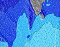 | 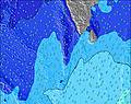 | |||||||||||
Swell Altura (m) Direção Período (s) | SSW 12 | SSE 9 | SSW 12 | S 18 | S 17 | SSE 8 | SSW 16 | SSW 16 | SSW 16 | SSW 15 | SSE 9 | SSE 9 | SSW 14 | SSW 14 | SSW 14 | SSW 14 | SSW 13 | SSW 13 |
Onda Gráfico | ||||||||||||||||||
109 | 113 | 113 | 304 | 293 | 113 | 226 | 223 | 223 | 209 | 154 | 151 | 186 | 183 | 134 | 220 | 201 | 154 | |
Vento (km/h) | ||||||||||||||||||
Estado do Vento maral cruzado-maral Cruzado cruzado-terral terral cristalino | cross | cross | cross | cross | cross | cross | cross | cross-off | cross-off | cross-off | cross-off | cross-off | cross-off | glassy | cross | cross-off | cross | cross-off |
Maré Alta | 4:57AM0.74m | 4:29PM0.81m | 5:46AM0.70m | 4:52PM0.73m | ||||||||||||||
Maré Baixa | 10:32PM0.14m | 10:23AM0.34m | 11:05PM0.16m | 10:59AM0.42m | ||||||||||||||
— | — | — | 6:01 | — | — | — | — | — | — | — | 6:01 | — | — | — | — | — | — | |
— | — | — | — | — | — | — | 6:22 | — | — | — | — | — | — | — | 6:22 | — | — | |
mm | — | — | — | — | — | — | — | — | — | — | — | — | — | — | — | — | — | — |
Temp. °C | 28 | 28 | 28 | 28 | 28 | 28 | 28 | 28 | 28 | 28 | 28 | 27 | 27 | 27 | 28 | 28 | 28 | 28 |
Ressent. °C | 30 | 31 | 31 | 30 | 31 | 31 | 31 | 31 | 31 | 31 | 32 | 31 | 31 | 31 | 32 | 32 | 32 | 32 |
Swell 1 Altura (m) Direção Período (s) | WNW 10 | WNW 10 | WNW 9 | WNW 9 | WNW 9 | WNW 9 | WNW 9 | SSE 8 | SSE 9 | SSE 9 | SSE 9 | SSE 9 | SSE 9 | SSE 9 | SSE 9 | SSE 8 | SSE 8 | SSE 8 |
214 | 210 | 201 | 193 | 158 | 143 | 140 | 113 | 136 | 154 | 154 | 151 | 119 | 127 | 116 | 103 | 101 | 111 | |
Swell 2 Altura (m) Direção Período (s) | SSE 8 | SSE 9 | SSE 8 | SSE 8 | SSE 9 | SSE 8 | SSE 8 | WNW 9 | WNW 9 | WNW 8 | WNW 8 | WNW 8 | WNW 8 | WNW 8 | WNW 8 | SSW 14 | SSW 13 | SSW 13 |
68 | 86 | 82 | 78 | 116 | 111 | 111 | 137 | 106 | 101 | 101 | 78 | 78 | 76 | 59 | 220 | 201 | 154 | |
Swell 3 Altura (m) Direção Período (s) | SSW 12 | SSW 12 | SSW 12 | S 18 | S 17 | SSW 12 | SSW 16 | SSW 16 | SSW 16 | SSW 15 | SSW 11 | S 14 | SSW 14 | SSW 14 | SSW 14 | WNW 8 | WNW 8 | WNW 8 |
109 | 113 | 113 | 304 | 293 | 113 | 226 | 223 | 223 | 209 | 73 | 107 | 186 | 183 | 134 | 75 | 58 | 42 | |
Ondas de vento Altura (m) Direção Período (s) | — | — | — | — | — | — | — | — | — | — | — | — | — | — | — | — | — | — |
— | — | — | — | — | — | — | — | — | — | — | — | — | — | — | — | — | — | |
Terral ou glassy mais perto | ||||||||||||||||||
Distância (km) | 8 | 8 | 8 | 8 | 8 | 8 | 8 | 0 | 0 | 0 | 0 | 0 | 0 | 0 | 8 | 0 | 8 | 0 |
Melhor previsões de ondas em North Male Atoll | ||||||||||||||||||
Melhor previsões de ondas em Maldives | ||||||||||||||||||
Buscador de Ondas Global | ||||||||||||||||||
- Map Icons:
 Break
Break Live Wave Height (m)
 Live Wind Speed (km/h)
 Surf Rating (10 Max)
 Ocean Swells (m)
- Wind Speed (km/h)
widget de graça do Surf-Forecast.com para o seu site
O relatório de surf / widget do tempo abaixo está disponível para incorporar em sites de terceiros gratuitamente e fornece um resumo das nossas Furana surf tempo. Simplesmente pegar o trecho de código html que fornecemos e colá-lo em seu próprio site. Você pode escolher seu idioma preferido e unidades métrico/imperial para o surf tempo de alimentação para atender aos usuários do seu site.... Clique aqui para adquirir o código.
 Nearest