
Previsão:

Previsão de curto prazochuviscos (total 2mm), principalmente caindo na Segunda à tarde. Warm (máx. 24°C na Terça à tarde, mín 18°C no Domingo à noite). o vento será geralmente fraco. | |||||||||||||||||||||
Dom 2 | Segunda-feira 3 | Terça-feira 4 | |||||||||||||||||||
11 AM | 2 PM | 5 PM | 8 PM | 11 PM | 2 AM | 5 AM | 8 AM | 11 AM | 2 PM | 5 PM | 8 PM | 11 PM | 2 AM | 5 AM | 8 AM | 11 AM | 2 PM | 5 PM | 8 PM | 11 PM | |
Mapa da altura do Swell |  |  |  | 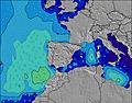 |  |  | 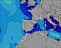 |  | |||||||||||||
Swell Altura (m) Direção Período (s) | NW 7 | NW 7 | NW 7 | WNW 10 | NNE 6 | NNE 6 | WNW 10 | WNW 10 | WNW 9 | WNW 9 | WNW 9 | NW 9 | NW 9 | WNW 8 | WNW 8 | WNW 8 | NW 9 | WNW 7 | WNW 9 | WNW 8 | WNW 8 |
Onda Gráfico | |||||||||||||||||||||
14 | 12 | 12 | 19 | 19 | 18 | 18 | 18 | 17 | 16 | 27 | 21 | 21 | 48 | 50 | 48 | 27 | 21 | 43 | 39 | 40 | |
Vento (km/h) | |||||||||||||||||||||
Estado do Vento maral cruzado-maral Cruzado cruzado-terral terral cristalino | glassy | on | on | cross-on | cross | cross-off | glassy | glassy | glassy | cross-on | cross | cross-on | glassy | glassy | glassy | glassy | cross-on | on | on | glassy | glassy |
Maré Alta | 7:43PM3.95m | 8:04AM3.68m | 8:20PM3.84m | 8:44AM3.59m | 9:03PM3.68m | ||||||||||||||||
Maré Baixa | 1:29PM0.77m | 1:55AM0.75m | 2:05PM0.85m | 2:32AM0.85m | 2:46PM0.98m | ||||||||||||||||
— | — | — | — | — | — | 7:13 | — | — | — | — | — | — | — | 7:13 | — | — | — | — | — | — | |
— | — | — | 9:45 | — | — | — | — | — | — | — | 9:43 | — | — | — | — | — | — | — | 9:42 | — | |
mm | — | — | — | — | — | — | — | — | — | — | 1 | — | — | — | — | — | — | — | — | — | — |
Temp. °C | 21 | 23 | 23 | 22 | 19 | 18 | 18 | 18 | 22 | 23 | 23 | 23 | 19 | 19 | 19 | 19 | 22 | 24 | 23 | 22 | 20 |
Ressent. °C | 23 | 24 | 24 | 23 | 20 | 19 | 20 | 20 | 24 | 23 | 23 | 24 | 21 | 20 | 20 | 20 | 23 | 24 | 24 | 23 | 22 |
Swell 1 Altura (m) Direção Período (s) | NNE 5 | NE 4 | NNE 5 | NNE 5 | NNE 6 | NNE 6 | NNE 5 | NNE 5 | NNE 5 | WNW 9 | WNW 9 | NW 9 | WNW 7 | WNW 8 | WNW 8 | WNW 8 | W 7 | WNW 7 | WNW 9 | WNW 8 | WNW 8 |
14 | 5 | 8 | 9 | 18 | 18 | 11 | 11 | 5 | 16 | 27 | 21 | 18 | 48 | 50 | 48 | 27 | 21 | 43 | 39 | 40 | |
Swell 2 Altura (m) Direção Período (s) | NW 7 | NW 7 | NW 7 | NW 7 | NW 7 | NW 7 | NW 7 | WNW 10 | WNW 9 | NNW 8 | NNW 8 | NNW 7 | NW 9 | NNW 8 | NNW 8 | NNW 8 | NW 9 | WNW 9 | NNW 8 | NNW 8 | NNW 11 |
12 | 12 | 12 | 13 | 13 | 13 | 12 | 18 | 17 | 11 | 11 | 11 | 21 | 14 | 14 | 14 | 20 | 16 | 7 | 7 | 12 | |
Swell 3 Altura (m) Direção Período (s) | WNW 9 | N 5 | WNW 10 | WNW 10 | WNW 10 | WNW 10 | WNW 10 | NNW 7 | NNW 7 | NNE 5 | NNE 4 | WNW 7 | NNW 7 | NE 4 | NE 4 | — | NNW 8 | NNW 8 | NW 11 | NW 11 | NNW 8 |
8 | 4 | 10 | 19 | 19 | 18 | 18 | 10 | 10 | 4 | 2 | 9 | 5 | 1 | 1 | — | 7 | 7 | 5 | 5 | 7 | |
Ondas de vento Altura (m) Direção Período (s) | — | — | — | — | — | — | — | — | — | — | — | — | — | — | — | — | — | — | — | — | — |
— | — | — | — | — | — | — | — | — | — | — | — | — | — | — | — | — | — | — | — | — | |
Terral ou glassy mais perto | |||||||||||||||||||||
Distância (km) | 208 | 284 | 284 | 252 | 169 | 163 | 16 | 16 | 160 | 242 | 16 | 101 | 15 | 0 | 0 | 0 | 15 | 242 | 284 | 190 | 16 |
Melhor previsões de ondas em Asturias | |||||||||||||||||||||
Melhor previsões de ondas em Spain (Europe) | |||||||||||||||||||||
Buscador de Ondas Global | |||||||||||||||||||||
- Map Icons:
 Break
Break Live Wave Height (m)
 Live Wind Speed (km/h)
 Surf Rating (10 Max)
 Ocean Swells (m)
- Wind Speed (km/h)
widget de graça do Surf-Forecast.com para o seu site
O relatório de surf / widget do tempo abaixo está disponível para incorporar em sites de terceiros gratuitamente e fornece um resumo das nossas Xivares surf tempo. Simplesmente pegar o trecho de código html que fornecemos e colá-lo em seu próprio site. Você pode escolher seu idioma preferido e unidades métrico/imperial para o surf tempo de alimentação para atender aos usuários do seu site.... Clique aqui para adquirir o código.
 Nearest