
Previsão:

Previsão de curto prazoprincipalmente seco. Warm (máx. 27°C no Domingo de manhã, mín 26°C no Domingo de manhã). principalmente ventos fortes. | ||||||||||||||||||||||||
Domingo 26 | Segunda-feira 27 | Terça-feira 28 | ||||||||||||||||||||||
2 AM | 5 AM | 8 AM | 11 AM | 2 PM | 5 PM | 8 PM | 11 PM | 2 AM | 5 AM | 8 AM | 11 AM | 2 PM | 5 PM | 8 PM | 11 PM | 2 AM | 5 AM | 8 AM | 11 AM | 2 PM | 5 PM | 8 PM | 11 PM | |
Mapa da altura do Swell | 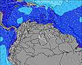 | 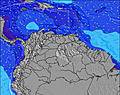 |  | 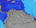 | 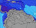 |  |  |  |  | |||||||||||||||
Swell Altura (m) Direção Período (s) | ENE 7 | ENE 7 | ENE 7 | ENE 7 | ENE 7 | ENE 7 | ENE 7 | ENE 7 | ENE 7 | ENE 7 | E 7 | E 7 | E 7 | E 7 | ENE 6 | E 6 | E 7 | E 7 | E 7 | E 7 | E 7 | E 6 | E 6 | E 6 |
Onda Gráfico | ||||||||||||||||||||||||
0 | 0 | 0 | 0 | 0 | 0 | 0 | 0 | 0 | 0 | 0 | 0 | 0 | 0 | 0 | 0 | 0 | 0 | 0 | 0 | 0 | 0 | 0 | 0 | |
Vento (km/h) | ||||||||||||||||||||||||
Estado do Vento maral cruzado-maral Cruzado cruzado-terral terral cristalino | cross-on | cross-on | cross-on | cross-on | cross-on | cross-on | cross-on | cross-on | cross-on | cross-on | cross-on | cross-on | cross-on | cross-on | cross-on | cross-on | cross-on | cross-on | cross-on | cross-on | cross-on | cross-on | cross-on | cross-on |
Maré Alta | 10:33PM0.34m | 11:12PM0.35m | ||||||||||||||||||||||
Maré Baixa | 7:35AM0.00m | 8:08AM0.01m | 8:42AM0.02m | |||||||||||||||||||||
— | 6:24 | — | — | — | — | — | — | — | 6:24 | — | — | — | — | — | — | — | 6:24 | — | — | — | — | — | — | |
— | — | — | — | — | 7:07 | — | — | — | — | — | — | — | 7:07 | — | — | — | — | — | — | — | 7:07 | — | — | |
mm | — | — | — | — | — | — | — | — | — | — | — | — | — | — | — | — | — | — | — | — | — | — | — | — |
Temp. °C | 26 | 26 | 26 | 27 | 27 | 27 | 27 | 27 | 27 | 27 | 27 | 27 | 27 | 27 | 27 | 27 | 27 | 27 | 27 | 27 | 27 | 27 | 27 | 27 |
Ressent. °C | 25 | 25 | 26 | 27 | 26 | 25 | 26 | 26 | 26 | 26 | 26 | 26 | 27 | 25 | 25 | 25 | 26 | 26 | 26 | 26 | 27 | 26 | 26 | 26 |
Swell 1 Altura (m) Direção Período (s) | — | — | — | — | — | — | — | — | — | — | — | — | — | — | — | — | — | — | — | — | — | — | — | — |
— | — | — | — | — | — | — | — | — | — | — | — | — | — | — | — | — | — | — | — | — | — | — | — | |
Swell 2 Altura (m) Direção Período (s) | — | — | — | — | — | — | — | — | — | — | — | — | — | — | — | — | — | — | — | — | — | — | — | — |
— | — | — | — | — | — | — | — | — | — | — | — | — | — | — | — | — | — | — | — | — | — | — | — | |
Swell 3 Altura (m) Direção Período (s) | — | — | — | — | — | — | — | — | — | — | — | — | — | — | — | — | — | — | — | — | — | — | — | — |
— | — | — | — | — | — | — | — | — | — | — | — | — | — | — | — | — | — | — | — | — | — | — | — | |
Ondas de vento Altura (m) Direção Período (s) | ENE 7 | ENE 7 | ENE 7 | ENE 7 | ENE 7 | ENE 7 | ENE 7 | ENE 7 | ENE 7 | ENE 7 | E 7 | E 7 | E 7 | E 7 | ENE 6 | E 6 | E 7 | E 7 | E 7 | E 7 | E 7 | E 6 | E 6 | E 6 |
290 | 290 | 268 | 277 | 285 | 316 | 350 | 360 | 360 | 352 | 345 | 341 | 331 | 289 | 303 | 345 | 360 | 366 | 366 | 319 | 278 | 233 | 221 | 221 | |
Terral ou glassy mais perto | ||||||||||||||||||||||||
Distância (km) | 293 | 293 | 350 | 392 | 364 | 350 | 307 | 293 | 293 | 293 | 293 | 319 | 397 | 397 | 344 | 307 | 293 | 293 | 293 | 364 | 1090 | 428 | 413 | 344 |
Melhor previsões de ondas em Aruba | ||||||||||||||||||||||||
Melhor previsões de ondas em Aruba | ||||||||||||||||||||||||
Buscador de Ondas Global | ||||||||||||||||||||||||
- Map Icons:
 Break
Break Live Wave Height (m)
 Live Wind Speed (km/h)
 Surf Rating (10 Max)
 Ocean Swells (m)
- Wind Speed (km/h)
widget de graça do Surf-Forecast.com para o seu site
O relatório de surf / widget do tempo abaixo está disponível para incorporar em sites de terceiros gratuitamente e fornece um resumo das nossas Urirama surf tempo. Simplesmente pegar o trecho de código html que fornecemos e colá-lo em seu próprio site. Você pode escolher seu idioma preferido e unidades métrico/imperial para o surf tempo de alimentação para atender aos usuários do seu site.... Clique aqui para adquirir o código.
 Nearest