
Previsão:

Previsão de curto prazoprincipalmente seco. Warm (máx. 34°C na Quarta de manhã, mín 25°C na Terça à noite). o vento será geralmente fraco. | ||||||||||||||||||||||||
Ter 14 | Quarta-feira 15 | Quinta-feira 16 | Sex 17 | |||||||||||||||||||||
12 PM | 3 PM | 6 PM | 9 PM | 12 AM | 3 AM | 6 AM | 9 AM | 12 PM | 3 PM | 6 PM | 9 PM | 12 AM | 3 AM | 6 AM | 9 AM | 12 PM | 3 PM | 6 PM | 9 PM | 12 AM | 3 AM | 6 AM | 9 AM | |
Mapa da altura do Swell |  |  |  | 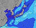 |  |  | 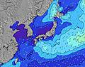 |  |  | 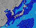 | ||||||||||||||
Swell Altura (m) Direção Período (s) | S 9 | S 9 | S 9 | S 9 | S 9 | S 9 | SSW 9 | S 8 | S 8 | S 8 | SSW 5 | SSW 6 | SSW 6 | SSW 5 | E 10 | S 8 | S 8 | E 9 | E 9 | E 9 | E 10 | E 10 | E 10 | E 10 |
Onda Gráfico | ||||||||||||||||||||||||
106 | 80 | 80 | 78 | 41 | 40 | 79 | 52 | 50 | 49 | 44 | 109 | 90 | 53 | 17 | 29 | 29 | 28 | 28 | 28 | 29 | 29 | 29 | 29 | |
Vento (km/h) | ||||||||||||||||||||||||
Estado do Vento maral cruzado-maral Cruzado cruzado-terral terral cristalino | cross-on | on | glassy | cross-off | cross-off | cross-off | cross-off | cross-off | cross-off | cross-off | cross-off | cross-off | cross-off | cross-off | cross-off | cross-off | cross-off | glassy | glassy | glassy | cross-off | cross-off | off | glassy |
Maré Alta | 6:56PM1.93m | 5:52AM1.96m | 7:35PM1.94m | 6:42AM1.97m | 8:12PM1.92m | 7:30AM1.93m | ||||||||||||||||||
Maré Baixa | 12:01PM-0.09m | 00:25AM0.96m | 12:47PM-0.10m | 1:09AM0.88m | 1:31PM-0.04m | 1:51AM0.80m | ||||||||||||||||||
— | — | — | — | — | 5:16 | — | — | — | — | — | — | — | 5:18 | — | — | — | — | — | — | — | 5:18 | — | — | |
— | — | 7:22 | — | — | — | — | — | — | — | 7:21 | — | — | — | — | — | — | — | 7:21 | — | — | — | — | 7:20 | |
mm | — | — | — | — | — | — | — | — | — | — | — | — | — | — | — | — | — | — | — | — | — | — | — | — |
Temp. °C | 31 | 30 | 30 | 28 | 26 | 25 | 26 | 30 | 34 | 34 | 32 | 28 | 27 | 27 | 27 | 30 | 33 | 33 | 32 | 28 | 28 | 27 | 26 | 29 |
Ressent. °C | 34 | 33 | 35 | 32 | 28 | 27 | 29 | 33 | 37 | 36 | 34 | 31 | 30 | 31 | 31 | 34 | 38 | 38 | 38 | 33 | 33 | 32 | 30 | 34 |
Swell 1 Altura (m) Direção Período (s) | S 9 | S 9 | S 9 | S 9 | S 6 | S 6 | S 6 | S 8 | S 8 | S 8 | S 6 | S 6 | S 5 | S 5 | S 5 | S 8 | S 8 | SSW 5 | SSW 5 | SSW 5 | E 10 | S 7 | E 10 | E 10 |
106 | 80 | 80 | 78 | 21 | 16 | 17 | 52 | 50 | 49 | 32 | 35 | 28 | 15 | 15 | 29 | 29 | 8 | 8 | 8 | 29 | 17 | 29 | 29 | |
Swell 2 Altura (m) Direção Período (s) | E 9 | E 9 | E 9 | E 9 | S 9 | S 9 | SSW 9 | E 9 | E 9 | E 10 | E 10 | E 10 | E 10 | E 10 | E 10 | E 10 | E 10 | E 9 | E 9 | E 9 | S 5 | E 10 | S 7 | S 7 |
15 | 15 | 15 | 15 | 41 | 40 | 26 | 15 | 16 | 17 | 17 | 17 | 17 | 16 | 17 | 17 | 17 | 28 | 28 | 28 | 8 | 29 | 17 | 9 | |
Swell 3 Altura (m) Direção Período (s) | SE 12 | SE 12 | ESE 12 | SE 12 | E 9 | E 9 | SE 10 | SE 10 | SE 10 | SE 10 | S 8 | S 8 | S 8 | S 8 | S 8 | SE 9 | ESE 9 | S 8 | S 7 | S 7 | S 7 | SE 9 | ESE 10 | ESE 9 |
22 | 22 | 14 | 21 | 15 | 15 | 17 | 17 | 17 | 17 | 12 | 12 | 11 | 11 | 11 | 14 | 8 | 10 | 10 | 4 | 9 | 3 | 9 | 9 | |
Ondas de vento Altura (m) Direção Período (s) | — | — | — | — | SSW 6 | SSW 5 | SSW 9 | — | SSW 5 | SSW 5 | SSW 5 | SSW 6 | SSW 6 | SSW 5 | — | SSW 6 | SSW 4 | — | — | — | — | — | — | — |
— | — | — | — | 33 | 26 | 79 | — | 23 | 28 | 44 | 109 | 90 | 53 | — | 25 | 11 | — | — | — | — | — | — | — | |
Terral ou glassy mais perto | ||||||||||||||||||||||||
Distância (km) | 57 | 57 | 0 | 0 | 0 | 0 | 0 | 0 | 0 | 0 | 10 | 0 | 0 | 0 | 25 | 0 | 0 | 31 | 31 | 25 | 25 | 25 | 0 | 25 |
Melhor previsões de ondas em Kyu Shu | ||||||||||||||||||||||||
Melhor previsões de ondas em Japan | ||||||||||||||||||||||||
Buscador de Ondas Global | ||||||||||||||||||||||||
- Map Icons:
 Break
Break Live Wave Height (m)
 Live Wind Speed (km/h)
 Surf Rating (10 Max)
 Ocean Swells (m)
- Wind Speed (km/h)
widget de graça do Surf-Forecast.com para o seu site
O relatório de surf / widget do tempo abaixo está disponível para incorporar em sites de terceiros gratuitamente e fornece um resumo das nossas Takanabe surf tempo. Simplesmente pegar o trecho de código html que fornecemos e colá-lo em seu próprio site. Você pode escolher seu idioma preferido e unidades métrico/imperial para o surf tempo de alimentação para atender aos usuários do seu site.... Clique aqui para adquirir o código.
 Nearest