
Previsão:

Previsão de curto prazoAlguns chuviscos, mais intensos durante Terça à noite. Warm (máx. 28°C no Domingo à tarde, mín 24°C no Domingo à noite). principalmente ventos frescos. | ||||||||||||||||||||
Dom 2 | Segunda-feira 3 | Terça-feira 4 | ||||||||||||||||||
12 PM | 3 PM | 6 PM | 9 PM | 12 AM | 3 AM | 6 AM | 9 AM | 12 PM | 3 PM | 6 PM | 9 PM | 12 AM | 3 AM | 6 AM | 9 AM | 12 PM | 3 PM | 6 PM | 9 PM | |
Mapa da altura do Swell |  |  |  |  |  |  | 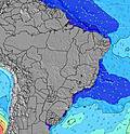 |  | ||||||||||||
Swell Altura (m) Direção Período (s) | E 7 | E 7 | E 7 | E 6 | E 6 | E 6 | E 6 | E 6 | E 6 | E 6 | E 6 | E 6 | E 6 | E 6 | E 6 | E 6 | E 6 | E 6 | E 6 | E 6 |
Onda Gráfico | ||||||||||||||||||||
186 | 220 | 134 | 112 | 104 | 112 | 109 | 113 | 113 | 124 | 102 | 83 | 80 | 82 | 88 | 102 | 104 | 104 | 88 | 88 | |
Vento (km/h) | ||||||||||||||||||||
Estado do Vento maral cruzado-maral Cruzado cruzado-terral terral cristalino | cross | cross | cross | cross | cross | cross | cross-off | cross-off | cross | cross | cross | cross | cross | cross | cross | cross | cross | cross | cross | cross |
Maré Alta | 7:06PM2.57m | 7:20AM2.63m | 7:44PM2.53m | 8:02AM2.50m | 8:28PM2.45m | |||||||||||||||
Maré Baixa | 1:00PM0.30m | 1:13AM0.41m | 1:36PM0.37m | 1:54AM0.47m | 2:16PM0.48m | |||||||||||||||
— | — | — | — | — | 5:41 | — | — | — | — | — | — | — | 5:41 | — | — | — | — | — | — | |
— | 5:39 | — | — | — | — | — | — | — | 5:39 | — | — | — | — | — | — | — | 5:39 | — | — | |
mm | — | — | — | — | — | — | — | — | — | — | — | — | — | — | — | — | — | — | — | — |
Temp. °C | 28 | 28 | 26 | 26 | 26 | 25 | 24 | 25 | 28 | 28 | 26 | 26 | 25 | 25 | 25 | 27 | 28 | 28 | 26 | 26 |
Ressent. °C | 25 | 25 | 25 | 26 | 26 | 26 | 24 | 25 | 27 | 27 | 27 | 27 | 26 | 26 | 26 | 26 | 26 | 27 | 26 | 27 |
Swell 1 Altura (m) Direção Período (s) | — | — | NNE 8 | NNE 8 | NNE 8 | NNE 8 | NNE 8 | NNE 8 | NNE 8 | NNE 8 | NNE 8 | NNE 8 | NNE 7 | NNE 8 | NNE 10 | NNE 9 | NNE 9 | NNE 9 | NE 9 | NNE 9 |
— | — | 7 | 6 | 6 | 6 | 6 | 6 | 6 | 6 | 6 | 6 | 5 | 6 | 18 | 16 | 16 | 16 | 19 | 15 | |
Swell 2 Altura (m) Direção Período (s) | — | — | — | — | — | N 12 | N 12 | N 12 | N 11 | NE 11 | NNE 11 | NNE 10 | NNE 10 | NNE 10 | N 10 | N 10 | N 10 | — | — | N 9 |
— | — | — | — | — | 3 | 3 | 3 | 2 | 5 | 11 | 11 | 10 | 9 | 2 | 2 | 2 | — | — | 2 | |
Swell 3 Altura (m) Direção Período (s) | — | — | — | — | — | — | — | — | N 12 | N 11 | N 11 | N 11 | N 11 | — | — | N 12 | — | — | — | — |
— | — | — | — | — | — | — | — | 3 | 2 | 2 | 2 | 2 | — | — | 3 | — | — | — | — | |
Ondas de vento Altura (m) Direção Período (s) | E 7 | E 7 | E 7 | E 6 | E 6 | E 6 | E 6 | E 6 | E 6 | E 6 | E 6 | E 6 | E 6 | E 6 | E 6 | E 6 | E 6 | E 6 | E 6 | E 6 |
186 | 220 | 134 | 112 | 104 | 112 | 109 | 113 | 113 | 124 | 102 | 83 | 80 | 82 | 88 | 102 | 104 | 104 | 88 | 88 | |
Terral ou glassy mais perto | ||||||||||||||||||||
Distância (km) | 1796 | 2367 | 1196 | 1196 | 506 | 506 | 426 | 1236 | 1796 | 2190 | 535 | 535 | 522 | 522 | 426 | 759 | 1796 | 1796 | 1796 | 1236 |
Melhor previsões de ondas em Ceará | ||||||||||||||||||||
Melhor previsões de ondas em Brazil | ||||||||||||||||||||
Buscador de Ondas Global | ||||||||||||||||||||
- Map Icons:
 Break
Break Live Wave Height (m)
 Live Wind Speed (km/h)
 Surf Rating (10 Max)
 Ocean Swells (m)
- Wind Speed (km/h)
widget de graça do Surf-Forecast.com para o seu site
O relatório de surf / widget do tempo abaixo está disponível para incorporar em sites de terceiros gratuitamente e fornece um resumo das nossas Tabinha surf tempo. Simplesmente pegar o trecho de código html que fornecemos e colá-lo em seu próprio site. Você pode escolher seu idioma preferido e unidades métrico/imperial para o surf tempo de alimentação para atender aos usuários do seu site.... Clique aqui para adquirir o código.
 Nearest