
Previsão:

Previsão de curto prazochuva moderada (total 19mm), mais intensa na Terça à tarde. Very mild (máx. 14°C na Terça de manhã, mín 6°C na Terça à noite). Ventos diminuem (vento forte de Oeste-Sudoeste na Terça à noite, ventos moderados de Sudoeste na Quarta à noite). | ||||||||||||||||||
Seg 27 | Terça-feira 28 | Quarta-feira 29 | ||||||||||||||||
7 PM | 10 PM | 1 AM | 4 AM | 7 AM | 10 AM | 1 PM | 4 PM | 7 PM | 10 PM | 1 AM | 4 AM | 7 AM | 10 AM | 1 PM | 4 PM | 7 PM | 10 PM | |
Mapa da altura do Swell |  |  |  |  |  | 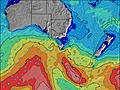 |  | |||||||||||
Swell Altura (m) Direção Período (s) | SW 11 | SW 13 | SW 13 | SW 14 | SW 13 | SW 13 | SW 12 | SW 15 | WSW 15 | SW 14 | SW 14 | WSW 13 | SW 17 | SW 16 | SW 16 | SW 16 | SW 15 | SW 14 |
Onda Gráfico | ||||||||||||||||||
191 | 418 | 480 | 526 | 437 | 418 | 314 | 871 | 1939 | 2263 | 2085 | 3172 | 7353 | 6797 | 6368 | 5205 | 3746 | 3094 | |
Vento (km/h) | ||||||||||||||||||
Estado do Vento maral cruzado-maral Cruzado cruzado-terral terral cristalino | cross-off | cross-off | cross-off | cross-off | cross-off | cross-off | cross-off | cross-off | cross-on | cross-off | cross | cross | cross-on | cross-on | cross-on | cross-on | cross-on | cross-on |
Maré Alta | 8:51PM1.82m | 10:50AM1.93m | 9:54PM1.78m | 11:49AM1.99m | ||||||||||||||
Maré Baixa | 3:45AM0.55m | 4:35PM1.22m | 4:45AM0.55m | 5:43PM1.17m | ||||||||||||||
— | — | — | — | 7:24 | — | — | — | — | — | — | — | 7:24 | — | — | — | — | — | |
— | — | — | — | — | — | — | 5:25 | — | — | — | — | — | — | — | 5:27 | — | — | |
mm | — | — | — | — | — | — | — | 1 | 3 | 1 | 2 | 1 | 3 | 1 | 1 | — | — | 1 |
Temp. °C | 12 | 12 | 12 | 13 | 12 | 13 | 14 | 12 | 9 | 9 | 6 | 9 | 10 | 10 | 11 | 12 | 11 | 11 |
Ressent. °C | 5 | 4 | 3 | 3 | 1 | 2 | 4 | 3 | 0 | -1 | -6 | -3 | -4 | -3 | -1 | 1 | 2 | 2 |
Swell 1 Altura (m) Direção Período (s) | SW 11 | SW 13 | SW 13 | SW 14 | SW 13 | SW 13 | SW 12 | SW 15 | N 7 | SW 14 | SW 14 | — | — | — | — | — | — | — |
191 | 418 | 480 | 526 | 437 | 418 | 314 | 871 | 1 | 2263 | 2085 | — | — | — | — | — | — | — | |
Swell 2 Altura (m) Direção Período (s) | SW 13 | — | — | — | — | SSW 17 | SW 16 | SW 15 | — | — | — | — | — | — | — | — | — | — |
140 | — | — | — | — | 27 | 295 | 640 | — | — | — | — | — | — | — | — | — | — | |
Swell 3 Altura (m) Direção Período (s) | — | — | — | — | — | — | — | — | — | — | — | — | — | — | — | — | — | — |
— | — | — | — | — | — | — | — | — | — | — | — | — | — | — | — | — | — | |
Ondas de vento Altura (m) Direção Período (s) | NNW 3 | NNW 4 | NNW 4 | NNW 4 | NNW 5 | NW 5 | NW 5 | NW 4 | WSW 15 | NW 5 | NW 5 | WSW 13 | SW 17 | SW 16 | SW 16 | SW 16 | SW 15 | SW 14 |
5 | 13 | 21 | 34 | 56 | 74 | 65 | 45 | 1939 | 29 | 41 | 3172 | 7353 | 6797 | 6368 | 5205 | 3746 | 3094 | |
Terral ou glassy mais perto | ||||||||||||||||||
Distância (km) | 87 | 99 | 95 | 111 | 254 | 254 | 482 | 248 | 112 | 454 | 112 | 248 | 309 | 477 | 1322 | 787 | 85 | 85 |
Melhor previsões de ondas em Phillip Island | ||||||||||||||||||
Melhor previsões de ondas em Australia | ||||||||||||||||||
Buscador de Ondas Global | ||||||||||||||||||
- Map Icons:
 Break
Break Live Wave Height (m)
 Live Wind Speed (km/h)
 Surf Rating (10 Max)
 Ocean Swells (m)
- Wind Speed (km/h)
widget de graça do Surf-Forecast.com para o seu site
O relatório de surf / widget do tempo abaixo está disponível para incorporar em sites de terceiros gratuitamente e fornece um resumo das nossas Sunderland Bay surf tempo. Simplesmente pegar o trecho de código html que fornecemos e colá-lo em seu próprio site. Você pode escolher seu idioma preferido e unidades métrico/imperial para o surf tempo de alimentação para atender aos usuários do seu site.... Clique aqui para adquirir o código.
 Nearest