
Previsão:

Previsão de curto prazoprincipalmente seco. Warm (máx. 26°C no Sábado à tarde, mín 18°C na Quarta à noite). o vento será geralmente fraco. | ||||||||||||||||||||||||
Quar 15 | Quinta-feira 16 | Sexta-feira 17 | Sáb 18 | |||||||||||||||||||||
5 PM | 8 PM | 11 PM | 2 AM | 5 AM | 8 AM | 11 AM | 2 PM | 5 PM | 8 PM | 11 PM | 2 AM | 5 AM | 8 AM | 11 AM | 2 PM | 5 PM | 8 PM | 11 PM | 2 AM | 5 AM | 8 AM | 11 AM | 2 PM | |
Mapa da altura do Swell |  |  |  |  |  |  |  |  | 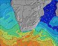 | |||||||||||||||
Swell Altura (m) Direção Período (s) | ESE 11 | ESE 11 | ESE 10 | ESE 10 | ESE 10 | ESE 10 | ESE 10 | ESE 10 | ESE 10 | ESE 10 | ESE 10 | ESE 10 | ESE 10 | ESE 10 | ESE 10 | ESE 10 | ESE 10 | ESE 10 | ESE 10 | E 10 | E 10 | E 10 | ESE 10 | E 10 |
Onda Gráfico | ||||||||||||||||||||||||
974 | 974 | 807 | 720 | 640 | 627 | 527 | 446 | 437 | 437 | 358 | 358 | 358 | 301 | 301 | 288 | 245 | 240 | 240 | 231 | 196 | 196 | 160 | 151 | |
Vento (km/h) | ||||||||||||||||||||||||
Estado do Vento maral cruzado-maral Cruzado cruzado-terral terral cristalino | on | on | cross | cross | cross | cross | cross-on | on | on | cross-on | glassy | cross-off | off | off | cross-off | cross | cross | cross-off | cross-off | cross-off | cross-off | cross-off | cross-off | cross-off |
Maré Alta | 4:38PM2.14m | 4:53AM2.10m | 5:18PM2.18m | 5:31AM2.08m | 5:57PM2.15m | 6:07AM2.01m | ||||||||||||||||||
Maré Baixa | 10:45PM0.10m | 11:02AM0.02m | 11:25PM0.12m | 11:39AM0.03m | 00:04AM0.19m | 12:16PM0.10m | ||||||||||||||||||
— | — | — | — | 6:35 | — | — | — | — | — | — | — | 6:35 | — | — | — | — | — | — | — | 6:35 | — | — | — | |
5:12 | — | — | — | — | — | — | — | 5:12 | — | — | — | — | — | — | — | 5:13 | — | — | — | — | — | — | 5:13 | |
mm | — | — | — | — | — | — | — | — | — | — | — | — | — | — | — | — | — | — | — | — | — | — | — | — |
Temp. °C | 21 | 21 | 20 | 19 | 18 | 18 | 21 | 22 | 21 | 21 | 20 | 19 | 18 | 18 | 21 | 23 | 21 | 21 | 20 | 19 | 19 | 18 | 23 | 26 |
Ressent. °C | 21 | 21 | 20 | 18 | 18 | 17 | 20 | 21 | 21 | 20 | 21 | 20 | 19 | 19 | 21 | 21 | 19 | 21 | 20 | 19 | 19 | 16 | 19 | 22 |
Swell 1 Altura (m) Direção Período (s) | ESE 11 | ESE 11 | ESE 10 | ESE 10 | ESE 10 | ESE 10 | ESE 10 | ESE 10 | ESE 10 | ESE 10 | ESE 10 | ESE 10 | ESE 10 | ESE 10 | ESE 10 | ESE 10 | ESE 10 | ESE 10 | ESE 10 | E 10 | E 10 | E 10 | ESE 10 | E 10 |
974 | 974 | 807 | 720 | 640 | 627 | 527 | 446 | 437 | 437 | 358 | 358 | 358 | 301 | 301 | 288 | 245 | 240 | 240 | 231 | 196 | 196 | 160 | 151 | |
Swell 2 Altura (m) Direção Período (s) | S 9 | SSW 10 | S 10 | S 11 | SSE 11 | SSE 10 | SSE 10 | SSE 10 | SSE 9 | SSE 9 | SSE 9 | SSE 9 | SSE 9 | SSW 9 | SSW 8 | S 7 | S 7 | S 6 | S 10 | S 6 | S 17 | S 9 | SSW 14 | SSW 12 |
7 | 18 | 7 | 9 | 12 | 11 | 20 | 18 | 17 | 16 | 16 | 16 | 8 | 25 | 21 | 15 | 8 | 3 | 8 | 2 | 22 | 2 | 18 | 29 | |
Swell 3 Altura (m) Direção Período (s) | — | — | S 11 | SSE 11 | SSE 11 | S 14 | S 14 | SSW 9 | SW 9 | SW 9 | SSE 12 | SSW 12 | SSW 10 | SSE 8 | SSE 9 | SSE 8 | SSE 10 | S 8 | SSW 6 | SSW 12 | S 6 | S 15 | S 16 | S 16 |
— | — | 2 | 12 | 11 | 4 | 4 | 8 | 3 | 3 | 13 | 14 | 10 | 7 | 8 | 7 | 9 | 5 | 8 | 14 | 1 | 4 | 5 | 21 | |
Ondas de vento Altura (m) Direção Período (s) | — | — | — | — | — | — | — | — | — | — | — | — | — | — | — | — | NE 3 | NE 3 | NE 3 | NNE 3 | N 4 | N 4 | N 5 | NNE 5 |
— | — | — | — | — | — | — | — | — | — | — | — | — | — | — | — | 3 | 3 | 3 | 4 | 6 | 19 | 43 | 64 | |
Terral ou glassy mais perto | ||||||||||||||||||||||||
Distância (km) | 273 | 204 | 118 | 148 | 148 | 152 | 204 | 204 | 407 | 204 | 0 | 0 | 0 | 0 | 0 | 354 | 233 | 0 | 0 | 0 | 0 | 204 | 204 | 356 |
Melhor previsões de ondas em KwaZulu-Natal North Coast | ||||||||||||||||||||||||
Melhor previsões de ondas em South Africa | ||||||||||||||||||||||||
Buscador de Ondas Global | ||||||||||||||||||||||||
- Map Icons:
 Break
Break Live Wave Height (m)
 Live Wind Speed (km/h)
 Surf Rating (10 Max)
 Ocean Swells (m)
- Wind Speed (km/h)
widget de graça do Surf-Forecast.com para o seu site
O relatório de surf / widget do tempo abaixo está disponível para incorporar em sites de terceiros gratuitamente e fornece um resumo das nossas Sodwana surf tempo. Simplesmente pegar o trecho de código html que fornecemos e colá-lo em seu próprio site. Você pode escolher seu idioma preferido e unidades métrico/imperial para o surf tempo de alimentação para atender aos usuários do seu site.... Clique aqui para adquirir o código.
 Nearest