
Previsão:

Previsão de curto prazoprincipalmente seco. Warm (máx. 23°C na Terça à tarde, mín 22°C na Quarta à noite). principalmente ventos frescos. | ||||||||||||||||||||||||
Ter 14 | Quarta-feira 15 | Quinta-feira 16 | Sex 17 | |||||||||||||||||||||
11 AM | 2 PM | 5 PM | 8 PM | 11 PM | 2 AM | 5 AM | 8 AM | 11 AM | 2 PM | 5 PM | 8 PM | 11 PM | 2 AM | 5 AM | 8 AM | 11 AM | 2 PM | 5 PM | 8 PM | 11 PM | 2 AM | 5 AM | 8 AM | |
Mapa da altura do Swell |  |  |  |  |  |  |  | 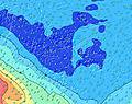 |  | |||||||||||||||
Swell Altura (m) Direção Período (s) | E 8 | E 8 | E 8 | ENE 7 | ENE 7 | ENE 7 | ENE 8 | ENE 8 | ENE 8 | N 9 | N 9 | N 9 | N 9 | N 9 | N 9 | ENE 8 | ENE 8 | ENE 8 | ENE 8 | ENE 8 | ENE 8 | ENE 8 | ENE 8 | NNE 9 |
Onda Gráfico | ||||||||||||||||||||||||
4 | 5 | 4 | 5 | 5 | 5 | 6 | 6 | 6 | 6 | 6 | 6 | 6 | 6 | 6 | 7 | 7 | 6 | 6 | 6 | 6 | 6 | 6 | 8 | |
Vento (km/h) | ||||||||||||||||||||||||
Estado do Vento maral cruzado-maral Cruzado cruzado-terral terral cristalino | cross-off | cross-off | cross-off | cross-off | cross-off | cross-off | cross-off | cross-off | cross-off | cross-off | cross-off | cross-off | off | cross-off | cross-off | cross-off | off | cross-off | cross-off | cross-off | off | off | cross-off | off |
Maré Alta | 1:15PM0.33m | 1:44AM0.30m | 1:53PM0.34m | 2:14AM0.29m | 2:30PM0.33m | 2:44AM0.28m | ||||||||||||||||||
Maré Baixa | 7:40PM-0.00m | 7:46AM0.03m | 8:16PM0.01m | 8:18AM0.03m | 8:50PM0.04m | |||||||||||||||||||
— | — | — | — | — | — | 6:28 | — | — | — | — | — | — | — | 6:28 | — | — | — | — | — | — | — | 6:28 | — | |
— | — | 5:37 | — | — | — | — | — | — | — | 5:38 | — | — | — | — | — | — | — | 5:38 | — | — | — | — | 5:38 | |
mm | — | — | — | — | — | — | — | — | — | — | — | — | — | — | — | — | — | — | — | — | — | — | — | — |
Temp. °C | 23 | 23 | 23 | 23 | 23 | 23 | 23 | 23 | 23 | 23 | 23 | 23 | 23 | 23 | 22 | 23 | 23 | 23 | 23 | 23 | 23 | 22 | 23 | 23 |
Ressent. °C | 19 | 18 | 19 | 19 | 20 | 20 | 20 | 21 | 21 | 20 | 19 | 20 | 20 | 21 | 19 | 20 | 20 | 20 | 19 | 19 | 19 | 18 | 19 | 19 |
Swell 1 Altura (m) Direção Período (s) | SW 12 | SW 12 | SW 12 | SW 12 | SW 11 | SW 11 | SW 10 | SW 10 | SW 11 | SW 14 | SW 14 | SW 14 | SW 14 | SW 14 | SW 14 | SW 14 | SW 14 | SW 14 | SSW 14 | SSW 13 | SSW 13 | SW 13 | SW 13 | SW 13 |
252 | 240 | 277 | 203 | 137 | 110 | 102 | 82 | 90 | 231 | 228 | 194 | 238 | 241 | 206 | 206 | 206 | 160 | 125 | 118 | 114 | 84 | 84 | 83 | |
Swell 2 Altura (m) Direção Período (s) | SW 16 | SW 16 | SW 16 | SW 16 | SSW 16 | SSW 15 | SSW 15 | SSW 15 | SW 14 | ENE 8 | ENE 8 | ENE 8 | ENE 8 | ENE 8 | ENE 8 | ENE 8 | ENE 8 | ENE 8 | ENE 8 | ENE 8 | ENE 8 | WNW 16 | WNW 15 | WNW 15 |
129 | 125 | 127 | 121 | 160 | 158 | 156 | 152 | 102 | 6 | 6 | 6 | 6 | 6 | 6 | 7 | 7 | 6 | 6 | 6 | 6 | 24 | 22 | 22 | |
Swell 3 Altura (m) Direção Período (s) | E 8 | E 8 | E 8 | ENE 7 | ENE 7 | ENE 7 | ENE 8 | ENE 8 | ENE 8 | N 9 | N 9 | N 9 | N 9 | N 9 | N 9 | WNW 16 | WNW 16 | WNW 16 | WNW 16 | WNW 16 | WNW 16 | ENE 8 | ENE 8 | NNE 9 |
4 | 5 | 4 | 5 | 5 | 5 | 6 | 6 | 6 | 6 | 6 | 6 | 6 | 6 | 6 | 25 | 25 | 25 | 25 | 24 | 24 | 6 | 6 | 8 | |
Ondas de vento Altura (m) Direção Período (s) | SW 4 | SW 4 | SSW 4 | SSW 3 | S 3 | S 3 | SSW 3 | SSW 3 | SSW 3 | SSW 3 | SW 3 | SSW 3 | S 3 | SSW 3 | SW 3 | SSW 3 | S 3 | S 3 | SSW 4 | SSW 4 | S 4 | S 3 | S 3 | S 3 |
12 | 14 | 9 | 7 | 6 | 3 | 3 | 3 | 2 | 2 | 4 | 6 | 5 | 3 | 5 | 3 | 3 | 5 | 10 | 10 | 9 | 6 | 5 | 5 | |
Terral ou glassy mais perto | ||||||||||||||||||||||||
Distância (km) | 3848 | 3849 | 3849 | 3849 | 3517 | 3517 | 3517 | 3517 | 3517 | 3527 | 3527 | 3848 | 3517 | 3517 | 3517 | 3517 | 41 | 41 | 2611 | 2611 | 2611 | 2611 | 2611 | 2611 |
Melhor previsões de ondas em Tahiti | ||||||||||||||||||||||||
Melhor previsões de ondas em French Polynesia | ||||||||||||||||||||||||
Buscador de Ondas Global | ||||||||||||||||||||||||
- Map Icons:
 Break
Break Live Wave Height (m)
 Live Wind Speed (km/h)
 Surf Rating (10 Max)
 Ocean Swells (m)
- Wind Speed (km/h)
widget de graça do Surf-Forecast.com para o seu site
O relatório de surf / widget do tempo abaixo está disponível para incorporar em sites de terceiros gratuitamente e fornece um resumo das nossas Point Venus Reef surf tempo. Simplesmente pegar o trecho de código html que fornecemos e colá-lo em seu próprio site. Você pode escolher seu idioma preferido e unidades métrico/imperial para o surf tempo de alimentação para atender aos usuários do seu site.... Clique aqui para adquirir o código.
 Nearest