
Previsão:

Previsão de curto prazoprincipalmente seco. Warm (máx. 22°C no Sábado de manhã, mín 18°C na Seg à noite). o vento será geralmente fraco. | |||||||||||||||||||||
Sáb 25 | Domingo 26 | Segunda-feira 27 | |||||||||||||||||||
10 AM | 1 PM | 4 PM | 7 PM | 10 PM | 1 AM | 4 AM | 7 AM | 10 AM | 1 PM | 4 PM | 7 PM | 10 PM | 1 AM | 4 AM | 7 AM | 10 AM | 1 PM | 4 PM | 7 PM | 10 PM | |
Mapa da altura do Swell |  | 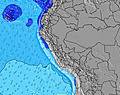 |  | 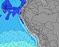 | 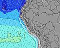 |  | 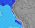 | 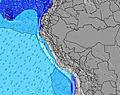 | |||||||||||||
Swell Altura (m) Direção Período (s) | SW 18 | SW 18 | SSW 12 | SSW 12 | SW 16 | SSW 11 | SW 16 | SW 20 | SW 20 | SW 15 | SW 18 | SW 18 | SW 18 | SW 18 | SW 18 | SW 18 | SW 17 | SW 17 | SW 16 | SW 16 | SW 16 |
Onda Gráfico | |||||||||||||||||||||
375 | 370 | 429 | 407 | 511 | 372 | 357 | 373 | 455 | 360 | 409 | 528 | 609 | 694 | 786 | 777 | 1062 | 1194 | 1271 | 1240 | 1240 | |
Vento (km/h) | |||||||||||||||||||||
Estado do Vento maral cruzado-maral Cruzado cruzado-terral terral cristalino | cross-on | cross-on | cross | cross-off | cross-off | cross-off | cross-off | glassy | cross | cross | cross | cross | cross-off | glassy | glassy | glassy | cross-on | cross-on | cross | cross | cross-off |
Maré Alta | 2:53PM0.47m | 4:45AM0.82m | 3:44PM0.47m | 5:21AM0.85m | 4:27PM0.48m | ||||||||||||||||
Maré Baixa | 10:51AM0.38m | 9:15PM0.17m | 11:28AM0.36m | 9:56PM0.14m | 12:00PM0.34m | ||||||||||||||||
6:28 | — | — | — | — | — | 6:26 | — | — | — | — | — | — | — | 6:26 | — | — | — | — | — | — | |
— | — | 5:59 | — | — | — | — | — | — | — | 5:59 | — | — | — | — | — | — | — | 6:00 | — | — | |
mm | — | — | — | — | — | — | — | — | — | — | — | — | — | — | — | — | — | — | — | — | — |
Temp. °C | 21 | 22 | 21 | 20 | 19 | 19 | 19 | 19 | 20 | 21 | 21 | 19 | 19 | 19 | 19 | 19 | 20 | 21 | 21 | 19 | 19 |
Ressent. °C | 22 | 22 | 22 | 21 | 20 | 20 | 20 | 21 | 20 | 21 | 21 | 20 | 20 | 20 | 20 | 20 | 20 | 21 | 21 | 19 | 19 |
Swell 1 Altura (m) Direção Período (s) | SW 13 | SW 12 | SSW 12 | SSW 12 | SSW 11 | SSW 11 | SW 11 | SSW 11 | SSW 11 | SW 15 | SW 15 | SW 18 | SW 18 | SW 18 | SW 18 | SW 18 | SW 17 | SW 17 | SW 16 | SW 16 | SW 16 |
238 | 287 | 429 | 407 | 386 | 372 | 198 | 286 | 275 | 360 | 355 | 528 | 609 | 694 | 786 | 777 | 1062 | 1194 | 1271 | 1240 | 1240 | |
Swell 2 Altura (m) Direção Período (s) | SW 18 | SW 18 | SW 17 | SW 17 | SW 16 | SW 16 | SW 16 | SW 16 | SW 15 | SW 10 | SW 18 | SW 14 | SW 14 | SW 14 | S 6 | S 6 | S 6 | S 6 | S 6 | WNW 14 | WNW 14 |
375 | 370 | 427 | 394 | 511 | 366 | 357 | 344 | 375 | 127 | 409 | 248 | 293 | 189 | 38 | 37 | 40 | 41 | 54 | 40 | 40 | |
Swell 3 Altura (m) Direção Período (s) | SSW 9 | SSW 7 | SW 21 | SW 21 | WNW 15 | SW 20 | S 6 | SW 20 | SW 20 | S 6 | S 6 | SW 10 | SW 10 | S 6 | SW 13 | WSW 13 | SW 10 | WNW 14 | SSW 9 | S 13 | S 12 |
103 | 54 | 224 | 224 | 44 | 315 | 37 | 373 | 455 | 28 | 39 | 80 | 96 | 37 | 175 | 111 | 45 | 40 | 15 | 3 | 3 | |
Ondas de vento Altura (m) Direção Período (s) | — | — | — | — | — | S 6 | — | — | — | — | — | S 6 | — | — | — | — | — | — | — | S 6 | S 6 |
— | — | — | — | — | 53 | — | — | — | — | — | 39 | — | — | — | — | — | — | — | 66 | 66 | |
Terral ou glassy mais perto | |||||||||||||||||||||
Distância (km) | 28 | 28 | 1 | 0 | 0 | 0 | 0 | 0 | 28 | 28 | 28 | 1 | 0 | 0 | 0 | 0 | 28 | 28 | 28 | 1 | 0 |
Melhor previsões de ondas em Lima | |||||||||||||||||||||
Melhor previsões de ondas em Peru | |||||||||||||||||||||
Buscador de Ondas Global | |||||||||||||||||||||
- Map Icons:
 Break
Break Live Wave Height (m)
 Live Wind Speed (km/h)
 Surf Rating (10 Max)
 Ocean Swells (m)
- Wind Speed (km/h)
widget de graça do Surf-Forecast.com para o seu site
O relatório de surf / widget do tempo abaixo está disponível para incorporar em sites de terceiros gratuitamente e fornece um resumo das nossas Playa Norte surf tempo. Simplesmente pegar o trecho de código html que fornecemos e colá-lo em seu próprio site. Você pode escolher seu idioma preferido e unidades métrico/imperial para o surf tempo de alimentação para atender aos usuários do seu site.... Clique aqui para adquirir o código.
 Nearest