
Previsão:

Previsão de curto prazoAlguns chuviscos, mais intensos durante Sábado à noite. Very mild (máx. 17°C no Domingo à tarde, mín 13°C no Domingo à noite). o vento será geralmente fraco. | |||||||||||||||||||
Sáb 18 | Domingo 19 | Segunda-feira 20 | |||||||||||||||||
5 PM | 8 PM | 11 PM | 2 AM | 5 AM | 8 AM | 11 AM | 2 PM | 5 PM | 8 PM | 11 PM | 2 AM | 5 AM | 8 AM | 11 AM | 2 PM | 5 PM | 8 PM | 11 PM | |
Mapa da altura do Swell |  |  | 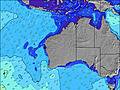 |  |  | 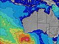 |  | ||||||||||||
Swell Altura (m) Direção Período (s) | WSW 15 | WSW 16 | WSW 16 | WSW 15 | WSW 15 | WSW 14 | WSW 14 | WSW 14 | WSW 14 | WSW 13 | WSW 13 | WSW 13 | WSW 13 | WSW 13 | WSW 13 | WSW 13 | SW 13 | SW 13 | SW 14 |
Onda Gráfico | |||||||||||||||||||
6675 | 6533 | 5700 | 4774 | 3835 | 3199 | 2673 | 2171 | 1744 | 1533 | 1306 | 1060 | 943 | 928 | 822 | 737 | 668 | 668 | 822 | |
Vento (km/h) | |||||||||||||||||||
Estado do Vento maral cruzado-maral Cruzado cruzado-terral terral cristalino | on | on | on | on | cross-on | cross-on | cross-on | on | on | glassy | cross-off | off | off | off | glassy | on | cross-on | cross-on | cross-on |
Maré Alta | 2:34AM0.38m | 10:05AM0.43m | 2:50AM0.44m | 9:10AM0.39m | |||||||||||||||
Maré Baixa | 6:41PM0.22m | 5:19AM0.36m | 6:15PM0.22m | 7:01AM0.38m | 6:01PM0.21m | ||||||||||||||
— | — | — | — | 7:13 | — | — | — | — | — | — | — | 7:13 | — | — | — | — | — | — | |
5:31 | — | — | — | — | — | — | — | 5:31 | — | — | — | — | — | — | — | 5:32 | — | — | |
mm | — | — | — | — | 1 | — | — | — | — | — | — | — | — | — | — | — | — | — | — |
Temp. °C | 17 | 16 | 16 | 16 | 16 | 16 | 16 | 16 | 17 | 16 | 15 | 14 | 13 | 13 | 14 | 15 | 15 | 16 | 15 |
Ressent. °C | 12 | 12 | 13 | 13 | 13 | 12 | 13 | 13 | 14 | 14 | 13 | 12 | 11 | 10 | 13 | 12 | 12 | 13 | 12 |
Swell 1 Altura (m) Direção Período (s) | WSW 15 | WSW 16 | WSW 16 | WSW 15 | WSW 15 | WSW 14 | WSW 14 | WSW 14 | WSW 14 | WSW 13 | WSW 13 | WSW 13 | WSW 13 | WSW 13 | WSW 13 | WSW 13 | SW 13 | SW 13 | SW 14 |
6675 | 6533 | 5700 | 4774 | 3835 | 3199 | 2673 | 2171 | 1744 | 1533 | 1306 | 1060 | 943 | 928 | 822 | 737 | 668 | 668 | 822 | |
Swell 2 Altura (m) Direção Período (s) | — | — | — | — | WSW 15 | — | W 13 | — | — | — | — | — | — | — | — | SW 16 | SW 16 | WSW 16 | — |
— | — | — | — | 1258 | — | 55 | — | — | — | — | — | — | — | — | 67 | 66 | 102 | — | |
Swell 3 Altura (m) Direção Período (s) | — | — | — | — | — | — | — | — | — | — | — | — | — | — | — | SW 16 | — | — | — |
— | — | — | — | — | — | — | — | — | — | — | — | — | — | — | 10 | — | — | — | |
Ondas de vento Altura (m) Direção Período (s) | — | — | — | — | — | — | — | — | — | — | — | — | — | — | — | — | — | — | — |
— | — | — | — | — | — | — | — | — | — | — | — | — | — | — | — | — | — | — | |
Terral ou glassy mais perto | |||||||||||||||||||
Distância (km) | 354 | 351 | 292 | 292 | 292 | 292 | 203 | 167 | 167 | 0 | 0 | 0 | 0 | 0 | 0 | 416 | 167 | 108 | 21 |
Melhor previsões de ondas em Perth City Coast | |||||||||||||||||||
Melhor previsões de ondas em Australia | |||||||||||||||||||
Buscador de Ondas Global | |||||||||||||||||||
- Map Icons:
 Break
Break Live Wave Height (m)
 Live Wind Speed (km/h)
 Surf Rating (10 Max)
 Ocean Swells (m)
- Wind Speed (km/h)
widget de graça do Surf-Forecast.com para o seu site
O relatório de surf / widget do tempo abaixo está disponível para incorporar em sites de terceiros gratuitamente e fornece um resumo das nossas Mullaloo surf tempo. Simplesmente pegar o trecho de código html que fornecemos e colá-lo em seu próprio site. Você pode escolher seu idioma preferido e unidades métrico/imperial para o surf tempo de alimentação para atender aos usuários do seu site.... Clique aqui para adquirir o código.
 Nearest