
Previsão:

Previsão de curto prazoAlguns chuviscos, mais intensos durante Segunda à noite. Warm (máx. 23°C no Sábado à noite, mín 22°C no Domingo de manhã). o vento será geralmente fraco. | ||||||||||||||||||
Sáb 25 | Domingo 26 | Segunda-feira 27 | ||||||||||||||||
8 PM | 11 PM | 2 AM | 5 AM | 8 AM | 11 AM | 2 PM | 5 PM | 8 PM | 11 PM | 2 AM | 5 AM | 8 AM | 11 AM | 2 PM | 5 PM | 8 PM | 11 PM | |
Mapa da altura do Swell | 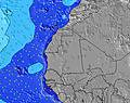 | 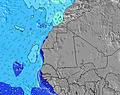 | 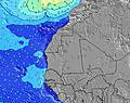 | 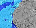 | 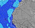 | 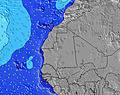 | 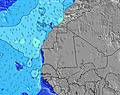 | |||||||||||
Swell Altura (m) Direção Período (s) | S 10 | S 10 | S 9 | S 9 | S 9 | S 9 | S 9 | S 8 | S 8 | S 8 | S 8 | S 8 | S 8 | S 8 | S 8 | S 8 | S 8 | SSE 8 |
Onda Gráfico | ||||||||||||||||||
45 | 44 | 43 | 41 | 54 | 54 | 54 | 52 | 50 | 49 | 48 | 33 | 33 | 33 | 33 | 35 | 50 | 90 | |
Vento (km/h) | ||||||||||||||||||
Estado do Vento maral cruzado-maral Cruzado cruzado-terral terral cristalino | off | off | off | off | off | cross-off | cross-off | off | off | off | off | off | cross-off | cross-off | cross-off | cross-off | off | off |
Maré Alta | 6:12PM0.54m | 6:34AM0.67m | 7:06PM0.57m | 7:21AM0.72m | 7:48PM0.61m | |||||||||||||
Maré Baixa | 11:44PM0.25m | 12:51PM0.22m | 00:39AM0.22m | 1:37PM0.18m | ||||||||||||||
— | — | — | 6:09 | — | — | — | — | — | — | — | 6:09 | — | — | — | — | — | — | |
— | — | — | — | — | — | — | 7:06 | — | — | — | — | — | — | — | 7:06 | — | — | |
mm | — | — | — | — | — | — | — | — | — | — | — | — | — | — | — | — | 1 | — |
Temp. °C | 23 | 23 | 23 | 23 | 22 | 22 | 23 | 23 | 23 | 23 | 22 | 23 | 23 | 22 | 23 | 23 | 23 | 23 |
Ressent. °C | 24 | 22 | 23 | 23 | 22 | 22 | 23 | 24 | 24 | 25 | 23 | 24 | 23 | 23 | 25 | 24 | 26 | 25 |
Swell 1 Altura (m) Direção Período (s) | N 9 | N 9 | N 8 | N 9 | N 9 | N 9 | N 9 | N 9 | N 8 | N 8 | N 8 | N 9 | N 9 | NNE 8 | NNE 8 | NNE 8 | NNE 8 | NNE 8 |
235 | 235 | 241 | 247 | 270 | 320 | 306 | 306 | 241 | 235 | 235 | 258 | 258 | 286 | 286 | 293 | 256 | 256 | |
Swell 2 Altura (m) Direção Período (s) | NE 8 | NE 9 | NE 9 | NE 9 | NE 9 | S 9 | NE 9 | NE 9 | NE 9 | NE 9 | NE 9 | NE 9 | S 8 | S 8 | S 8 | S 8 | S 8 | SSE 8 |
156 | 168 | 183 | 188 | 183 | 54 | 196 | 170 | 183 | 156 | 135 | 132 | 33 | 33 | 33 | 35 | 50 | 90 | |
Swell 3 Altura (m) Direção Período (s) | S 10 | S 10 | S 9 | S 9 | S 9 | NW 10 | S 9 | S 8 | S 8 | S 8 | S 8 | S 8 | NW 9 | NE 9 | NE 9 | NW 9 | NW 9 | NW 9 |
45 | 44 | 43 | 41 | 54 | 4 | 54 | 52 | 50 | 49 | 48 | 33 | 3 | 41 | 21 | 3 | 3 | 3 | |
Ondas de vento Altura (m) Direção Período (s) | — | — | — | — | — | NE 9 | — | — | — | — | — | — | NE 9 | — | — | — | — | — |
— | — | — | — | — | 183 | — | — | — | — | — | — | 132 | — | — | — | — | — | |
Terral ou glassy mais perto | ||||||||||||||||||
Distância (km) | 206 | 206 | 206 | 13 | 13 | 206 | 206 | 13 | 3 | 3 | 3 | 5 | 206 | 13 | 3 | 1426 | 3 | 0 |
Melhor previsões de ondas em Cape-Verde - Sal | ||||||||||||||||||
Melhor previsões de ondas em Cape Verde | ||||||||||||||||||
Buscador de Ondas Global | ||||||||||||||||||
- Map Icons:
 Break
Break Live Wave Height (m)
 Live Wind Speed (km/h)
 Surf Rating (10 Max)
 Ocean Swells (m)
- Wind Speed (km/h)
widget de graça do Surf-Forecast.com para o seu site
O relatório de surf / widget do tempo abaixo está disponível para incorporar em sites de terceiros gratuitamente e fornece um resumo das nossas Monte Leao surf tempo. Simplesmente pegar o trecho de código html que fornecemos e colá-lo em seu próprio site. Você pode escolher seu idioma preferido e unidades métrico/imperial para o surf tempo de alimentação para atender aos usuários do seu site.... Clique aqui para adquirir o código.
 Nearest