
Previsão:

Previsão de curto prazoChuva intensa (total 60mm), mais intensa durante Quinta à noite. Warm (máx. 28°C na Quarta de manhã, mín 24°C na Qui à noite). o vento será geralmente fraco. | |||||||||||||||||||||
Quar 22 | Quinta-feira 23 | Sexta-feira 24 | |||||||||||||||||||
10 AM | 1 PM | 4 PM | 7 PM | 10 PM | 1 AM | 4 AM | 7 AM | 10 AM | 1 PM | 4 PM | 7 PM | 10 PM | 1 AM | 4 AM | 7 AM | 10 AM | 1 PM | 4 PM | 7 PM | 10 PM | |
Mapa da altura do Swell | 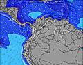 | 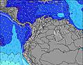 | 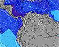 | 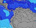 | 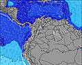 | 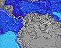 | 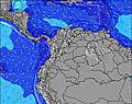 | 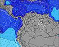 | |||||||||||||
Swell Altura (m) Direção Período (s) | SW 13 | SW 13 | SW 13 | SW 13 | SW 12 | SW 12 | SW 12 | SW 12 | SW 12 | SW 12 | SW 26 | SW 26 | SW 26 | SW 26 | SW 25 | SW 24 | SW 24 | SW 24 | SW 24 | SW 24 | SW 22 |
Onda Gráfico | |||||||||||||||||||||
171 | 168 | 166 | 161 | 120 | 118 | 116 | 114 | 89 | 89 | 105 | 105 | 105 | 105 | 100 | 197 | 271 | 271 | 271 | 195 | 179 | |
Vento (km/h) | |||||||||||||||||||||
Estado do Vento maral cruzado-maral Cruzado cruzado-terral terral cristalino | cross-on | cross-on | on | on | cross-on | cross-on | cross | glassy | glassy | on | cross-on | cross-on | glassy | cross-off | glassy | glassy | glassy | cross-on | cross-on | cross | cross |
Maré Alta | 9:36AM2.93m | 10:12PM2.59m | 10:30AM2.76m | 11:16PM2.48m | 11:31AM2.67m | ||||||||||||||||
Maré Baixa | 4:02PM0.86m | 4:13AM1.07m | 5:01PM0.95m | 5:15AM1.18m | 6:04PM0.97m | ||||||||||||||||
6:03 | — | — | — | — | — | 6:03 | — | — | — | — | — | — | — | 6:03 | — | — | — | — | — | — | |
— | — | 6:29 | — | — | — | — | — | — | — | 6:29 | — | — | — | — | — | — | — | 6:29 | — | — | |
mm | 1 | 1 | — | — | 2 | 3 | 1 | — | — | 1 | — | 1 | 5 | 12 | 7 | 8 | 1 | 4 | 1 | 2 | 3 |
Temp. °C | 28 | 28 | 28 | 28 | 27 | 26 | 25 | 25 | 27 | 27 | 27 | 27 | 26 | 24 | 25 | 24 | 26 | 26 | 26 | 26 | 25 |
Ressent. °C | 31 | 29 | 30 | 32 | 32 | 29 | 28 | 29 | 31 | 30 | 30 | 31 | 31 | 28 | 30 | 28 | 31 | 29 | 30 | 30 | 29 |
Swell 1 Altura (m) Direção Período (s) | SW 13 | SW 13 | SW 13 | SW 13 | SW 12 | SW 12 | SW 12 | SW 12 | SW 6 | SW 7 | SW 7 | SW 7 | SW 7 | SW 7 | SW 7 | WSW 7 | WSW 6 | WSW 6 | WSW 6 | SW 11 | SW 11 |
171 | 168 | 166 | 161 | 120 | 118 | 116 | 114 | 29 | 52 | 52 | 52 | 44 | 44 | 44 | 56 | 47 | 42 | 40 | 99 | 99 | |
Swell 2 Altura (m) Direção Período (s) | SW 6 | SW 10 | SW 21 | W 11 | W 6 | SW 6 | SW 5 | SW 5 | SW 12 | SW 12 | SW 12 | SW 12 | SW 12 | SW 11 | SW 11 | SW 11 | SW 24 | SW 11 | SW 11 | W 6 | W 6 |
8 | 15 | 17 | 2 | 6 | 8 | 9 | 14 | 89 | 89 | 89 | 68 | 66 | 60 | 58 | 58 | 271 | 75 | 75 | 28 | 18 | |
Swell 3 Altura (m) Direção Período (s) | SW 10 | SW 21 | W 11 | SW 20 | W 11 | W 5 | W 6 | SW 19 | SW 19 | SW 19 | SW 26 | SW 26 | SW 26 | SW 26 | SW 25 | SW 24 | SW 11 | SW 24 | SW 24 | SW 24 | SW 22 |
15 | 18 | 2 | 16 | 2 | 2 | 2 | 15 | 15 | 14 | 105 | 105 | 105 | 105 | 100 | 197 | 58 | 271 | 271 | 195 | 179 | |
Ondas de vento Altura (m) Direção Período (s) | — | SW 6 | SW 6 | SW 6 | SW 5 | — | — | — | — | — | — | — | — | — | — | — | — | — | — | — | — |
— | 15 | 16 | 16 | 10 | — | — | — | — | — | — | — | — | — | — | — | — | — | — | — | — | |
Terral ou glassy mais perto | |||||||||||||||||||||
Distância (km) | 311 | 311 | 613 | 343 | 10 | 5 | 5 | 0 | 0 | 316 | 316 | 311 | 0 | 0 | 0 | 0 | 0 | 311 | 311 | 5 | 5 |
Melhor previsões de ondas em Pacific Coast | |||||||||||||||||||||
Melhor previsões de ondas em Colombia | |||||||||||||||||||||
Buscador de Ondas Global | |||||||||||||||||||||
- Map Icons:
 Break
Break Live Wave Height (m)
 Live Wind Speed (km/h)
 Surf Rating (10 Max)
 Ocean Swells (m)
- Wind Speed (km/h)
widget de graça do Surf-Forecast.com para o seu site
O relatório de surf / widget do tempo abaixo está disponível para incorporar em sites de terceiros gratuitamente e fornece um resumo das nossas Mecana surf tempo. Simplesmente pegar o trecho de código html que fornecemos e colá-lo em seu próprio site. Você pode escolher seu idioma preferido e unidades métrico/imperial para o surf tempo de alimentação para atender aos usuários do seu site.... Clique aqui para adquirir o código.
 Nearest