
Matunuck-The point Surf Guide
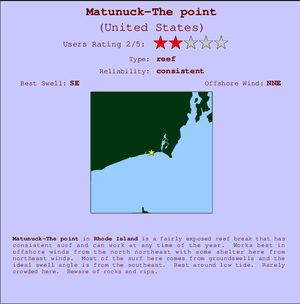
Matanuck-The point in Rhode Island is a fairly exposed reef break that has consistent surf and can work at any time of the year. The best wind direction is from the north northeast with some shelter here from northeast winds. Windswells and groundswells in equal measure and the best swell direction is from the southeast. Right and better left hand reef breaks.. Best around low tide. Rarely crowded here. Hazards include rocks and rips.
Matunuck-The point Spot Info
| Type: | Rating: | Reliability: | Todays Sea Temp*: |
|---|---|---|---|
| consistent | 20.7°C*ocean temperature recorded from satellite |
Surfing Matunuck-The point:
The best conditions reported for surf at Matunuck-The point occur when a Southeast swell combines with an offshore wind direction from the North-northeast.

Previsão da Energia de Ondas (Força): 12hrs


Matunuck-The point Surf:
Friday, 17 July 2026, 12:47 Local time| Sexta-feira 17 | ||||
| 11AM | 2PM | 5PM | 8PM | |
| Wave (m) | ||||
| Período (s) | 5 | 6 | 6 | 6 |
| Vento (km/h) | ||||
| Estado do Vento | cross | cross- on |
cross- on |
cross- on |
- /breaks/Matanuck_The-Point/forecasts/latest
Matunuck-The point Surf Guide
Matanuck-The point in Rhode Island is a fairly exposed reef break that has consistent surf and can work at any time of the year. The best wind direction is from the north northeast with some shelter here from northeast winds. Windswells and groundswells in equal measure and the best swell direction is from the southeast. Right and better left hand reef breaks.. Best around low tide. Rarely crowded here. Hazards include rocks and rips.
Matunuck-The point Spot Info
Type: Rating: Reliability: Todays Sea Temp*:  Reef
Reef 2
2consistent 20.7°C*ocean temperature recorded from satelliteSurfing Matunuck-The point:
The best conditions reported for surf at Matunuck-The point occur when a Southeast swell combines with an offshore wind direction from the North-northeast.
Previsão da Energia de Ondas (Força): 12hrs
Use a aba navegação acima para ver temperatura do mar em Matunuck-The point, fotografias de Matunuck-The point, previsões detalhadas do swell em Matunuck-The point, previsões do vento e do tempo, webcams em Matunuck-The point , vento atual em Rhode Island com base em dados ao vivo fornecidos por estações de meteorologia e previsões da maré em Matunuck-The point. O link para os mapas do swell em United States abrirá uma imagem ampliada monstrando United States e os mares próximos. Estes mapas do swell podem ser animados para mostrar diferentes componentes do swell, energia das ondas, período das ondas, altura das ondas, assim como previsões do vento e do tempo, observações em tempo real do estado do tempo e do mar graças às bóias de United States, navios passantes e estações de meteorologia presentes na costa. Cada uma das páginas de previsão para este surf break apresenta as ferramentas do buscador global e regional para localizar as melores condições de surf na área ao redor de Matunuck-The point.
Matunuck-The point Surf:
Friday, 17 July 2026, 12:47 Local timeSexta-feira 17 11AM 2PM 5PM 8PM Wave (m) Período (s) 5 6 6 6 Vento (km/h) Estado do Vento cross cross-
oncross-
oncross-
on- /breaks/Matanuck_The-Point/forecasts/latest
- /breaks/Matanuck_The-Point/forecasts/latest/six_day
Matunuck-The point Surf Guide
Matanuck-The point in Rhode Island is a fairly exposed reef break that has consistent surf and can work at any time of the year. The best wind direction is from the north northeast with some shelter here from northeast winds. Windswells and groundswells in equal measure and the best swell direction is from the southeast. Right and better left hand reef breaks.. Best around low tide. Rarely crowded here. Hazards include rocks and rips.
Matunuck-The point Spot Info
Type: Rating: Reliability: Todays Sea Temp*: Reef2consistent 20.7°C*ocean temperature recorded from satelliteSurfing Matunuck-The point:
The best conditions reported for surf at Matunuck-The point occur when a Southeast swell combines with an offshore wind direction from the North-northeast.
Previsão da Energia de Ondas (Força): 12hrs
Use a aba navegação acima para ver temperatura do mar em Matunuck-The point, fotografias de Matunuck-The point, previsões detalhadas do swell em Matunuck-The point, previsões do vento e do tempo, webcams em Matunuck-The point , vento atual em Rhode Island com base em dados ao vivo fornecidos por estações de meteorologia e previsões da maré em Matunuck-The point. O link para os mapas do swell em United States abrirá uma imagem ampliada monstrando United States e os mares próximos. Estes mapas do swell podem ser animados para mostrar diferentes componentes do swell, energia das ondas, período das ondas, altura das ondas, assim como previsões do vento e do tempo, observações em tempo real do estado do tempo e do mar graças às bóias de United States, navios passantes e estações de meteorologia presentes na costa. Cada uma das páginas de previsão para este surf break apresenta as ferramentas do buscador global e regional para localizar as melores condições de surf na área ao redor de Matunuck-The point.
Matunuck-The point Surf:
Friday, 17 July 2026, 12:47 Local timeSexta-feira 17 11AM 2PM 5PM 8PM Wave (m) Período (s) 5 6 6 6 Vento (km/h) Estado do Vento cross cross-
oncross-
oncross-
on- /breaks/Matanuck_The-Point/forecasts/latest
Matunuck-The point Surf Guide
Matanuck-The point in Rhode Island is a fairly exposed reef break that has consistent surf and can work at any time of the year. The best wind direction is from the north northeast with some shelter here from northeast winds. Windswells and groundswells in equal measure and the best swell direction is from the southeast. Right and better left hand reef breaks.. Best around low tide. Rarely crowded here. Hazards include rocks and rips.
Matunuck-The point Spot Info
Type: Rating: Reliability: Todays Sea Temp*: Reef2consistent 20.7°C*ocean temperature recorded from satelliteSurfing Matunuck-The point:
The best conditions reported for surf at Matunuck-The point occur when a Southeast swell combines with an offshore wind direction from the North-northeast.
Previsão da Energia de Ondas (Força): 12hrs
Use a aba navegação acima para ver temperatura do mar em Matunuck-The point, fotografias de Matunuck-The point, previsões detalhadas do swell em Matunuck-The point, previsões do vento e do tempo, webcams em Matunuck-The point , vento atual em Rhode Island com base em dados ao vivo fornecidos por estações de meteorologia e previsões da maré em Matunuck-The point. O link para os mapas do swell em United States abrirá uma imagem ampliada monstrando United States e os mares próximos. Estes mapas do swell podem ser animados para mostrar diferentes componentes do swell, energia das ondas, período das ondas, altura das ondas, assim como previsões do vento e do tempo, observações em tempo real do estado do tempo e do mar graças às bóias de United States, navios passantes e estações de meteorologia presentes na costa. Cada uma das páginas de previsão para este surf break apresenta as ferramentas do buscador global e regional para localizar as melores condições de surf na área ao redor de Matunuck-The point.
Matunuck-The point Surf:
Friday, 17 July 2026, 12:47 Local timeSexta-feira 17 11AM 2PM 5PM 8PM Wave (m) Período (s) 5 6 6 6 Vento (km/h) Estado do Vento cross cross-
oncross-
oncross-
onTide Times:
Para Moonstone Beach, Rhode Island %{dist} %{km} de %{location}
A PRÓXIMA É ÀS (hora local) faltam maré alta maré baixa Matunuck-The point Tide Times and Tide Chart
Live Weather:
At Westerly Airport, 21 km from Matunuck-The point.
light winds from the N
(km/h)
ClearAir temperature
23.9°CCurrent weather near Matunuck-The point
Buoy Data:
At Block Island, RI, 35 miles from Matunuck-The point.
7AM 8AM 9AM 10AM Idade dos dados 4 hr 3 hr 2 hr 1 hr Altura de onda (m) 

Período Dominante (s) 15 15 14 14 Overall Matunuck-The point Surf Consistency and Wind Distribution in Julho


Wind stats for Matunuck-The point: see the variation in direction and stength by month.
fotos da galeria
Contornos: Estradas & Rios: Escolha um spot de surf da lista 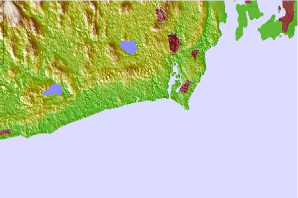
Use este mapa de relevo para navegar até Rhode Island surf quebras e estações que estão na área de maré Matunuck-The point
Outros Spots de Surf mais próximos de Matunuck-The point:
(Clique no nome do local para maiores detalhes)- Closest spot0 mi
- Second closest spot1 mi
- Third closest spot1 mi
- Fourth closest spot2 mi
- Fifth closest spot3 mi
Bóias ondográficas mais próxima de Matunuck-The point:
- Closest bóia ondográfica35 mi
- Second closest bóia ondográfica54 mi
- Third closest bóia ondográfica60 mi
- Fourth closest bóia ondográfica71 mi
- Fifth closest bóia ondográfica71 mi
Estações de maré mais próximo de Matunuck-The point:
- Closest estação de maréMoonstone Beach1 mi
- Second closest estação de maréPoint Judith Harbor of Refuge3 mi
- Third closest estação de maréCharlestown5 mi
- Fourth closest estação de maréNarragansett Pier, Narragansett Bay6 mi
- Fifth closest estação de maréWatson Pier, Boston Neck, Narragansett Bay9 mi
Airports
- The closest passenger airport to Matunuck-The point is Theodore Francis Green State (Providence) Airport (PVD) in USA, 40 km (25 miles) away (directly).
- The second nearest airport to Matunuck-The point is North Central State (Smithfield) Airport (SFZ), also in USA, 61 km (38 miles) away.
- Third is Otis Angb (Falmouth) Airport (FMH) in USA, 91 km (57 miles) away.
- Hartford Brainard Airport (HFD) in USA is 100 km (62 miles) away.
- The Francis S Gabreski (West Hampton Beach) Airport (FOK), also in USA is the fifth nearest airport to Matunuck-The point and is 108 km (67 miles) away.
- /breaks/Matanuck_The-Point/forecasts/latest
 Nearest