
Previsão:

Previsão de curto prazoprincipalmente seco. Very mild (máx. 17°C no Domingo à tarde, mín 14°C no Domingo à noite). o vento será geralmente fraco. | ||||||||||||||||||
Sáb 25 | Domingo 26 | Segunda-feira 27 | ||||||||||||||||
8 PM | 11 PM | 2 AM | 5 AM | 8 AM | 11 AM | 2 PM | 5 PM | 8 PM | 11 PM | 2 AM | 5 AM | 8 AM | 11 AM | 2 PM | 5 PM | 8 PM | 11 PM | |
Mapa da altura do Swell |  |  | 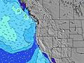 |  |  | 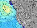 |  | |||||||||||
Swell Altura (m) Direção Período (s) | SW 21 | SW 21 | SW 21 | SW 21 | SW 20 | SW 20 | SW 19 | SW 19 | SW 19 | SW 19 | SW 19 | SW 19 | SW 18 | SW 18 | SW 18 | SW 18 | SW 18 | SW 18 |
Onda Gráfico | ||||||||||||||||||
548 | 368 | 365 | 361 | 318 | 455 | 546 | 546 | 450 | 303 | 303 | 293 | 379 | 375 | 375 | 375 | 375 | 379 | |
Vento (km/h) | ||||||||||||||||||
Estado do Vento maral cruzado-maral Cruzado cruzado-terral terral cristalino | cross | cross | cross | cross | cross | cross-on | cross-on | cross-on | glassy | cross-off | cross-off | cross-off | cross-off | cross-on | cross-on | cross-on | cross | cross-off |
Maré Alta | 10:12PM2.28m | 12:40PM1.73m | 10:59PM2.33m | 1:13PM1.79m | ||||||||||||||
Maré Baixa | 5:45AM-0.02m | 5:09PM1.11m | 6:24AM-0.10m | 5:53PM1.05m | ||||||||||||||
— | — | — | 5:50 | — | — | — | — | — | — | — | 5:52 | — | — | — | — | — | — | |
8:52 | — | — | — | — | — | — | — | 8:52 | — | — | — | — | — | — | — | 8:50 | — | |
mm | — | — | — | — | — | — | — | — | — | — | — | — | — | — | — | — | — | — |
Temp. °C | 15 | 15 | 16 | 15 | 15 | 16 | 17 | 16 | 16 | 15 | 15 | 14 | 15 | 16 | 17 | 16 | 16 | 15 |
Ressent. °C | 14 | 14 | 15 | 14 | 14 | 14 | 16 | 15 | 16 | 14 | 14 | 12 | 14 | 14 | 15 | 15 | 15 | 14 |
Swell 1 Altura (m) Direção Período (s) | SW 6 | SW 6 | SW 6 | NW 10 | NW 10 | NW 10 | SW 19 | SW 19 | WNW 9 | NW 9 | NW 9 | NW 9 | NW 9 | SW 18 | SW 18 | SW 18 | SW 18 | SW 18 |
62 | 43 | 28 | 104 | 115 | 110 | 546 | 546 | 133 | 99 | 99 | 97 | 83 | 375 | 375 | 375 | 375 | 379 | |
Swell 2 Altura (m) Direção Período (s) | SW 21 | SW 21 | SW 21 | SW 21 | SW 20 | SW 20 | NW 9 | NW 9 | SW 19 | SW 19 | SW 19 | SW 19 | SW 18 | NW 9 | NW 9 | NW 9 | NW 9 | NW 9 |
548 | 368 | 365 | 361 | 318 | 455 | 106 | 123 | 450 | 303 | 303 | 293 | 379 | 83 | 81 | 81 | 77 | 59 | |
Swell 3 Altura (m) Direção Período (s) | NW 9 | WNW 8 | WNW 8 | SW 6 | SW 6 | SW 5 | SW 12 | SW 5 | SW 12 | W 5 | WSW 5 | WSW 6 | WSW 5 | SW 21 | WSW 5 | WSW 5 | WSW 5 | WSW 5 |
59 | 47 | 47 | 20 | 15 | 10 | 23 | 9 | 22 | 14 | 17 | 17 | 19 | 72 | 26 | 19 | 15 | 15 | |
Ondas de vento Altura (m) Direção Período (s) | — | — | — | — | — | — | SW 5 | — | — | — | — | — | — | WSW 5 | — | — | — | — |
— | — | — | — | — | — | 13 | — | — | — | — | — | — | 26 | — | — | — | — | |
Terral ou glassy mais perto | ||||||||||||||||||
Distância (km) | 135 | 84 | 135 | 135 | 84 | 135 | 135 | 135 | 84 | 84 | 29 | 7 | 29 | 135 | 135 | 135 | 84 | 29 |
Melhor previsões de ondas em North Oregon | ||||||||||||||||||
Melhor previsões de ondas em United States | ||||||||||||||||||
Buscador de Ondas Global | ||||||||||||||||||
- Map Icons:
 Break
Break Live Wave Height (m)
 Live Wind Speed (km/h)
 Surf Rating (10 Max)
 Ocean Swells (m)
- Wind Speed (km/h)
widget de graça do Surf-Forecast.com para o seu site
O relatório de surf / widget do tempo abaixo está disponível para incorporar em sites de terceiros gratuitamente e fornece um resumo das nossas Manzanita surf tempo. Simplesmente pegar o trecho de código html que fornecemos e colá-lo em seu próprio site. Você pode escolher seu idioma preferido e unidades métrico/imperial para o surf tempo de alimentação para atender aos usuários do seu site.... Clique aqui para adquirir o código.
 Nearest