
Previsão:

Previsão de curto prazochuva moderada (total 18mm), mais intensa na Segunda de manhã. Warm (máx. 27°C na Seg à noite, mín 23°C na Seg à noite). o vento será geralmente fraco. | |||||||||||||||||||||||
Segunda-feira 3 | Terça-feira 4 | Quarta-feira 5 | |||||||||||||||||||||
5 AM | 8 AM | 11 AM | 2 PM | 5 PM | 8 PM | 11 PM | 2 AM | 5 AM | 8 AM | 11 AM | 2 PM | 5 PM | 8 PM | 11 PM | 2 AM | 5 AM | 8 AM | 11 AM | 2 PM | 5 PM | 8 PM | 11 PM | |
Mapa da altura do Swell |  |  | 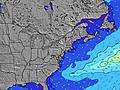 |  | 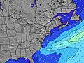 |  |  | 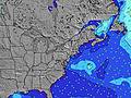 |  | ||||||||||||||
Swell Altura (m) Direção Período (s) | SSE 8 | SSE 8 | SSE 8 | SSE 8 | SSE 8 | SSE 8 | SSE 8 | SSE 8 | NE 3 | E 4 | SE 7 | SE 6 | ESE 7 | ESE 7 | SE 7 | SE 7 | SE 7 | SE 7 | SE 7 | SE 7 | E 12 | ENE 4 | SE 6 |
Onda Gráfico | |||||||||||||||||||||||
0 | 0 | 0 | 0 | 0 | 0 | 0 | 0 | 6 | 17 | 102 | 56 | 91 | 86 | 82 | 57 | 57 | 45 | 44 | 15 | 3 | 2 | 18 | |
Vento (km/h) | |||||||||||||||||||||||
Estado do Vento maral cruzado-maral Cruzado cruzado-terral terral cristalino | cross-on | cross | cross | cross | cross | cross | off | cross | cross | cross-on | cross | cross | cross | cross | cross | glassy | cross-off | cross-on | cross-on | cross | glassy | cross-on | cross-on |
Maré Alta | 12:17PM1.16m | 00:29AM1.14m | 1:03PM1.20m | 1:18AM1.08m | 1:53PM1.23m | ||||||||||||||||||
Maré Baixa | 6:02AM0.08m | 6:24PM0.19m | 6:45AM0.09m | 7:22PM0.21m | 7:31AM0.10m | 8:23PM0.22m | |||||||||||||||||
5:58 | — | — | — | — | — | — | — | 5:58 | — | — | — | — | — | — | — | 6:00 | — | — | — | — | — | — | |
— | — | — | — | — | 8:07 | — | — | — | — | — | — | — | 8:06 | — | — | — | — | — | — | — | 8:05 | — | |
mm | 2 | 5 | 4 | 3 | 3 | 3 | — | — | — | — | — | — | — | — | — | — | — | — | — | — | — | — | — |
Temp. °C | 24 | 24 | 24 | 25 | 25 | 27 | 26 | 24 | 23 | 23 | 24 | 24 | 24 | 23 | 23 | 23 | 23 | 23 | 23 | 24 | 25 | 25 | 25 |
Ressent. °C | 23 | 24 | 25 | 26 | 27 | 29 | 29 | 22 | 21 | 22 | 22 | 22 | 23 | 24 | 25 | 27 | 27 | 26 | 25 | 27 | 29 | 27 | 27 |
Swell 1 Altura (m) Direção Período (s) | — | — | SSE 8 | SSE 8 | SSE 8 | SSE 8 | SSE 8 | SSE 8 | SSE 8 | SSE 7 | SSE 7 | SE 6 | SE 7 | ESE 7 | SE 7 | SE 7 | SE 7 | SE 7 | SE 7 | SE 7 | E 4 | ENE 4 | SE 6 |
— | — | 268 | 228 | 350 | 188 | 165 | 119 | 88 | 61 | 164 | 56 | 55 | 86 | 82 | 57 | 57 | 45 | 44 | 15 | 2 | 2 | 18 | |
Swell 2 Altura (m) Direção Período (s) | — | — | — | — | — | — | — | — | — | — | — | S 7 | S 7 | E 8 | E 9 | — | E 9 | — | S 7 | SSE 6 | — | — | — |
— | — | — | — | — | — | — | — | — | — | — | 63 | 47 | 1 | 2 | — | 2 | — | 43 | 13 | — | — | — | |
Swell 3 Altura (m) Direção Período (s) | — | — | — | — | — | — | — | — | — | — | — | — | — | — | — | — | — | — | E 11 | E 4 | E 12 | — | E 10 |
— | — | — | — | — | — | — | — | — | — | — | — | — | — | — | — | — | — | 2 | 3 | 3 | — | 2 | |
Ondas de vento Altura (m) Direção Período (s) | SSE 8 | SSE 8 | — | — | SSE 8 | — | — | NE 3 | NE 3 | E 4 | SE 7 | — | ESE 7 | ENE 4 | — | — | — | — | — | — | SSE 6 | SSE 6 | S 4 |
344 | 338 | — | — | 181 | — | — | 2 | 6 | 17 | 102 | — | 91 | 23 | — | — | — | — | — | — | 26 | 34 | 11 | |
Terral ou glassy mais perto | |||||||||||||||||||||||
Distância (km) | 1501 | 117 | 97 | 97 | 24 | 14 | 2 | 76 | 136 | 139 | 141 | 278 | 304 | 73 | 141 | 2 | 18 | 50 | 72 | 6 | 30 | 279 | 34 |
Melhor previsões de ondas em New Jersey | |||||||||||||||||||||||
Melhor previsões de ondas em United States | |||||||||||||||||||||||
Buscador de Ondas Global | |||||||||||||||||||||||
- Map Icons:
 Break
Break Live Wave Height (m)
 Live Wind Speed (km/h)
 Surf Rating (10 Max)
 Ocean Swells (m)
- Wind Speed (km/h)
widget de graça do Surf-Forecast.com para o seu site
O relatório de surf / widget do tempo abaixo está disponível para incorporar em sites de terceiros gratuitamente e fornece um resumo das nossas Kirbys Point surf tempo. Simplesmente pegar o trecho de código html que fornecemos e colá-lo em seu próprio site. Você pode escolher seu idioma preferido e unidades métrico/imperial para o surf tempo de alimentação para atender aos usuários do seu site.... Clique aqui para adquirir o código.
 Nearest