
Previsão:

Previsão de curto prazoChuva intensa (total 40mm), mais intensa durante Domingo à noite. Warm (máx. 29°C na Quarta à tarde, mín 25°C na Seg à noite). Ventos diminuem (ventos frescos de Su-Sudoeste no Domingo à noite, calmo na Terça de manhã). | |||||||||||||||||||
Dom 2 | Segunda-feira 3 | Terça-feira 4 | |||||||||||||||||
5 PM | 8 PM | 11 PM | 2 AM | 5 AM | 8 AM | 11 AM | 2 PM | 5 PM | 8 PM | 11 PM | 2 AM | 5 AM | 8 AM | 11 AM | 2 PM | 5 PM | 8 PM | 11 PM | |
Mapa da altura do Swell |  |  | 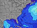 | 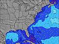 | 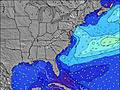 | 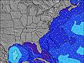 | 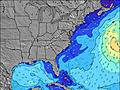 | ||||||||||||
Swell Altura (m) Direção Período (s) | S 6 | S 7 | S 7 | S 7 | SSW 7 | S 7 | S 7 | S 7 | S 6 | S 7 | S 7 | S 7 | S 7 | S 7 | SSW 7 | S 6 | S 6 | S 6 | S 6 |
Onda Gráfico | |||||||||||||||||||
186 | 226 | 286 | 382 | 134 | 206 | 222 | 220 | 175 | 226 | 440 | 254 | 233 | 127 | 83 | 109 | 102 | 83 | 64 | |
Vento (km/h) | |||||||||||||||||||
Estado do Vento maral cruzado-maral Cruzado cruzado-terral terral cristalino | on | on | on | cross-on | on | cross-on | on | on | cross-on | cross-on | cross-on | on | cross-on | cross-on | glassy | on | on | on | on |
Maré Alta | 10:50PM1.42m | 11:23AM1.40m | 11:34PM1.36m | 12:14PM1.42m | |||||||||||||||
Maré Baixa | 4:36PM0.31m | 5:02AM0.24m | 5:24PM0.35m | 5:43AM0.23m | 6:19PM0.39m | ||||||||||||||
— | — | — | — | 6:24 | — | — | — | — | — | — | — | 6:26 | — | — | — | — | — | — | |
— | 8:12 | — | — | — | — | — | — | — | 8:10 | — | — | — | — | — | — | — | 8:10 | — | |
mm | 1 | — | — | 4 | 5 | 3 | 1 | 1 | 2 | 2 | 2 | 2 | 2 | 4 | 3 | 2 | 2 | 1 | — |
Temp. °C | 28 | 27 | 27 | 27 | 27 | 26 | 26 | 27 | 27 | 26 | 25 | 26 | 26 | 25 | 25 | 26 | 25 | 26 | 27 |
Ressent. °C | 28 | 26 | 26 | 27 | 27 | 26 | 26 | 28 | 26 | 26 | 25 | 28 | 28 | 28 | 29 | 27 | 28 | 27 | 29 |
Swell 1 Altura (m) Direção Período (s) | — | — | — | SE 8 | SSE 8 | — | — | — | — | — | — | — | S 7 | SE 7 | SSW 6 | SE 7 | SE 7 | SE 6 | — |
— | — | — | 136 | 88 | — | — | — | — | — | — | — | 153 | 55 | 66 | 75 | 36 | 33 | — | |
Swell 2 Altura (m) Direção Período (s) | — | — | — | — | — | — | — | — | — | — | — | — | — | — | SE 7 | — | — | — | — |
— | — | — | — | — | — | — | — | — | — | — | — | — | — | 36 | — | — | — | — | |
Swell 3 Altura (m) Direção Período (s) | — | — | — | — | — | — | — | — | — | — | — | — | — | — | — | — | — | — | — |
— | — | — | — | — | — | — | — | — | — | — | — | — | — | — | — | — | — | — | |
Ondas de vento Altura (m) Direção Período (s) | S 6 | S 7 | S 7 | S 7 | SSW 7 | S 7 | S 7 | S 7 | S 6 | S 7 | S 7 | S 7 | S 7 | S 7 | SSW 7 | S 6 | S 6 | S 6 | S 6 |
186 | 226 | 286 | 382 | 134 | 206 | 222 | 220 | 175 | 226 | 440 | 254 | 233 | 127 | 83 | 109 | 102 | 83 | 64 | |
Terral ou glassy mais perto | |||||||||||||||||||
Distância (km) | 501 | 536 | 504 | 491 | 549 | 214 | 536 | 538 | 804 | 552 | 328 | 378 | 29 | 29 | 0 | 501 | 29 | 385 | 274 |
Melhor previsões de ondas em North Carolina | |||||||||||||||||||
Melhor previsões de ondas em United States | |||||||||||||||||||
Buscador de Ondas Global | |||||||||||||||||||
- Map Icons:
 Break
Break Live Wave Height (m)
 Live Wind Speed (km/h)
 Surf Rating (10 Max)
 Ocean Swells (m)
- Wind Speed (km/h)
widget de graça do Surf-Forecast.com para o seu site
O relatório de surf / widget do tempo abaixo está disponível para incorporar em sites de terceiros gratuitamente e fornece um resumo das nossas Holden Beach surf tempo. Simplesmente pegar o trecho de código html que fornecemos e colá-lo em seu próprio site. Você pode escolher seu idioma preferido e unidades métrico/imperial para o surf tempo de alimentação para atender aos usuários do seu site.... Clique aqui para adquirir o código.
 Nearest