
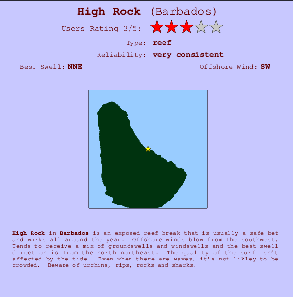
High Rock Surf Guide
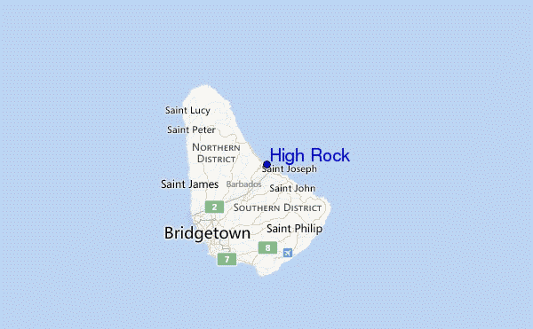
High Rock on the East Coast is an exposed reef break that has very consistent waves and works all around the year. The best wind direction is from the southwest. Waves just as likely from local windswells as from distant groundswells and the ideal swell direction is from the north northeast. A choice of left and right reefs. The quality of the surf isn't affected by the tide. Even when there are waves, it's not likley to be crowded. Watch out for urchins, rips, rocks and sharks.
High Rock Spot Info
| Type: | Rating: | Reliability: | Todays Sea Temp*: |
|---|---|---|---|
| very consistent | 28.3°C*ocean temperature recorded from satellite |
Surfing High Rock:
The best conditions reported for surf at High Rock occur when a North-northeast swell combines with an offshore wind direction from the Southwest.

Previsão da Energia de Ondas (Força): 12hrs


High Rock Surf:
Monday, 27 July 2026, 20:24 Local time| Segunda-feira 27 | Ter | |||
| 5PM | 8PM | 11PM | 2AM | |
| Wave (m) | ||||
| Período (s) | 8 | 8 | 8 | 8 |
| Vento (km/h) | ||||
| Estado do Vento | cross- on |
cross- on |
cross- on |
cross- on |
- /breaks/High-Rock/forecasts/latest
High Rock Surf Guide
High Rock on the East Coast is an exposed reef break that has very consistent waves and works all around the year. The best wind direction is from the southwest. Waves just as likely from local windswells as from distant groundswells and the ideal swell direction is from the north northeast. A choice of left and right reefs. The quality of the surf isn't affected by the tide. Even when there are waves, it's not likley to be crowded. Watch out for urchins, rips, rocks and sharks.
High Rock Spot Info
Type: Rating: Reliability: Todays Sea Temp*:  Reef
Reef 3
3very consistent 28.3°C*ocean temperature recorded from satelliteSurfing High Rock:
The best conditions reported for surf at High Rock occur when a North-northeast swell combines with an offshore wind direction from the Southwest.
Previsão da Energia de Ondas (Força): 12hrs
Use a aba navegação acima para ver temperatura do mar em High Rock, fotografias de High Rock, previsões detalhadas do swell em High Rock, previsões do vento e do tempo, webcams em High Rock , vento atual em Barbados com base em dados ao vivo fornecidos por estações de meteorologia e previsões da maré em High Rock. O link para os mapas do swell em Barbados abrirá uma imagem ampliada monstrando Barbados e os mares próximos. Estes mapas do swell podem ser animados para mostrar diferentes componentes do swell, energia das ondas, período das ondas, altura das ondas, assim como previsões do vento e do tempo, observações em tempo real do estado do tempo e do mar graças às bóias de Barbados, navios passantes e estações de meteorologia presentes na costa. Cada uma das páginas de previsão para este surf break apresenta as ferramentas do buscador global e regional para localizar as melores condições de surf na área ao redor de High Rock.
High Rock Surf:
Monday, 27 July 2026, 20:24 Local timeSegunda-feira 27 Ter 5PM 8PM 11PM 2AM Wave (m) Período (s) 8 8 8 8 Vento (km/h) Estado do Vento cross-
oncross-
oncross-
oncross-
on- /breaks/High-Rock/forecasts/latest
- /breaks/High-Rock/forecasts/latest/six_day
High Rock Surf Guide
High Rock on the East Coast is an exposed reef break that has very consistent waves and works all around the year. The best wind direction is from the southwest. Waves just as likely from local windswells as from distant groundswells and the ideal swell direction is from the north northeast. A choice of left and right reefs. The quality of the surf isn't affected by the tide. Even when there are waves, it's not likley to be crowded. Watch out for urchins, rips, rocks and sharks.
High Rock Spot Info
Type: Rating: Reliability: Todays Sea Temp*: Reef3very consistent 28.3°C*ocean temperature recorded from satelliteSurfing High Rock:
The best conditions reported for surf at High Rock occur when a North-northeast swell combines with an offshore wind direction from the Southwest.
Previsão da Energia de Ondas (Força): 12hrs
Use a aba navegação acima para ver temperatura do mar em High Rock, fotografias de High Rock, previsões detalhadas do swell em High Rock, previsões do vento e do tempo, webcams em High Rock , vento atual em Barbados com base em dados ao vivo fornecidos por estações de meteorologia e previsões da maré em High Rock. O link para os mapas do swell em Barbados abrirá uma imagem ampliada monstrando Barbados e os mares próximos. Estes mapas do swell podem ser animados para mostrar diferentes componentes do swell, energia das ondas, período das ondas, altura das ondas, assim como previsões do vento e do tempo, observações em tempo real do estado do tempo e do mar graças às bóias de Barbados, navios passantes e estações de meteorologia presentes na costa. Cada uma das páginas de previsão para este surf break apresenta as ferramentas do buscador global e regional para localizar as melores condições de surf na área ao redor de High Rock.
High Rock Surf:
Monday, 27 July 2026, 20:24 Local timeSegunda-feira 27 Ter 5PM 8PM 11PM 2AM Wave (m) Período (s) 8 8 8 8 Vento (km/h) Estado do Vento cross-
oncross-
oncross-
oncross-
on- /breaks/High-Rock/forecasts/latest
High Rock Surf Guide
High Rock on the East Coast is an exposed reef break that has very consistent waves and works all around the year. The best wind direction is from the southwest. Waves just as likely from local windswells as from distant groundswells and the ideal swell direction is from the north northeast. A choice of left and right reefs. The quality of the surf isn't affected by the tide. Even when there are waves, it's not likley to be crowded. Watch out for urchins, rips, rocks and sharks.
High Rock Spot Info
Type: Rating: Reliability: Todays Sea Temp*: Reef3very consistent 28.3°C*ocean temperature recorded from satelliteSurfing High Rock:
The best conditions reported for surf at High Rock occur when a North-northeast swell combines with an offshore wind direction from the Southwest.
Previsão da Energia de Ondas (Força): 12hrs
Use a aba navegação acima para ver temperatura do mar em High Rock, fotografias de High Rock, previsões detalhadas do swell em High Rock, previsões do vento e do tempo, webcams em High Rock , vento atual em Barbados com base em dados ao vivo fornecidos por estações de meteorologia e previsões da maré em High Rock. O link para os mapas do swell em Barbados abrirá uma imagem ampliada monstrando Barbados e os mares próximos. Estes mapas do swell podem ser animados para mostrar diferentes componentes do swell, energia das ondas, período das ondas, altura das ondas, assim como previsões do vento e do tempo, observações em tempo real do estado do tempo e do mar graças às bóias de Barbados, navios passantes e estações de meteorologia presentes na costa. Cada uma das páginas de previsão para este surf break apresenta as ferramentas do buscador global e regional para localizar as melores condições de surf na área ao redor de High Rock.
High Rock Surf:
Monday, 27 July 2026, 20:24 Local timeSegunda-feira 27 Ter 5PM 8PM 11PM 2AM Wave (m) Período (s) 8 8 8 8 Vento (km/h) Estado do Vento cross-
oncross-
oncross-
oncross-
onTide Times:
Para Barclays %{dist} %{km} de %{location}
A PRÓXIMA É ÀS (hora local) faltam maré alta maré baixa High Rock Tide Times and Tide Chart
Live Weather:
At Grantley Adams International Airport, 17 km from High Rock.
moderate winds from the E
(km/h)
Shower - in the vicinityAir temperature
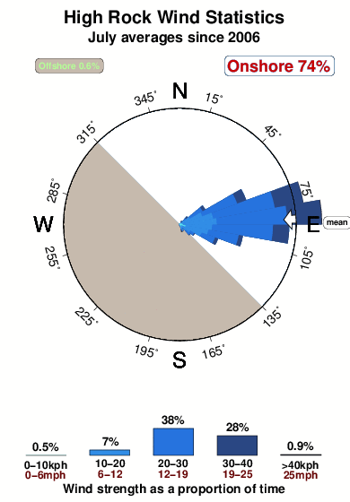
28°COverall High Rock Surf Consistency and Wind Distribution in Julho
fotos da galeria
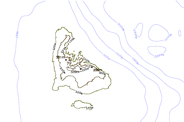
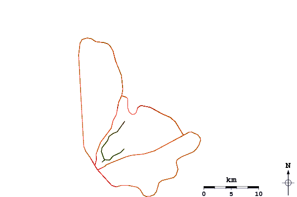
Contornos: Estradas & Rios: Escolha um spot de surf da lista 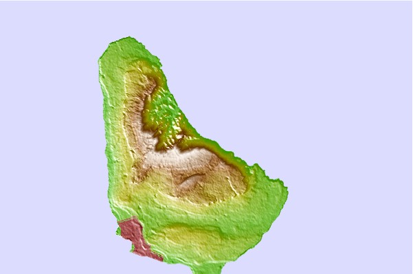
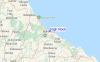
Use este mapa de relevo para navegar até Barbados surf quebras e estações que estão na área de maré High Rock
Outros Spots de Surf mais próximos de High Rock:
(Clique no nome do local para maiores detalhes)- Closest spot0 mi
- Second closest spot0 mi
- Third closest spot1 mi
- Fourth closest spot1 mi
- Fifth closest spot1 mi
Bóias ondográficas mais próxima de High Rock:
- Closest bóia ondográfica242 mi
- Second closest bóia ondográfica350 mi
- Third closest bóia ondográfica446 mi
- Fourth closest bóia ondográfica492 mi
- Fifth closest bóia ondográfica527 mi
Estações de maré mais próximo de High Rock:
- Closest estação de maréBridgetown, Barbados11 mi
- Second closest estação de maréVieux Fort Bay104 mi
- Third closest estação de maréLe Robert109 mi
- Fourth closest estação de maréBisee112 mi
- Fifth closest estação de maréPort Castries114 mi
Airports
- The closest passenger airport to High Rock is Grantley Adams International (Bridgetown) Airport (BGI) in Barbados, 16 km (10 miles) away (directly).
- The second nearest airport to High Rock is Hewanorra International (Hewandorra) Airport (UVF) in St. Lucia Island, 165 km (102 miles) away.
- Third is George F L Charles (Castries) Airport (SLU) in St. Lucia Island, 183 km (114 miles) away.
- Mustique Airport (MQS) in St.vincent/grenadines is 183 km (114 miles) away.
- E T Joshua (Kingstown) Airport (SVD), also in St.vincent/grenadines is the fifth nearest airport to High Rock and is 183 km (114 miles) away.
- /breaks/High-Rock/forecasts/latest


 Nearest