
Previsão:

Previsão de curto prazoAlguns chuviscos, mais intensos durante Segunda de manhã. Warm (máx. 25°C na Terça à tarde, mín 17°C na Seg à noite). o vento será geralmente fraco. | |||||||||||||||||||||||
Segunda-feira 27 | Terça-feira 28 | Quarta-feira 29 | |||||||||||||||||||||
5 AM | 8 AM | 11 AM | 2 PM | 5 PM | 8 PM | 11 PM | 2 AM | 5 AM | 8 AM | 11 AM | 2 PM | 5 PM | 8 PM | 11 PM | 2 AM | 5 AM | 8 AM | 11 AM | 2 PM | 5 PM | 8 PM | 11 PM | |
Mapa da altura do Swell |  |  |  |  | 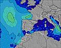 |  |  | 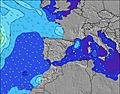 |  | ||||||||||||||
Swell Altura (m) Direção Período (s) | NW 7 | NNW 11 | NNW 10 | NNW 10 | NNW 10 | NNW 10 | NNW 10 | NNW 10 | NNW 10 | NNW 10 | NNW 10 | NNW 10 | NW 10 | NW 10 | NW 10 | NNW 10 | NNW 9 | NW 9 | NW 9 | NW 9 | NW 9 | NW 9 | NW 9 |
Onda Gráfico | |||||||||||||||||||||||
125 | 207 | 494 | 457 | 419 | 436 | 445 | 394 | 367 | 367 | 320 | 272 | 229 | 192 | 188 | 161 | 151 | 123 | 120 | 97 | 78 | 62 | 109 | |
Vento (km/h) | |||||||||||||||||||||||
Estado do Vento maral cruzado-maral Cruzado cruzado-terral terral cristalino | cross | cross-on | glassy | cross-on | cross-on | cross | cross-off | cross-off | cross-off | cross-off | cross | cross | cross-on | glassy | cross | cross-off | cross-off | cross-off | cross | cross-on | cross-on | cross | cross |
Maré Alta | 4:10AM2.94m | 4:26PM3.18m | 4:49AM3.09m | 5:03PM3.36m | 5:24AM3.22m | 5:38PM3.51m | |||||||||||||||||
Maré Baixa | 10:04AM0.92m | 10:33PM0.76m | 10:44AM0.74m | 11:11PM0.59m | 11:20AM0.58m | ||||||||||||||||||
6:56 | — | — | — | — | — | — | — | 6:58 | — | — | — | — | — | — | — | 6:58 | — | — | — | — | — | — | |
— | — | — | — | — | 9:42 | — | — | — | — | — | — | — | 9:40 | — | — | — | — | — | — | — | 9:39 | — | |
mm | — | 1 | — | — | — | — | — | — | — | — | — | — | — | — | — | — | — | — | — | — | — | — | — |
Temp. °C | 20 | 20 | 20 | 21 | 21 | 21 | 19 | 18 | 17 | 18 | 23 | 24 | 25 | 25 | 23 | 21 | 20 | 20 | 23 | 23 | 23 | 21 | 19 |
Ressent. °C | 20 | 21 | 22 | 21 | 20 | 20 | 19 | 17 | 16 | 16 | 21 | 23 | 26 | 27 | 24 | 22 | 20 | 20 | 23 | 23 | 23 | 21 | 20 |
Swell 1 Altura (m) Direção Período (s) | NW 7 | NW 8 | NNW 10 | NNW 10 | NNW 10 | NNW 10 | NNW 10 | NNW 10 | NNW 10 | NNW 10 | NNW 10 | NNW 10 | NW 10 | NW 10 | NW 10 | NNW 10 | NNW 9 | NW 9 | NW 9 | NW 9 | NW 9 | NW 9 | NW 9 |
125 | 129 | 494 | 457 | 419 | 436 | 445 | 394 | 367 | 367 | 320 | 272 | 229 | 192 | 188 | 161 | 151 | 123 | 120 | 97 | 78 | 62 | 109 | |
Swell 2 Altura (m) Direção Período (s) | NNW 11 | NNW 11 | — | — | — | — | — | — | — | — | — | — | — | ENE 4 | NE 4 | NE 4 | — | WNW 3 | — | — | — | — | — |
113 | 207 | — | — | — | — | — | — | — | — | — | — | — | 11 | 7 | 4 | — | 1 | — | — | — | — | — | |
Swell 3 Altura (m) Direção Período (s) | — | — | — | — | — | — | — | — | — | — | — | — | — | — | — | — | — | — | — | — | — | — | — |
— | — | — | — | — | — | — | — | — | — | — | — | — | — | — | — | — | — | — | — | — | — | — | |
Ondas de vento Altura (m) Direção Período (s) | — | — | — | — | — | — | — | ESE 2 | ESE 2 | — | — | ENE 4 | NE 4 | — | — | W 2 | WNW 3 | — | WNW 3 | NW 3 | NW 3 | NW 3 | NW 3 |
— | — | — | — | — | — | — | 1 | 1 | — | — | 9 | 16 | — | — | 1 | 1 | — | 1 | 1 | 2 | 4 | 6 | |
Terral ou glassy mais perto | |||||||||||||||||||||||
Distância (km) | 7 | 7 | 0 | 42 | 42 | 40 | 0 | 0 | 0 | 0 | 17 | 40 | 4 | 0 | 7 | 0 | 0 | 0 | 7 | 140 | 45 | 45 | 12 |
Melhor previsões de ondas em Spain - Cantabria | |||||||||||||||||||||||
Melhor previsões de ondas em Spain (Europe) | |||||||||||||||||||||||
Buscador de Ondas Global | |||||||||||||||||||||||
- Map Icons:
 Break
Break Live Wave Height (m)
 Live Wind Speed (km/h)
 Surf Rating (10 Max)
 Ocean Swells (m)
- Wind Speed (km/h)
widget de graça do Surf-Forecast.com para o seu site
O relatório de surf / widget do tempo abaixo está disponível para incorporar em sites de terceiros gratuitamente e fornece um resumo das nossas El Brusco surf tempo. Simplesmente pegar o trecho de código html que fornecemos e colá-lo em seu próprio site. Você pode escolher seu idioma preferido e unidades métrico/imperial para o surf tempo de alimentação para atender aos usuários do seu site.... Clique aqui para adquirir o código.
 Nearest