
Previsão:

Previsão de curto prazoprincipalmente seco. Very mild (máx. 16°C na Qui de manhã, mín 10°C na Sexta de noite). o vento será geralmente fraco. | ||||||||||||||||||||||||
Quar 15 | Quinta-feira 16 | Sexta-feira 17 | Sábado 18 | |||||||||||||||||||||
7 PM | 10 PM | 1 AM | 4 AM | 7 AM | 10 AM | 1 PM | 4 PM | 7 PM | 10 PM | 1 AM | 4 AM | 7 AM | 10 AM | 1 PM | 4 PM | 7 PM | 10 PM | 1 AM | 4 AM | 7 AM | 10 AM | 1 PM | 4 PM | |
Mapa da altura do Swell |  |  |  |  |  |  |  |  | 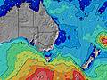 | |||||||||||||||
Swell Altura (m) Direção Período (s) | S 8 | S 7 | S 8 | E 11 | E 11 | E 11 | E 11 | E 11 | E 11 | E 11 | SSE 6 | S 5 | S 5 | S 5 | SSE 5 | E 5 | E 5 | E 7 | E 7 | E 7 | E 7 | ENE 7 | ENE 7 | ENE 7 |
Onda Gráfico | ||||||||||||||||||||||||
0 | 0 | 0 | 2 | 2 | 2 | 2 | 2 | 2 | 2 | 117 | 95 | 78 | 57 | 29 | 5 | 7 | 27 | 26 | 27 | 39 | 42 | 42 | 55 | |
Vento (km/h) | ||||||||||||||||||||||||
Estado do Vento maral cruzado-maral Cruzado cruzado-terral terral cristalino | cross-off | off | off | off | cross-off | cross-off | cross-off | cross | cross | cross-off | cross-off | cross-off | cross-off | cross-off | cross | cross-on | glassy | off | off | off | off | glassy | cross-on | cross-on |
Maré Alta | 8:53PM1.96m | 9:56AM1.27m | 9:41PM1.89m | 10:46AM1.31m | 10:29PM1.78m | 11:35AM1.34m | ||||||||||||||||||
Maré Baixa | 3:51AM0.06m | 3:15PM0.47m | 4:36AM0.09m | 4:09PM0.51m | 5:19AM0.15m | |||||||||||||||||||
— | — | — | — | 7:03 | — | — | — | — | — | — | — | 7:03 | — | — | — | — | — | — | — | 7:03 | — | — | — | |
— | — | — | — | — | — | — | 5:02 | — | — | — | — | — | — | — | 5:04 | — | — | — | — | — | — | — | 5:05 | |
mm | — | — | — | — | — | — | — | — | — | — | — | — | — | — | — | — | — | — | — | — | — | — | — | — |
Temp. °C | 13 | 13 | 12 | 13 | 14 | 15 | 16 | 16 | 14 | 14 | 13 | 12 | 11 | 12 | 14 | 13 | 13 | 12 | 12 | 11 | 10 | 11 | 13 | 12 |
Ressent. °C | 11 | 11 | 9 | 9 | 9 | 10 | 11 | 12 | 11 | 12 | 10 | 9 | 8 | 9 | 12 | 11 | 13 | 10 | 11 | 10 | 9 | 11 | 11 | 11 |
Swell 1 Altura (m) Direção Período (s) | S 15 | S 15 | S 8 | S 8 | S 14 | S 14 | S 18 | S 18 | S 12 | S 12 | S 18 | S 19 | S 11 | S 11 | S 8 | S 10 | S 10 | S 10 | S 10 | S 10 | S 10 | ENE 7 | ENE 7 | ENE 7 |
4 | 4 | 358 | 305 | 4 | 14 | 25 | 25 | 11 | 11 | 27 | 27 | 21 | 22 | 31 | 141 | 98 | 72 | 69 | 68 | 66 | 42 | 42 | 55 | |
Swell 2 Altura (m) Direção Período (s) | — | — | S 15 | S 15 | S 18 | S 18 | S 13 | S 12 | S 18 | S 19 | E 11 | S 16 | S 15 | S 15 | S 11 | E 5 | E 5 | E 7 | E 7 | E 7 | E 7 | S 10 | S 9 | S 9 |
— | — | 4 | 4 | 6 | 24 | 13 | 12 | 26 | 27 | 2 | 5 | 18 | 17 | 22 | 4 | 7 | 27 | 26 | 27 | 39 | 45 | 41 | 38 | |
Swell 3 Altura (m) Direção Período (s) | — | — | — | E 11 | E 11 | E 11 | E 11 | E 11 | E 11 | E 11 | E 11 | E 11 | S 19 | E 7 | E 7 | ENE 7 | ENE 7 | S 21 | S 21 | S 21 | S 21 | S 20 | S 19 | S 19 |
— | — | — | 2 | 2 | 2 | 2 | 2 | 2 | 2 | 2 | 2 | 7 | 1 | 1 | 5 | 5 | 9 | 35 | 35 | 9 | 31 | 29 | 27 | |
Ondas de vento Altura (m) Direção Período (s) | S 8 | S 7 | S 8 | S 8 | S 8 | S 8 | S 7 | S 7 | S 6 | SSE 6 | SSE 6 | S 5 | S 5 | S 5 | SSE 5 | — | — | — | — | — | — | — | — | — |
217 | 246 | 535 | 482 | 282 | 255 | 216 | 208 | 188 | 155 | 117 | 95 | 78 | 57 | 29 | — | — | — | — | — | — | — | — | — | |
Terral ou glassy mais perto | ||||||||||||||||||||||||
Distância (km) | 3 | 3 | 3 | 3 | 3 | 10 | 12 | 200 | 10 | 3 | 0 | 0 | 0 | 3 | 199 | 43 | 6 | 6 | 3 | 3 | 3 | 3 | 82 | 12 |
Melhor previsões de ondas em South Coast - New South Wales | ||||||||||||||||||||||||
Melhor previsões de ondas em Australia | ||||||||||||||||||||||||
Buscador de Ondas Global | ||||||||||||||||||||||||
- Map Icons:
 Break
Break Live Wave Height (m)
 Live Wind Speed (km/h)
 Surf Rating (10 Max)
 Ocean Swells (m)
- Wind Speed (km/h)
widget de graça do Surf-Forecast.com para o seu site
O relatório de surf / widget do tempo abaixo está disponível para incorporar em sites de terceiros gratuitamente e fornece um resumo das nossas Dolphin Point surf tempo. Simplesmente pegar o trecho de código html que fornecemos e colá-lo em seu próprio site. Você pode escolher seu idioma preferido e unidades métrico/imperial para o surf tempo de alimentação para atender aos usuários do seu site.... Clique aqui para adquirir o código.
 Nearest