
Previsão:

Previsão de curto prazoprincipalmente seco. Warm (máx. 24°C na Terça de manhã, mín 18°C na Quarta à noite). Ventos aumentam (calmo na Seg à noite, ventos frescos de Nor-Noroeste na Quarta à noite). | |||||||||||||||||||||||
Segunda-feira 3 | Terça-feira 4 | Quarta-feira 5 | |||||||||||||||||||||
4 AM | 7 AM | 10 AM | 1 PM | 4 PM | 7 PM | 10 PM | 1 AM | 4 AM | 7 AM | 10 AM | 1 PM | 4 PM | 7 PM | 10 PM | 1 AM | 4 AM | 7 AM | 10 AM | 1 PM | 4 PM | 7 PM | 10 PM | |
Mapa da altura do Swell |  |  | 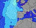 |  | 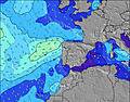 |  |  | 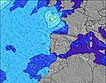 |  | ||||||||||||||
Swell Altura (m) Direção Período (s) | W 9 | W 9 | W 9 | WNW 9 | WNW 9 | WNW 8 | WNW 7 | W 9 | W 9 | WNW 9 | WNW 9 | WNW 9 | WNW 8 | WNW 8 | WNW 8 | WNW 8 | WNW 8 | NNW 10 | NNW 9 | WNW 8 | NNW 9 | NW 10 | NNW 10 |
Onda Gráfico | |||||||||||||||||||||||
64 | 61 | 60 | 84 | 132 | 180 | 89 | 158 | 158 | 129 | 129 | 126 | 118 | 115 | 92 | 90 | 90 | 81 | 75 | 74 | 110 | 309 | 349 | |
Vento (km/h) | |||||||||||||||||||||||
Estado do Vento maral cruzado-maral Cruzado cruzado-terral terral cristalino | cross-on | cross | cross | cross | cross-on | cross-on | on | on | on | glassy | cross | cross-on | on | on | on | on | cross-on | cross-on | cross-on | cross-on | on | cross-on | cross-on |
Maré Alta | 6:15AM2.58m | 6:29PM2.74m | 6:54AM2.52m | 7:11PM2.61m | 7:40AM2.43m | 8:02PM2.45m | |||||||||||||||||
Maré Baixa | 12:13PM0.42m | 00:43AM0.38m | 12:54PM0.52m | 1:25AM0.50m | 1:43PM0.64m | ||||||||||||||||||
6:39 | — | — | — | — | — | — | — | 6:39 | — | — | — | — | — | — | — | 6:41 | — | — | — | — | — | — | |
— | — | — | — | — | 8:46 | — | — | — | — | — | — | — | 8:45 | — | — | — | — | — | — | — | 8:45 | — | |
mm | — | — | — | — | — | — | — | — | — | — | — | — | — | — | — | — | — | — | — | — | — | — | — |
Temp. °C | 20 | 20 | 21 | 22 | 22 | 22 | 21 | 21 | 21 | 21 | 23 | 24 | 23 | 22 | 21 | 20 | 20 | 19 | 20 | 20 | 20 | 19 | 19 |
Ressent. °C | 22 | 21 | 21 | 22 | 22 | 23 | 22 | 22 | 23 | 23 | 24 | 23 | 22 | 22 | 22 | 21 | 21 | 19 | 19 | 18 | 17 | 15 | 16 |
Swell 1 Altura (m) Direção Período (s) | W 9 | W 9 | W 9 | WNW 9 | WNW 9 | WNW 8 | WNW 7 | W 9 | W 9 | WNW 9 | WNW 9 | WNW 9 | WNW 8 | WNW 8 | WNW 8 | WNW 8 | WNW 8 | WNW 8 | WNW 8 | NNW 9 | NNW 9 | WNW 10 | WNW 10 |
64 | 61 | 60 | 84 | 132 | 180 | 89 | 158 | 158 | 129 | 129 | 126 | 118 | 115 | 92 | 90 | 90 | 65 | 63 | 53 | 110 | 37 | 35 | |
Swell 2 Altura (m) Direção Período (s) | NNW 5 | NNW 7 | NNW 7 | NNW 7 | NNW 7 | N 7 | WNW 9 | N 8 | N 8 | N 8 | NNW 8 | N 8 | NNW 11 | NW 11 | NNW 11 | NNW 11 | NNW 10 | NNW 10 | NNW 9 | NNW 11 | WNW 10 | SW 12 | WNW 7 |
5 | 11 | 11 | 11 | 5 | 4 | 65 | 5 | 5 | 5 | 6 | 5 | 13 | 20 | 47 | 64 | 68 | 81 | 75 | 47 | 37 | 6 | 17 | |
Swell 3 Altura (m) Direção Período (s) | NNW 7 | NNW 5 | NNW 5 | — | — | S 13 | N 8 | SW 13 | SW 13 | SW 13 | S 13 | N 10 | N 10 | NNW 9 | SW 12 | SW 12 | SW 12 | WNW 10 | WNW 10 | WNW 10 | SW 12 | SW 12 | SW 12 |
11 | 5 | 2 | — | — | 4 | 5 | 7 | 7 | 7 | 3 | 2 | 2 | 8 | 6 | 6 | 6 | 31 | 34 | 33 | 6 | 6 | 6 | |
Ondas de vento Altura (m) Direção Período (s) | — | — | — | WSW 2 | — | — | — | — | — | — | — | — | — | — | — | — | — | — | — | WNW 8 | NW 7 | NW 10 | NNW 10 |
— | — | — | 1 | — | — | — | — | — | — | — | — | — | — | — | — | — | — | — | 74 | 77 | 309 | 349 | |
Terral ou glassy mais perto | |||||||||||||||||||||||
Distância (km) | 17 | 45 | 142 | 41 | 403 | 403 | 34 | 34 | 34 | 0 | 12 | 41 | 223 | 37 | 36 | 34 | 34 | 34 | 34 | 223 | 583 | 547 | 513 |
Melhor previsões de ondas em Ericeira | |||||||||||||||||||||||
Melhor previsões de ondas em Portugal | |||||||||||||||||||||||
Buscador de Ondas Global | |||||||||||||||||||||||
- Map Icons:
 Break
Break Live Wave Height (m)
 Live Wind Speed (km/h)
 Surf Rating (10 Max)
 Ocean Swells (m)
- Wind Speed (km/h)
widget de graça do Surf-Forecast.com para o seu site
O relatório de surf / widget do tempo abaixo está disponível para incorporar em sites de terceiros gratuitamente e fornece um resumo das nossas Coxos surf tempo. Simplesmente pegar o trecho de código html que fornecemos e colá-lo em seu próprio site. Você pode escolher seu idioma preferido e unidades métrico/imperial para o surf tempo de alimentação para atender aos usuários do seu site.... Clique aqui para adquirir o código.
 Nearest