
Previsão:

Previsão de curto prazochuva moderada (total 17mm), mais intensa na Qui à noite. Very mild (máx. 16°C na Qui à tarde, mín 12°C na Quarta à noite). Ventos diminuem (ventos frescos de Sul na Qui de manhã, vento fraco de Sul na Sex à noite). | ||||||||||||||||||||||||
Quar 15 | Quinta-feira 16 | Sexta-feira 17 | Sáb 18 | |||||||||||||||||||||
1 PM | 4 PM | 7 PM | 10 PM | 1 AM | 4 AM | 7 AM | 10 AM | 1 PM | 4 PM | 7 PM | 10 PM | 1 AM | 4 AM | 7 AM | 10 AM | 1 PM | 4 PM | 7 PM | 10 PM | 1 AM | 4 AM | 7 AM | 10 AM | |
Mapa da altura do Swell |  |  |  |  |  |  |  |  |  | 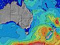 | ||||||||||||||
Swell Altura (m) Direção Período (s) | S 10 | S 9 | S 8 | S 8 | S 7 | S 7 | S 8 | S 8 | S 8 | S 8 | S 8 | S 7 | S 7 | S 7 | S 7 | S 6 | S 6 | E 6 | E 6 | E 7 | S 10 | S 11 | S 10 | S 10 |
Onda Gráfico | ||||||||||||||||||||||||
1478 | 1015 | 612 | 458 | 427 | 465 | 553 | 652 | 625 | 510 | 319 | 243 | 147 | 113 | 89 | 78 | 47 | 62 | 66 | 85 | 138 | 178 | 133 | 158 | |
Vento (km/h) | ||||||||||||||||||||||||
Estado do Vento maral cruzado-maral Cruzado cruzado-terral terral cristalino | cross-off | cross | cross | cross-off | cross-off | cross-off | cross-off | cross-off | cross | cross | cross | cross-on | cross-on | cross-on | cross-on | cross-on | cross | cross-on | cross-on | cross | cross | cross | cross | cross |
Maré Alta | 8:54PM1.82m | 9:46AM1.19m | 9:43PM1.75m | 10:34AM1.22m | 10:30PM1.64m | |||||||||||||||||||
Maré Baixa | 2:24PM0.24m | 3:44AM-0.06m | 3:16PM0.25m | 4:29AM-0.02m | 4:09PM0.28m | 5:12AM0.05m | ||||||||||||||||||
— | — | — | — | — | 6:56 | — | — | — | — | — | — | — | 6:56 | — | — | — | — | — | — | — | 6:56 | — | — | |
— | 5:02 | — | — | — | — | — | — | — | 5:04 | — | — | — | — | — | — | — | 5:04 | — | — | — | — | — | 5:05 | |
mm | — | — | — | — | — | — | — | — | 1 | 2 | 2 | 3 | 3 | 1 | 1 | — | 1 | 1 | 1 | — | — | 1 | — | — |
Temp. °C | 15 | 15 | 15 | 15 | 14 | 13 | 12 | 14 | 15 | 16 | 16 | 16 | 16 | 16 | 16 | 16 | 16 | 16 | 16 | 16 | 15 | 15 | 16 | 16 |
Ressent. °C | 9 | 10 | 10 | 10 | 10 | 9 | 7 | 8 | 9 | 11 | 12 | 13 | 14 | 13 | 13 | 13 | 13 | 14 | 14 | 14 | 14 | 13 | 12 | 12 |
Swell 1 Altura (m) Direção Período (s) | — | S 17 | S 15 | S 16 | S 15 | S 15 | S 15 | S 18 | S 18 | S 18 | S 8 | S 7 | S 7 | S 7 | S 7 | S 6 | S 6 | E 6 | E 6 | E 7 | E 7 | E 7 | E 7 | E 7 |
— | 5 | 5 | 5 | 5 | 4 | 4 | 6 | 25 | 25 | 319 | 243 | 147 | 113 | 89 | 78 | 47 | 62 | 66 | 85 | 85 | 85 | 106 | 123 | |
Swell 2 Altura (m) Direção Período (s) | — | — | — | — | — | — | — | — | — | SSW 18 | S 18 | S 18 | S 18 | E 8 | E 8 | E 8 | E 6 | S 6 | S 6 | S 6 | S 10 | S 10 | S 21 | S 21 |
— | — | — | — | — | — | — | — | — | 61 | 25 | 25 | 59 | 11 | 19 | 19 | 44 | 33 | 31 | 21 | 138 | 106 | 35 | 34 | |
Swell 3 Altura (m) Direção Período (s) | — | — | — | — | — | — | — | — | — | — | S 13 | E 8 | E 8 | S 18 | S 18 | S 16 | E 8 | S 8 | S 8 | S 8 | S 21 | S 21 | — | S 19 |
— | — | — | — | — | — | — | — | — | — | 13 | 5 | 10 | 58 | 25 | 19 | 19 | 20 | 20 | 20 | 8 | 35 | — | 7 | |
Ondas de vento Altura (m) Direção Período (s) | S 10 | S 9 | S 8 | S 8 | S 7 | S 7 | S 8 | S 8 | S 8 | S 8 | ESE 6 | ESE 6 | ESE 6 | ESE 6 | ESE 5 | ESE 6 | — | — | — | — | — | S 11 | S 10 | S 10 |
1478 | 1015 | 612 | 458 | 427 | 465 | 553 | 652 | 625 | 510 | 34 | 47 | 49 | 43 | 51 | 43 | — | — | — | — | — | 178 | 133 | 158 | |
Terral ou glassy mais perto | ||||||||||||||||||||||||
Distância (km) | 159 | 6 | 6 | 6 | 3 | 0 | 0 | 159 | 102 | 92 | 57 | 6 | 6 | 6 | 0 | 0 | 0 | 0 | 0 | 0 | 0 | 0 | 38 | 6 |
Melhor previsões de ondas em Sydney North Coast | ||||||||||||||||||||||||
Melhor previsões de ondas em Australia | ||||||||||||||||||||||||
Buscador de Ondas Global | ||||||||||||||||||||||||
- Map Icons:
 Break
Break Live Wave Height (m)
 Live Wind Speed (km/h)
 Surf Rating (10 Max)
 Ocean Swells (m)
- Wind Speed (km/h)
widget de graça do Surf-Forecast.com para o seu site
O relatório de surf / widget do tempo abaixo está disponível para incorporar em sites de terceiros gratuitamente e fornece um resumo das nossas Butterbox surf tempo. Simplesmente pegar o trecho de código html que fornecemos e colá-lo em seu próprio site. Você pode escolher seu idioma preferido e unidades métrico/imperial para o surf tempo de alimentação para atender aos usuários do seu site.... Clique aqui para adquirir o código.
 Nearest