
Previsão:

Previsão de curto prazochuviscos (total 5mm), principalmente caindo na Terça à tarde. Warm (máx. 22°C na Terça de manhã, mín 20°C na Terça à noite). Ventos diminuem (ventos fortes de Noroeste na Terça de manhã, vento fraco de Oeste na Quinta de manhã). | ||||||||||||||||||||||||
Ter 14 | Quarta-feira 15 | Quinta-feira 16 | Sex 17 | |||||||||||||||||||||
9 AM | 12 PM | 3 PM | 6 PM | 9 PM | 12 AM | 3 AM | 6 AM | 9 AM | 12 PM | 3 PM | 6 PM | 9 PM | 12 AM | 3 AM | 6 AM | 9 AM | 12 PM | 3 PM | 6 PM | 9 PM | 12 AM | 3 AM | 6 AM | |
Mapa da altura do Swell |  | 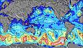 | 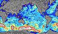 | 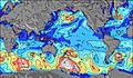 | 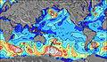 | 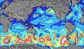 | 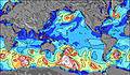 | 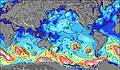 | 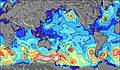 | |||||||||||||||
Swell Altura (m) Direção Período (s) | NW 6 | WNW 7 | WNW 8 | WNW 8 | W 9 | W 10 | W 10 | W 10 | W 10 | W 8 | W 8 | W 8 | W 12 | W 12 | W 12 | WSW 12 | WSW 12 | W 12 | W 12 | W 12 | WSW 12 | W 12 | W 7 | WSW 12 |
Onda Gráfico | ||||||||||||||||||||||||
301 | 472 | 673 | 846 | 1064 | 1102 | 963 | 858 | 753 | 477 | 368 | 258 | 765 | 776 | 909 | 944 | 960 | 956 | 972 | 956 | 718 | 1227 | 494 | 1807 | |
Vento (km/h) | ||||||||||||||||||||||||
Estado do Vento maral cruzado-maral Cruzado cruzado-terral terral cristalino | on | on | on | cross-on | cross-on | cross-on | cross-on | cross-on | cross-on | cross-on | cross-on | cross-on | cross-on | cross-on | cross-on | cross-on | cross-on | cross-on | cross-on | cross-on | cross-on | cross-on | cross-on | cross-on |
Maré Alta | 6:11PM0.54m | 6:53AM0.87m | 7:30PM0.54m | 8:00AM0.82m | 8:56PM0.56m | |||||||||||||||||||
Maré Baixa | 12:44PM0.20m | 11:52PM0.17m | 1:51PM0.20m | 1:06AM0.22m | 3:00PM0.20m | 2:32AM0.26m | ||||||||||||||||||
8:04 | — | — | — | — | — | — | 8:04 | — | — | — | — | — | — | — | 8:04 | — | — | — | — | — | — | — | 8:03 | |
— | — | — | 6:39 | — | — | — | — | — | — | — | 6:40 | — | — | — | — | — | — | — | 6:40 | — | — | — | 6:42 | |
mm | — | — | — | 1 | — | — | — | — | — | — | — | — | — | — | 1 | — | — | — | 1 | 1 | 1 | — | — | — |
Temp. °C | 21 | 22 | 22 | 22 | 21 | 21 | 20 | 20 | 20 | 20 | 20 | 20 | 20 | 20 | 20 | 20 | 20 | 21 | 21 | 21 | 21 | 21 | 20 | 20 |
Ressent. °C | 15 | 17 | 17 | 18 | 18 | 18 | 17 | 17 | 17 | 17 | 17 | 18 | 19 | 18 | 18 | 18 | 20 | 20 | 19 | 18 | 17 | 17 | 16 | 16 |
Swell 1 Altura (m) Direção Período (s) | SSE 11 | SSE 11 | SSE 11 | WSW 12 | SSE 11 | SSE 11 | SSE 11 | SSE 11 | SSE 11 | SSE 11 | SSE 11 | WSW 12 | SE 15 | W 12 | W 12 | WSW 12 | WSW 12 | W 12 | W 12 | W 12 | WSW 12 | SSE 13 | SSE 13 | SSE 12 |
275 | 214 | 180 | 361 | 183 | 130 | 149 | 193 | 193 | 190 | 154 | 228 | 322 | 776 | 909 | 944 | 960 | 956 | 972 | 956 | 718 | 520 | 444 | 417 | |
Swell 2 Altura (m) Direção Período (s) | SSW 12 | W 14 | WSW 13 | SSE 11 | SSW 14 | SSE 13 | SSE 13 | SW 19 | WSW 13 | WSW 13 | WSW 12 | SSE 11 | SSE 11 | SSE 14 | SSE 14 | SSE 13 | SSE 13 | SSE 13 | SSE 13 | SSE 13 | SSE 13 | SW 13 | SW 12 | N 10 |
98 | 103 | 229 | 183 | 127 | 120 | 116 | 281 | 168 | 170 | 160 | 154 | 157 | 672 | 617 | 669 | 659 | 649 | 649 | 572 | 572 | 369 | 217 | 2 | |
Swell 3 Altura (m) Direção Período (s) | WSW 15 | SSW 12 | SW 12 | SE 14 | SSE 14 | SSW 13 | SW 19 | WNW 11 | SW 18 | SW 18 | SW 18 | SE 16 | SW 17 | SW 16 | SW 16 | SW 15 | SW 15 | SW 14 | SW 14 | SW 14 | SW 13 | — | N 10 | N 12 |
44 | 55 | 35 | 93 | 78 | 70 | 177 | 12 | 266 | 263 | 258 | 248 | 346 | 371 | 486 | 499 | 550 | 590 | 534 | 457 | 380 | — | 2 | 3 | |
Ondas de vento Altura (m) Direção Período (s) | NW 6 | WNW 7 | WNW 8 | WNW 8 | W 9 | W 10 | W 10 | W 10 | W 10 | W 8 | W 8 | W 8 | W 12 | — | — | — | — | — | — | — | WNW 5 | W 12 | W 7 | WSW 12 |
301 | 472 | 673 | 846 | 1064 | 1102 | 963 | 858 | 753 | 477 | 368 | 258 | 765 | — | — | — | — | — | — | — | 44 | 1227 | 494 | 1807 | |
Terral ou glassy mais perto | ||||||||||||||||||||||||
Distância (km) | 3664 | 3598 | 3598 | 3647 | 3636 | 3598 | 3598 | 3665 | 3672 | 3675 | 3634 | 3634 | 3634 | 3682 | 3682 | 3672 | 3705 | 3737 | 3687 | 3541 | 3541 | 3541 | 3526 | 3526 |
Melhor previsões de ondas em Easter Island | ||||||||||||||||||||||||
Melhor previsões de ondas em Chile | ||||||||||||||||||||||||
Buscador de Ondas Global | ||||||||||||||||||||||||
- Map Icons:
 Break
Break Live Wave Height (m)
 Live Wind Speed (km/h)
 Surf Rating (10 Max)
 Ocean Swells (m)
- Wind Speed (km/h)
widget de graça do Surf-Forecast.com para o seu site
O relatório de surf / widget do tempo abaixo está disponível para incorporar em sites de terceiros gratuitamente e fornece um resumo das nossas Anakena surf tempo. Simplesmente pegar o trecho de código html que fornecemos e colá-lo em seu próprio site. Você pode escolher seu idioma preferido e unidades métrico/imperial para o surf tempo de alimentação para atender aos usuários do seu site.... Clique aqui para adquirir o código.
 Nearest