
Previsão:

Previsão de curto prazochuva moderada (total 10mm), mais intensa na Segunda de manhã. Warm (máx. 26°C no Domingo de manhã, mín 22°C no Domingo à noite). o vento será geralmente fraco. | ||||||||||||||||||||||
Domingo 2 | Segunda-feira 3 | Terça-feira 4 | ||||||||||||||||||||
6 AM | 9 AM | 12 PM | 3 PM | 6 PM | 9 PM | 12 AM | 3 AM | 6 AM | 9 AM | 12 PM | 3 PM | 6 PM | 9 PM | 12 AM | 3 AM | 6 AM | 9 AM | 12 PM | 3 PM | 6 PM | 9 PM | |
Mapa da altura do Swell |  |  |  |  |  |  | 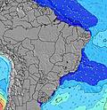 |  | ||||||||||||||
Swell Altura (m) Direção Período (s) | SE 7 | ESE 7 | ESE 7 | ESE 7 | ESE 7 | SE 7 | ESE 7 | ESE 7 | ESE 7 | E 7 | E 7 | E 7 | ESE 7 | ESE 8 | ESE 8 | ESE 8 | ESE 8 | E 8 | E 8 | E 8 | ESE 8 | ESE 8 |
Onda Gráfico | ||||||||||||||||||||||
210 | 102 | 121 | 102 | 111 | 147 | 97 | 178 | 89 | 109 | 106 | 106 | 220 | 256 | 256 | 296 | 327 | 198 | 201 | 239 | 435 | 383 | |
Vento (km/h) | ||||||||||||||||||||||
Estado do Vento maral cruzado-maral Cruzado cruzado-terral terral cristalino | cross-off | cross | cross | cross | cross | cross | cross-off | cross-off | cross-off | cross | cross-on | cross-on | cross-on | cross-on | cross | cross | cross | cross-on | cross-on | cross-on | cross-on | cross |
Maré Alta | 6:07AM2.21m | 6:31PM2.05m | 6:45AM2.13m | 7:10PM1.99m | 7:28AM2.02m | 7:56PM1.91m | ||||||||||||||||
Maré Baixa | 12:22PM0.25m | 00:32AM0.36m | 12:59PM0.32m | 1:14AM0.43m | 1:42PM0.42m | |||||||||||||||||
5:31 | — | — | — | — | — | — | 5:30 | — | — | — | — | — | — | — | 5:30 | — | — | — | — | — | — | |
— | — | — | 5:21 | — | — | — | — | — | — | — | 5:21 | — | — | — | — | — | — | — | 5:21 | — | — | |
mm | — | — | — | — | — | — | — | — | — | — | 1 | 1 | — | 1 | 1 | 1 | 1 | 1 | 1 | 1 | — | 1 |
Temp. °C | 23 | 25 | 26 | 26 | 25 | 24 | 23 | 22 | 22 | 25 | 26 | 26 | 25 | 25 | 24 | 24 | 24 | 25 | 26 | 26 | 25 | 25 |
Ressent. °C | 23 | 23 | 24 | 24 | 24 | 24 | 24 | 23 | 22 | 26 | 26 | 27 | 26 | 26 | 25 | 25 | 25 | 25 | 26 | 25 | 25 | 25 |
Swell 1 Altura (m) Direção Período (s) | ESE 7 | NNE 8 | NNE 8 | NNE 8 | NNE 8 | ESE 7 | ESE 7 | ESE 7 | ESE 7 | E 7 | E 7 | NNE 11 | E 7 | E 7 | E 8 | E 8 | E 8 | NE 9 | NE 9 | NE 9 | E 8 | E 8 |
121 | 7 | 7 | 7 | 6 | 114 | 97 | 91 | 89 | 109 | 106 | 12 | 106 | 131 | 160 | 164 | 169 | 13 | 13 | 13 | 241 | 247 | |
Swell 2 Altura (m) Direção Período (s) | NNE 8 | S 12 | S 15 | NNE 8 | S 14 | NE 8 | NE 8 | NE 8 | NE 8 | NE 8 | NE 8 | NE 11 | NNE 10 | NE 10 | NE 10 | NE 10 | NE 9 | S 14 | SE 14 | SE 14 | NE 9 | NE 9 |
7 | 3 | 4 | 7 | 4 | 3 | 3 | 3 | 3 | 3 | 3 | 4 | 10 | 16 | 16 | 16 | 14 | 4 | 8 | 7 | 13 | 13 | |
Swell 3 Altura (m) Direção Período (s) | — | S 15 | S 11 | S 15 | S 11 | S 14 | S 13 | N 13 | S 13 | N 12 | NE 11 | N 12 | N 12 | S 12 | N 7 | N 7 | — | SE 15 | N 10 | SSE 9 | SE 13 | SE 13 |
— | 4 | 3 | 4 | 2 | 4 | 4 | 3 | 3 | 3 | 5 | 3 | 3 | 3 | 4 | 4 | — | 8 | 2 | 17 | 7 | 7 | |
Ondas de vento Altura (m) Direção Período (s) | SE 7 | ESE 7 | ESE 7 | ESE 7 | ESE 7 | SE 7 | — | ESE 7 | — | — | — | E 7 | ESE 7 | ESE 8 | ESE 8 | ESE 8 | ESE 8 | E 8 | E 8 | E 8 | ESE 8 | ESE 8 |
210 | 102 | 121 | 102 | 111 | 147 | — | 178 | — | — | — | 106 | 220 | 256 | 256 | 296 | 327 | 198 | 201 | 239 | 435 | 383 | |
Terral ou glassy mais perto | ||||||||||||||||||||||
Distância (km) | 24 | 1487 | 1573 | 1011 | 987 | 80 | 0 | 0 | 7 | 80 | 1573 | 2002 | 6 | 6 | 6 | 5 | 5 | 1487 | 1573 | 1573 | 1573 | 1011 |
Melhor previsões de ondas em Rio Grande Do Norte | ||||||||||||||||||||||
Melhor previsões de ondas em Brazil | ||||||||||||||||||||||
Buscador de Ondas Global | ||||||||||||||||||||||
- Map Icons:
 Break
Break Live Wave Height (m)
 Live Wind Speed (km/h)
 Surf Rating (10 Max)
 Ocean Swells (m)
- Wind Speed (km/h)
widget de graça do Surf-Forecast.com para o seu site
O relatório de surf / widget do tempo abaixo está disponível para incorporar em sites de terceiros gratuitamente e fornece um resumo das nossas Afogadas surf tempo. Simplesmente pegar o trecho de código html que fornecemos e colá-lo em seu próprio site. Você pode escolher seu idioma preferido e unidades métrico/imperial para o surf tempo de alimentação para atender aos usuários do seu site.... Clique aqui para adquirir o código.
 Nearest