Trebarwith Strand Previsão para Surf
/ Cornwall (North) (60 surf breaks) /Previsão:

Surf em Trebarwith StrandPrevisão / Cornwall (North) / UK
Atualização das previsões em hora min s Forecast update imminent
Estas são ondas em águas abertas. Nas praias as ondas geralmente são menores, especialmente em picos mais abrigados.
A temperatura do mar em Trebarwith Strand hoje é
10.0° C
(O que é um pouco mais quente que o habitual)Actualizações em hora min s Forecast update imminent
Segunda-feira 09 | Terça-feira 10 | Quarta-feira 11 | Quin 12 | |||||||||||||||||||||
| 3 AM | 6 AM | 9 AM | 12 PM | 3 PM | 6 PM | 9 PM | 0 AM | 3 AM | 6 AM | 9 AM | 12 PM | 3 PM | 6 PM | 9 PM | 0 AM | 3 AM | 6 AM | 9 AM | 12 PM | 3 PM | 6 PM | 9 PM | 0 AM | |
Avaliação (10 max) | ||||||||||||||||||||||||
Mapa da altura do Swell |    |    |    |  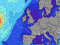 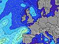 | ||||||||||||||||||||
| Maiores ondas (m) & direção (?) | ||||||||||||||||||||||||
| Período(s) (?) | 12 | 12 | 12 | 11 | 11 | 11 | 10 | 10 | 11 | 11 | 11 | 10 | 9 | 9 | 9 | 14 | 14 | 9 | 14 | 14 | 14 | 14 | 14 | 14 |
Onda (?)Gráfico | ||||||||||||||||||||||||
| 566 | 566 | 454 | 361 | 354 | 282 | 212 | 252 | 267 | 269 | 267 | 138 | 450 | 466 | 599 | 2299 | 754 | 809 | 3095 | 3844 | 3998 | 3521 | 2987 | 2651 | |
Vento (km/h) | ||||||||||||||||||||||||
| Estado do Vento (?) onshore cruzado-maral Cruzado cruzado-terral terral cristalino | cross- off | cross- off | cross | cross- on | on | on | on | on | on | cross- on | cross | cross- on | cross | cross | cross- on | cross- on | on | on | cross- on | on | on | on | cross- on | cross- on |
Maré Alta / altura (m) | 8:48AM 6.19 | 9:04PM 5.96 | 9:24AM 5.67 | 9:42PM 5.46 | 10:07AM 5.14 | 10:34PM 4.98 | ||||||||||||||||||
Maré Baixa / altura (m) | 2:37AM 1.14 | 2:52PM 1.43 | 3:10AM 1.63 | 3:27PM 1.93 | 3:50AM 2.14 | 4:13PM 2.43 | ||||||||||||||||||
Segunda-feira 09 | Terça-feira 10 | Quarta-feira 11 | Quin 12 | |||||||||||||||||||||
| Nascer do sol | - | - | 6:47 | - | - | - | - | - | - | - | 6:45 | - | - | - | - | - | - | - | 6:41 | - | - | - | - | - |
| Pôr do sol | - | - | - | - | - | 6:12 | - | - | - | - | - | - | - | 6:14 | - | - | - | - | - | - | - | 6:15 | - | - |
Chuva (mm) | - | - | - | - | - | - | - | - | - | - | - | - | - | - | 2 | 3 | - | - | - | - | - | - | - | - |
| Temp. °C | 10 | 10 | 10 | 11 | 11 | 9 | 8 | 8 | 8 | 8 | 8 | 11 | 11 | 9 | 10 | 11 | 9 | 8 | 8 | 9 | 9 | 9 | 8 | 8 |
| Feels °C (?) | 8 | 8 | 8 | 8 | 7 | 6 | 5 | 5 | 4 | 4 | 3 | 4 | 4 | 1 | 3 | 3 | 1 | -1 | 1 | 2 | 2 | 3 | 2 | 1 |
- Map Icons:
 Break
Break Live Wave Height (m)
 Live Wind Speed (km/h)
 Surf Rating (10 Max)
 Ocean Swells (m)
- Wind Speed (km/h)
widget de graça do Surf-Forecast.com para o seu site
O relatório de surf / widget do tempo abaixo está disponível para incorporar em sites de terceiros gratuitamente e fornece um resumo das nossas Trebarwith Strand surf tempo. Simplesmente pegar o trecho de código html que fornecemos e colá-lo em seu próprio site. Você pode escolher seu idioma preferido e unidades métrico/imperial para o surf tempo de alimentação para atender aos usuários do seu site.... Clique aqui para adquirir o código.
 Nearest