
Previsão:

Previsão de curto prazochuva moderada (total 13mm), mais intensa no Sábado à noite. Warm (máx. 21°C no Sábado à tarde, mín 19°C na Qui à noite). Ventos diminuem (ventos fortes de Oeste-Noroeste no Sábado de manhã, calmo no Sáb à noite). | |||||||||||||||||
Sexta-feira 31 | Sábado 1 | ||||||||||||||||
9 PM | 12 AM | 3 AM | 6 AM | 9 AM | 12 PM | 3 PM | 6 PM | 9 PM | 12 AM | 3 AM | 6 AM | 9 AM | 12 PM | 3 PM | 6 PM | 9 PM | |
Mapa da altura do Swell |  | 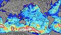 | 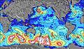 | 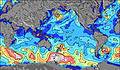 | 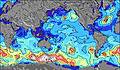 | 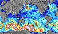 | 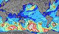 | ||||||||||
Swell Altura (m) Direção Período (s) | WSW 12 | WSW 11 | WSW 11 | W 10 | WSW 10 | WSW 10 | WSW 11 | WSW 11 | WSW 11 | WSW 11 | WSW 11 | WSW 11 | WSW 11 | WSW 11 | WSW 11 | WSW 11 | WSW 11 |
Onda Gráfico | |||||||||||||||||
336 | 341 | 183 | 800 | 898 | 1086 | 1155 | 1100 | 1100 | 1011 | 1061 | 792 | 1422 | 1574 | 1768 | 1602 | 1371 | |
Vento (km/h) | |||||||||||||||||
Estado do Vento maral cruzado-maral Cruzado cruzado-terral terral cristalino | on | on | on | cross-on | cross-on | on | on | on | on | on | on | on | on | on | on | on | cross-on |
Maré Alta | 6:11PM0.58m | 6:22AM0.68m | 6:49PM0.59m | 7:02AM0.66m | 7:30PM0.59m | ||||||||||||
Maré Baixa | 11:54PM0.19m | 12:27PM0.14m | 00:33AM0.20m | 1:03PM0.16m | |||||||||||||
— | — | — | 7:58 | — | — | — | — | — | — | — | 7:58 | — | — | — | — | — | |
— | — | — | — | — | — | — | 6:49 | — | — | — | — | — | — | — | 6:50 | — | |
mm | — | — | — | — | — | — | — | — | — | — | — | — | — | — | — | — | 1 |
Temp. °C | 20 | 19 | 20 | 20 | 20 | 20 | 20 | 20 | 20 | 20 | 20 | 20 | 20 | 20 | 21 | 21 | 20 |
Ressent. °C | 16 | 14 | 16 | 16 | 16 | 16 | 16 | 17 | 17 | 17 | 16 | 16 | 15 | 14 | 16 | 17 | 17 |
Swell 1 Altura (m) Direção Período (s) | WSW 12 | WSW 11 | WSW 11 | SW 12 | SW 14 | WSW 10 | WSW 11 | WSW 11 | WSW 11 | WSW 11 | WSW 11 | WSW 11 | SE 12 | SE 12 | SE 12 | SW 13 | WSW 11 |
336 | 341 | 183 | 75 | 97 | 1086 | 1155 | 1100 | 1100 | 1011 | 1061 | 792 | 98 | 118 | 114 | 412 | 1371 | |
Swell 2 Altura (m) Direção Período (s) | SSW 11 | SW 11 | SW 12 | SW 15 | SE 9 | SE 9 | SE 9 | SE 9 | SE 9 | SE 9 | SE 13 | SW 13 | NNW 11 | NNW 11 | N 14 | SE 12 | SW 13 |
151 | 123 | 106 | 76 | 21 | 20 | 20 | 19 | 13 | 14 | 46 | 199 | 11 | 11 | 14 | 112 | 700 | |
Swell 3 Altura (m) Direção Período (s) | SW 15 | SW 15 | SE 9 | SE 9 | NNW 12 | NNW 12 | NNW 11 | NNW 11 | NNW 11 | NNW 11 | NNW 11 | SE 13 | N 13 | N 14 | NNW 10 | N 13 | SE 12 |
141 | 107 | 21 | 21 | 14 | 13 | 12 | 12 | 12 | 12 | 12 | 80 | 14 | 15 | 11 | 13 | 112 | |
Ondas de vento Altura (m) Direção Período (s) | W 5 | WNW 5 | W 6 | W 10 | WSW 10 | — | — | — | — | — | — | NW 5 | WSW 11 | WSW 11 | WSW 11 | WSW 11 | — |
45 | 78 | 182 | 800 | 898 | — | — | — | — | — | — | 42 | 1422 | 1574 | 1768 | 1602 | — | |
Terral ou glassy mais perto | |||||||||||||||||
Distância (km) | 3547 | 3582 | 3594 | 3671 | 3683 | 3679 | 3567 | 3547 | 3610 | 3641 | 3641 | 3641 | 3654 | 3689 | 3641 | 3671 | 3679 |
Melhor previsões de ondas em Easter Island | |||||||||||||||||
Melhor previsões de ondas em Chile | |||||||||||||||||
Buscador de Ondas Global | |||||||||||||||||
- Map Icons:
 Break
Break Live Wave Height (m)
 Live Wind Speed (km/h)
 Surf Rating (10 Max)
 Ocean Swells (m)
- Wind Speed (km/h)
widget de graça do Surf-Forecast.com para o seu site
O relatório de surf / widget do tempo abaixo está disponível para incorporar em sites de terceiros gratuitamente e fornece um resumo das nossas Toroko surf tempo. Simplesmente pegar o trecho de código html que fornecemos e colá-lo em seu próprio site. Você pode escolher seu idioma preferido e unidades métrico/imperial para o surf tempo de alimentação para atender aos usuários do seu site.... Clique aqui para adquirir o código.
 Nearest