
Previsão:

Previsão de curto prazoprincipalmente seco. Warm (máx. 26°C no Domingo de manhã, mín 22°C no Sábado à noite). Ventos aumentam (vento fraco de Este-Sudeste no Sábado à noite, ventos frescos de Este na Terça de manhã). | ||||||||||||||||||
Sáb 1 | Domingo 2 | Segunda-feira 3 | ||||||||||||||||
7 PM | 10 PM | 1 AM | 4 AM | 7 AM | 10 AM | 1 PM | 4 PM | 7 PM | 10 PM | 1 AM | 4 AM | 7 AM | 10 AM | 1 PM | 4 PM | 7 PM | 10 PM | |
Mapa da altura do Swell |  |  |  |  |  | 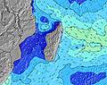 | 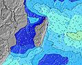 | |||||||||||
Swell Altura (m) Direção Período (s) | SSW 15 | SSW 14 | SSW 14 | SSW 14 | SSW 14 | SSW 14 | SSW 15 | SSW 16 | SSW 16 | SSW 15 | SSW 15 | S 19 | S 18 | S 18 | S 18 | S 17 | S 16 | S 16 |
Onda Gráfico | ||||||||||||||||||
1337 | 1319 | 982 | 1114 | 996 | 1191 | 1241 | 1241 | 1040 | 886 | 730 | 730 | 819 | 627 | 606 | 465 | 330 | 318 | |
Vento (km/h) | ||||||||||||||||||
Estado do Vento maral cruzado-maral Cruzado cruzado-terral terral cristalino | cross-off | cross-off | cross-off | cross-off | cross-off | cross-on | cross-on | cross-on | cross | cross | cross | cross | cross-off | cross | cross | cross-off | cross-off | cross-off |
Maré Alta | 2:19AM0.68m | 2:57PM0.65m | 2:51AM0.64m | 3:26PM0.64m | ||||||||||||||
Maré Baixa | 8:22PM0.18m | 8:42AM0.08m | 8:55PM0.18m | 9:09AM0.11m | 9:32PM0.20m | |||||||||||||
— | — | — | 6:39 | — | — | — | — | — | — | — | 6:39 | — | — | — | — | — | — | |
— | — | — | — | — | — | — | 5:52 | — | — | — | — | — | — | — | 5:52 | — | — | |
mm | — | — | — | — | — | — | — | — | — | — | — | — | — | — | — | — | — | — |
Temp. °C | 23 | 23 | 22 | 22 | 22 | 24 | 26 | 25 | 23 | 23 | 22 | 22 | 22 | 24 | 25 | 24 | 22 | 23 |
Ressent. °C | 22 | 23 | 22 | 23 | 24 | 24 | 25 | 23 | 21 | 21 | 20 | 20 | 20 | 21 | 22 | 21 | 20 | 21 |
Swell 1 Altura (m) Direção Período (s) | SSW 15 | SSW 14 | SSW 14 | SSW 14 | SSW 14 | SSW 14 | SSW 15 | SSW 16 | SSW 16 | SSW 15 | SSW 15 | SSW 14 | SW 14 | SW 14 | SW 14 | SW 14 | SW 14 | S 16 |
1337 | 1319 | 982 | 1114 | 996 | 1191 | 1241 | 1241 | 1040 | 886 | 730 | 553 | 469 | 463 | 390 | 331 | 304 | 318 | |
Swell 2 Altura (m) Direção Período (s) | — | ENE 10 | SSW 18 | ENE 10 | SSW 18 | NE 10 | NE 10 | SE 8 | S 22 | S 21 | S 20 | S 19 | S 18 | S 18 | E 10 | S 17 | S 16 | SW 13 |
— | 55 | 459 | 54 | 268 | 47 | 48 | 17 | 83 | 308 | 495 | 730 | 819 | 627 | 188 | 465 | 330 | 215 | |
Swell 3 Altura (m) Direção Período (s) | — | — | — | SSW 18 | ENE 10 | SSE 7 | SE 7 | E 10 | — | SSE 9 | SSE 9 | SE 9 | SE 9 | E 10 | S 18 | NE 10 | NE 10 | NE 10 |
— | — | — | 124 | 54 | 9 | 13 | 8 | — | 32 | 32 | 39 | 39 | 188 | 606 | 134 | 94 | 94 | |
Ondas de vento Altura (m) Direção Período (s) | ENE 10 | ESE 8 | ENE 10 | SE 8 | — | — | — | NE 5 | ENE 8 | NE 6 | ENE 10 | ENE 10 | ENE 10 | ESE 9 | ESE 9 | SSE 7 | SSE 7 | SE 7 |
64 | 78 | 75 | 70 | — | — | — | 8 | 96 | 31 | 148 | 148 | 151 | 211 | 202 | 37 | 35 | 39 | |
Terral ou glassy mais perto | ||||||||||||||||||
Distância (km) | 5 | 5 | 5 | 0 | 0 | 5 | 13 | 18 | 18 | 18 | 18 | 227 | 5 | 227 | 227 | 227 | 5 | 5 |
Melhor previsões de ondas em Mauritius | ||||||||||||||||||
Melhor previsões de ondas em Mauritius | ||||||||||||||||||
Buscador de Ondas Global | ||||||||||||||||||
- Map Icons:
 Break
Break Live Wave Height (m)
 Live Wind Speed (km/h)
 Surf Rating (10 Max)
 Ocean Swells (m)
- Wind Speed (km/h)
widget de graça do Surf-Forecast.com para o seu site
O relatório de surf / widget do tempo abaixo está disponível para incorporar em sites de terceiros gratuitamente e fornece um resumo das nossas Tamarin Bay surf tempo. Simplesmente pegar o trecho de código html que fornecemos e colá-lo em seu próprio site. Você pode escolher seu idioma preferido e unidades métrico/imperial para o surf tempo de alimentação para atender aos usuários do seu site.... Clique aqui para adquirir o código.
 Nearest