- Forecast
- Maps
- Live
- Weather State
- Spot Information
Previsão:

Surf em TafatafaPrevisão / Upolu / Samoa
Atualização das previsões em hora min s Forecast update imminent
Estas são ondas em águas abertas. Nas praias as ondas geralmente são menores, especialmente em picos mais abrigados.
A temperatura do mar em Tafatafa hoje é
29.5° C
(O que é normal para esta época do ano)Actualizações em hora min s Forecast update imminent
Segunda-feira 23 | Terça-feira 24 | Quarta-feira 25 | Quinta-feira 26 | |||||||||||||||||||||
| 10 AM | 1 PM | 4 PM | 7 PM | 10 PM | 1 AM | 4 AM | 7 AM | 10 AM | 1 PM | 4 PM | 7 PM | 10 PM | 1 AM | 4 AM | 7 AM | 10 AM | 1 PM | 4 PM | 7 PM | 10 PM | 1 AM | 4 AM | 7 AM | |
Avaliação (10 max) | ||||||||||||||||||||||||
Mapa da altura do Swell |  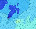  | 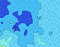  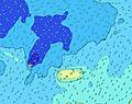 |  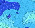 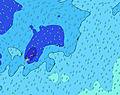 |  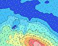 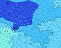 | ||||||||||||||||||||
| Maiores ondas (m) & direção (?) | ||||||||||||||||||||||||
| Período(s) (?) | 15 | 15 | 15 | 15 | 15 | 15 | 14 | 14 | 14 | 14 | 16 | 16 | 14 | 14 | 14 | 14 | 14 | 14 | 14 | 14 | 14 | 14 | 14 | 14 |
Onda (?)Gráfico | ||||||||||||||||||||||||
| 174 | 174 | 171 | 171 | 171 | 171 | 251 | 167 | 238 | 276 | 411 | 411 | 317 | 317 | 322 | 331 | 390 | 331 | 313 | 317 | 288 | 293 | 293 | 293 | |
Vento (km/h) | ||||||||||||||||||||||||
| Estado do Vento (?) onshore cruzado-maral Cruzado cruzado-terral terral cristalino | cross- off | cross- off | cross | cross | cross- off | cross- off | cross- off | cross- off | cross- off | cross- off | cross- off | cross- off | cross- off | cross- off | cross- off | cross- off | cross- off | cross- off | cross- off | cross- off | cross- off | cross- off | cross- off | cross- off |
Maré Alta / altura (m) | 11:06AM 1.01 | 11:40PM 0.89 | 12:12PM 1.00 | 12:53AM 0.87 | 1:21PM 1.01 | 2:04AM 0.88 | ||||||||||||||||||
Maré Baixa / altura (m) | 5:27PM 0.21 | 5:41AM 0.23 | 6:39PM 0.21 | 6:52AM 0.24 | 7:53PM 0.18 | |||||||||||||||||||
Segunda-feira 23 | Terça-feira 24 | Quarta-feira 25 | Quinta-feira 26 | |||||||||||||||||||||
| Nascer do sol | - | - | - | - | - | - | - | 6:26 | - | - | - | - | - | - | - | 6:26 | - | - | - | - | - | - | - | 6:26 |
| Pôr do sol | - | - | 6:52 | - | - | - | - | - | - | - | 6:52 | - | - | - | - | - | - | - | 6:52 | - | - | - | - | - |
Chuva (mm) | - | - | - | - | 1 | 1 | - | - | - | - | - | - | - | 1 | - | - | 1 | - | - | - | - | - | - | - |
| Temp. °C | 28 | 28 | 28 | 28 | 28 | 28 | 28 | 28 | 28 | 28 | 28 | 28 | 28 | 27 | 28 | 28 | 28 | 28 | 28 | 28 | 28 | 28 | 28 | 28 |
| Feels °C (?) | 28 | 28 | 29 | 29 | 29 | 29 | 29 | 29 | 29 | 28 | 29 | 29 | 29 | 28 | 30 | 30 | 30 | 29 | 29 | 29 | 29 | 29 | 29 | 29 |
- Map Icons:
 Break
Break Live Wave Height (m)
 Live Wind Speed (km/h)
 Surf Rating (10 Max)
 Ocean Swells (m)
- Wind Speed (km/h)
widget de graça do Surf-Forecast.com para o seu site
O relatório de surf / widget do tempo abaixo está disponível para incorporar em sites de terceiros gratuitamente e fornece um resumo das nossas Tafatafa surf tempo. Simplesmente pegar o trecho de código html que fornecemos e colá-lo em seu próprio site. Você pode escolher seu idioma preferido e unidades métrico/imperial para o surf tempo de alimentação para atender aos usuários do seu site.... Clique aqui para adquirir o código.
 Nearest