Previsão:

Previsão de curto prazochuviscos (total 3mm), principalmente caindo na Sexta de manhã. Warm (máx. 23°C na Qui de manhã, mín 19°C na Sexta de noite). o vento será geralmente fraco. | |||||||||||||||||||||
Quin 30 | Sexta-feira 31 | Sábado 1 | |||||||||||||||||||
9 AM | 12 PM | 3 PM | 6 PM | 9 PM | 12 AM | 3 AM | 6 AM | 9 AM | 12 PM | 3 PM | 6 PM | 9 PM | 12 AM | 3 AM | 6 AM | 9 AM | 12 PM | 3 PM | 6 PM | 9 PM | |
Mapa da altura do Swell | 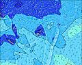 | 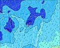 | 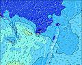 | 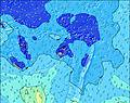 | 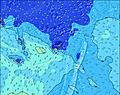 | 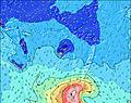 | 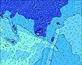 | 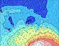 | |||||||||||||
Swell Altura (m) Direção Período (s) | S 12 | S 12 | S 12 | S 11 | SSE 11 | SSE 11 | ESE 6 | ESE 6 | SSW 16 | SSW 16 | SW 16 | SSW 15 | SSW 15 | SSW 16 | SSW 16 | SW 14 | SSW 14 | SSW 14 | SW 15 | SW 15 | SSW 13 |
Onda Gráfico | |||||||||||||||||||||
289 | 289 | 279 | 260 | 198 | 156 | 177 | 177 | 175 | 232 | 271 | 279 | 387 | 506 | 318 | 437 | 545 | 561 | 489 | 503 | 229 | |
Vento (km/h) | |||||||||||||||||||||
Estado do Vento maral cruzado-maral Cruzado cruzado-terral terral cristalino | cross | cross-on | cross | cross | cross | cross | cross | cross | cross | cross | cross-on | cross | cross | cross | cross | cross-off | cross | cross | cross-on | cross-on | cross |
Maré Alta | 6:41AM1.54m | 7:29PM1.40m | 7:19AM1.54m | 8:05PM1.44m | 7:58AM1.52m | 8:41PM1.46m | |||||||||||||||
Maré Baixa | 1:12PM0.18m | 1:17AM0.45m | 1:47PM0.19m | 1:56AM0.44m | 2:21PM0.21m | ||||||||||||||||
6:35 | — | — | — | — | — | — | 6:35 | — | — | — | — | — | — | — | 6:35 | — | — | — | — | — | |
— | — | 5:52 | — | — | — | — | — | — | — | 5:52 | — | — | — | — | — | — | — | 5:52 | — | — | |
mm | — | — | — | — | — | — | — | — | 1 | 1 | — | — | — | 1 | — | — | — | — | — | — | — |
Temp. °C | 22 | 23 | 23 | 22 | 21 | 20 | 21 | 21 | 21 | 22 | 22 | 21 | 21 | 20 | 19 | 19 | 21 | 23 | 23 | 22 | 22 |
Ressent. °C | 18 | 19 | 19 | 19 | 18 | 18 | 19 | 19 | 19 | 19 | 20 | 19 | 19 | 19 | 18 | 19 | 20 | 21 | 20 | 21 | 22 |
Swell 1 Altura (m) Direção Período (s) | S 12 | S 12 | S 12 | S 11 | SSE 11 | SSE 11 | S 11 | SSE 11 | SSE 10 | SSE 10 | SW 16 | SSW 15 | SSW 15 | SSW 16 | SSW 16 | SW 14 | SSW 14 | SSW 14 | SW 15 | SW 15 | SSE 11 |
289 | 289 | 279 | 260 | 198 | 156 | 149 | 153 | 131 | 100 | 271 | 279 | 387 | 506 | 318 | 437 | 545 | 561 | 489 | 503 | 163 | |
Swell 2 Altura (m) Direção Período (s) | SSW 12 | SSW 12 | SSW 12 | SSW 12 | SW 12 | SW 12 | SW 11 | SSW 11 | SSW 11 | SSW 16 | SSE 10 | S 10 | SSE 10 | S 10 | SSE 10 | S 10 | SSE 11 | ESE 6 | ESE 6 | SSE 11 | SSW 13 |
247 | 247 | 180 | 177 | 140 | 137 | 128 | 82 | 84 | 232 | 100 | 94 | 102 | 75 | 77 | 71 | 85 | 55 | 44 | 163 | 229 | |
Swell 3 Altura (m) Direção Período (s) | SE 13 | SE 13 | SE 13 | SE 13 | SE 13 | SE 13 | SE 12 | SE 12 | SSW 16 | SSW 11 | SSW 11 | SSW 11 | SSW 11 | SE 12 | SSE 12 | SSE 12 | S 10 | SE 11 | SE 11 | E 13 | SSW 16 |
178 | 172 | 170 | 172 | 134 | 130 | 124 | 74 | 175 | 84 | 84 | 82 | 81 | 71 | 91 | 90 | 48 | 101 | 103 | 3 | 171 | |
Ondas de vento Altura (m) Direção Período (s) | ESE 6 | ESE 6 | ESE 6 | ESE 6 | ESE 6 | ESE 6 | ESE 6 | ESE 6 | ESE 6 | ESE 7 | ESE 7 | ESE 6 | ESE 7 | ESE 7 | ESE 6 | ESE 7 | ESE 6 | — | — | ESE 6 | — |
153 | 115 | 115 | 98 | 112 | 139 | 177 | 177 | 170 | 152 | 175 | 153 | 131 | 93 | 70 | 58 | 56 | — | — | 30 | — | |
Terral ou glassy mais perto | |||||||||||||||||||||
Distância (km) | 81 | 81 | 81 | 81 | 81 | 81 | 81 | 81 | 81 | 81 | 81 | 81 | 81 | 53 | 3 | 0 | 6 | 22 | 22 | 22 | 3 |
Melhor previsões de ondas em Kadavu Passage | |||||||||||||||||||||
Melhor previsões de ondas em Fiji | |||||||||||||||||||||
Buscador de Ondas Global | |||||||||||||||||||||
- Map Icons:
 Break
Break Live Wave Height (m)
 Live Wind Speed (km/h)
 Surf Rating (10 Max)
 Ocean Swells (m)
- Wind Speed (km/h)
widget de graça do Surf-Forecast.com para o seu site
O relatório de surf / widget do tempo abaixo está disponível para incorporar em sites de terceiros gratuitamente e fornece um resumo das nossas Serua Rights surf tempo. Simplesmente pegar o trecho de código html que fornecemos e colá-lo em seu próprio site. Você pode escolher seu idioma preferido e unidades métrico/imperial para o surf tempo de alimentação para atender aos usuários do seu site.... Clique aqui para adquirir o código.
 Nearest