

- Forecast
- Maps
- Live
- Weather State
- Spot Information
Salinas Surf Forecast
/ Rio Grande Do Sul (19 surf breaks) /
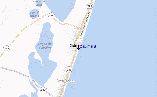
Salinas surf Forecast / Rio Grande Do Sul / Brazil
- Map Icons:
 Break
Break Live Wave Height (m)
 Live Wind Speed (km/h)
 Surf Rating (10 Max)
 Ocean Swells (m)
- Wind Speed (km/h)
How big are the waves at Salinas today?
The current surf forecast for Salinas at 2PM is: 1.2m 7s primary swell from a East-northeast direction and 1.0m 7s secondary swell from a East direction, 0.4m 8s secondary swell from a South-southeast direction (forecast issued at 08:00am May 06). The wind direction is predicted to be cross-offshore and the swell rating is 2.
| Time (-03) & Date | Wave Height | Wave Period |
|---|---|---|
| Morning (06 May) | 4.5ft (1.3m) | 7s |
| Afternoon (06 May) | 3.5ft (1.0m) | 7s |
| Evening (06 May) | 4.5ft (1.3m) | 7s |
Table - waves today at Salinas. (Swell directed towards the surf break)
Monday 06 | Tuesday 07 | Wednesday 08 | Thursday 09 | Friday 10 | Saturday 11 | Sunday 12 | Monday 13 | |||||||||||||||||||||||||||||||||||||||||||||||||||||
| 6 AM | 9 AM | 12 PM | 3 PM | 6 PM | 9 PM | 0 AM | 3 AM | 6 AM | 9 AM | 12 PM | 3 PM | 6 PM | 9 PM | 0 AM | 3 AM | 6 AM | 9 AM | 12 PM | 3 PM | 6 PM | 9 PM | 0 AM | 3 AM | 6 AM | 9 AM | 12 PM | 3 PM | 6 PM | 9 PM | 0 AM | 3 AM | 6 AM | 9 AM | 12 PM | 3 PM | 6 PM | 9 PM | 0 AM | 3 AM | 6 AM | 9 AM | 12 PM | 3 PM | 6 PM | 9 PM | 0 AM | 3 AM | 6 AM | 9 AM | 12 PM | 3 PM | 6 PM | 9 PM | 0 AM | 3 AM | 6 AM | 9 AM | 12 PM | 3 PM | |
Rating (10 max) | ||||||||||||||||||||||||||||||||||||||||||||||||||||||||||||
Swell Height Map |    |    |    |    |   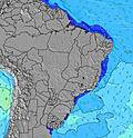 |  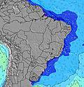 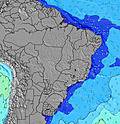 |  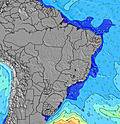 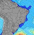 | 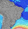 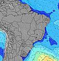 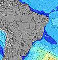 | ||||||||||||||||||||||||||||||||||||||||||||||||||||
| Wave Height (m) & direction (?) | ||||||||||||||||||||||||||||||||||||||||||||||||||||||||||||
| Period(s) (?) | 8 | 7 | 7 | 7 | 7 | 7 | 7 | 7 | 7 | 7 | 7 | 7 | 7 | 7 | 7 | 7 | 7 | 7 | 7 | 7 | 8 | 8 | 8 | 8 | 8 | 7 | 8 | 9 | 9 | 10 | 11 | 11 | 11 | 13 | 12 | 12 | 12 | 12 | 11 | 14 | 13 | 12 | 12 | 12 | 13 | 12 | 12 | 12 | 12 | 12 | 12 | 12 | 8 | 8 | 8 | 8 | 9 | 9 | 9 | 9 |
Wave (?)Graph | ||||||||||||||||||||||||||||||||||||||||||||||||||||||||||||
| Energy (?) | 178 | 172 | 129 | 94 | 134 | 142 | 159 | 108 | 108 | 108 | 91 | 93 | 118 | 131 | 142 | 131 | 134 | 131 | 155 | 169 | 161 | 138 | 138 | 107 | 94 | 117 | 347 | 238 | 246 | 361 | 382 | 394 | 451 | 551 | 383 | 325 | 400 | 387 | 292 | 281 | 582 | 584 | 579 | 608 | 752 | 738 | 794 | 742 | 730 | 890 | 706 | 1290 | 520 | 692 | 730 | 782 | 738 | 888 | 778 | 631 |
Wind (km/h) | ||||||||||||||||||||||||||||||||||||||||||||||||||||||||||||
| Wind State (?) onshore cross-onshore cross-shore cross-offshore offshore glassy | cross | cross- on | cross | cross | cross | cross | cross | cross- off | cross- on | glass | cross- on | cross- on | cross- on | cross- on | cross | cross- on | cross- on | cross | cross- off | off | cross- off | cross- off | off | cross- off | cross- off | cross- off | cross- off | cross- off | cross- off | cross- on | on | on | cross- on | cross- on | cross- on | cross- on | cross | cross | cross | off | off | off | off | cross- off | off | cross- off | off | off | glass | off | off | off | off | cross- off | cross- off | cross- off | cross- off | cross | cross | cross |
High Tide / height (m) | 3:11AM 0.43 | 11:01AM 0.39 | 2:59PM 0.38 | 11:27PM 0.27 | 4:12AM 0.32 | 11:45AM 0.44 | 4:18PM 0.40 | 11:37PM 0.32 | 5:17AM 0.22 | 12:27PM 0.46 | 5:34PM 0.43 | 12:03AM 0.37 | 6:20AM 0.14 | 1:08PM 0.47 | 6:42PM 0.45 | 12:35AM 0.43 | 7:20AM 0.09 | 1:49PM 0.46 | 7:44PM 0.47 | 1:11AM 0.47 | 8:14AM 0.07 | 2:29PM 0.43 | 8:41PM 0.48 | 1:49AM 0.49 | 9:00AM 0.08 | 3:11PM 0.40 | 9:32PM 0.47 | 2:29AM 0.49 | 9:39AM 0.11 | |||||||||||||||||||||||||||||||
Low Tide / height (m) | 7:06AM 0.21 | 1:12PM 0.36 | 7:37PM 0.08 | 1:21AM 0.25 | 7:37AM 0.16 | 2:22PM 0.37 | 8:23PM 0.15 | 2:59AM 0.17 | 8:09AM 0.11 | 3:12PM 0.37 | 9:07PM 0.23 | 4:05AM 0.08 | 8:44AM 0.07 | 3:57PM 0.35 | 9:50PM 0.31 | 4:58AM 0.03 | 9:21AM 0.05 | 4:39PM 0.32 | 10:32PM 0.36 | 5:46AM 0.00 | 10:03AM 0.04 | 5:19PM 0.30 | 11:14PM 0.40 | 6:30AM 0.01 | 10:49AM 0.05 | 5:57PM 0.27 | 11:58PM 0.41 | 7:12AM 0.05 | 11:41AM 0.07 | |||||||||||||||||||||||||||||||
Monday 06 | Tuesday 07 | Wednesday 08 | Thursday 09 | Friday 10 | Saturday 11 | Sunday 12 | Monday 13 | |||||||||||||||||||||||||||||||||||||||||||||||||||||
| Sunrise | - | 6:52 | - | - | - | - | - | - | - | 6:54 | - | - | - | - | - | - | - | 6:54 | - | - | - | - | - | - | - | 6:54 | - | - | - | - | - | - | - | 6:56 | - | - | - | - | - | - | - | 6:56 | - | - | - | - | - | - | - | 6:56 | - | - | - | - | - | - | - | 6:58 | - | - |
| Sunset | - | - | - | 5:39 | - | - | - | - | - | - | - | 5:39 | - | - | - | - | - | - | - | 5:38 | - | - | - | - | - | - | - | 5:37 | - | - | - | - | - | - | - | 5:37 | - | - | - | - | - | - | - | 5:37 | - | - | - | - | - | - | - | 5:36 | - | - | - | - | - | - | - | 5:36 |
Rain (mm) | - | - | - | - | - | - | - | - | - | - | - | - | - | - | - | - | - | - | - | - | 1 | - | - | 1 | - | - | - | - | - | - | - | - | - | 1 | 3 | 6 | 3 | 2 | 2 | 1 | 1 | 1 | - | - | 1 | 1 | - | 2 | - | 4 | 3 | 2 | 3 | 3 | 4 | 1 | - | 3 | 2 | 1 |
| Temp. °C | 24 | 24 | 29 | 31 | 28 | 26 | 25 | 25 | 24 | 24 | 28 | 29 | 25 | 25 | 26 | 25 | 24 | 25 | 29 | 28 | 23 | 23 | 22 | 18 | 17 | 16 | 17 | 17 | 16 | 16 | 16 | 17 | 17 | 17 | 18 | 19 | 19 | 19 | 19 | 19 | 18 | 19 | 22 | 21 | 20 | 20 | 19 | 19 | 19 | 20 | 19 | 19 | 19 | 19 | 17 | 17 | 17 | 17 | 16 | 16 |
| Feels °C (?) | 25 | 25 | 30 | 32 | 29 | 27 | 26 | 25 | 24 | 24 | 28 | 30 | 26 | 26 | 27 | 25 | 24 | 25 | 29 | 29 | 22 | 22 | 21 | 16 | 14 | 13 | 15 | 14 | 13 | 14 | 14 | 14 | 14 | 15 | 17 | 20 | 20 | 20 | 20 | 21 | 18 | 20 | 23 | 21 | 21 | 21 | 21 | 21 | 21 | 22 | 20 | 19 | 18 | 17 | 14 | 14 | 15 | 13 | 12 | 12 |
FREE! Surf-Forecast.com widget for your website
The surf report / weather widget below is available to embed on third party websites free of charge and provides a summary of our Salinas surf forecast. Simply grab the html code snippet that we provide and paste it into your own site. You can choose your preferred language and metric/imperial units for the surf forecast feed to suit users of your site. Click here to get the code.


 Nearest