
Previsão:

Previsão de curto prazochuviscos (total 7mm), principalmente caindo na Quarta à noite. Warm (máx. 31°C na Qui de manhã, mín 25°C na Terça à noite). o vento será geralmente fraco. | |||||||||||||||||||
Seg 27 | Terça-feira 28 | Quarta-feira 29 | |||||||||||||||||
3 PM | 6 PM | 9 PM | 12 AM | 3 AM | 6 AM | 9 AM | 12 PM | 3 PM | 6 PM | 9 PM | 12 AM | 3 AM | 6 AM | 9 AM | 12 PM | 3 PM | 6 PM | 9 PM | |
Mapa da altura do Swell |  |  | 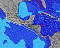 |  |  | 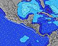 |  | ||||||||||||
Swell Altura (m) Direção Período (s) | SSW 19 | SSW 19 | SSW 17 | SSW 17 | SSW 17 | SSW 18 | SSW 18 | SSW 18 | SSW 17 | SSW 17 | SSW 16 | SSW 16 | SW 16 | SW 16 | SW 16 | SSW 16 | SSW 16 | SSW 16 | SW 15 |
Onda Gráfico | |||||||||||||||||||
750 | 742 | 1274 | 1352 | 1644 | 1837 | 1837 | 1663 | 1644 | 1570 | 1443 | 1408 | 1255 | 1255 | 1239 | 1141 | 1126 | 1112 | 967 | |
Vento (km/h) | |||||||||||||||||||
Estado do Vento maral cruzado-maral Cruzado cruzado-terral terral cristalino | cross-on | cross | cross | cross-off | cross-off | off | glassy | on | cross-on | cross | cross-off | cross-off | off | off | cross | on | cross-on | cross | off |
Maré Alta | 1:12PM1.82m | 1:49AM1.58m | 1:59PM1.88m | 2:34AM1.67m | 2:42PM1.93m | ||||||||||||||
Maré Baixa | 7:46PM0.44m | 7:42AM0.54m | 8:28PM0.37m | 8:28AM0.49m | |||||||||||||||
— | — | — | — | 5:41 | — | — | — | — | — | — | — | 5:41 | — | — | — | — | — | — | |
— | 6:25 | — | — | — | — | — | — | — | 6:25 | — | — | — | — | — | — | — | 6:25 | — | |
mm | — | — | — | — | 1 | — | — | — | — | — | — | — | 2 | — | — | — | — | — | 1 |
Temp. °C | 30 | 28 | 28 | 27 | 26 | 26 | 30 | 30 | 30 | 29 | 27 | 26 | 25 | 25 | 30 | 30 | 30 | 28 | 27 |
Ressent. °C | 33 | 31 | 31 | 30 | 29 | 29 | 34 | 31 | 32 | 31 | 30 | 29 | 27 | 27 | 33 | 31 | 33 | 31 | 31 |
Swell 1 Altura (m) Direção Período (s) | SW 16 | SW 16 | SSW 17 | SSW 17 | SSW 17 | SSW 18 | SSW 18 | SSW 18 | SSW 17 | SSW 17 | SSW 16 | SSW 16 | SW 16 | SW 16 | SW 16 | SSW 16 | SSW 16 | SSW 16 | SW 15 |
580 | 573 | 1274 | 1352 | 1644 | 1837 | 1837 | 1663 | 1644 | 1570 | 1443 | 1408 | 1255 | 1255 | 1239 | 1141 | 1126 | 1112 | 967 | |
Swell 2 Altura (m) Direção Período (s) | SSW 19 | SSW 19 | SE 6 | SSE 7 | SE 6 | SE 6 | SE 7 | SSE 7 | SSE 7 | SSE 6 | SSE 6 | S 9 | S 9 | S 9 | SSE 8 | SSE 8 | S 8 | S 8 | SSE 7 |
750 | 742 | 19 | 38 | 13 | 17 | 16 | 43 | 41 | 41 | 13 | 53 | 37 | 39 | 21 | 21 | 19 | 18 | 18 | |
Swell 3 Altura (m) Direção Período (s) | SSE 7 | SE 6 | S 9 | SW 10 | WSW 10 | — | — | SSW 11 | SSW 11 | S 9 | S 11 | S 11 | SSW 9 | — | — | W 10 | W 10 | W 10 | W 10 |
54 | 27 | 24 | 4 | 9 | — | — | 24 | 23 | 6 | 10 | 10 | 8 | — | — | 8 | 8 | 9 | 8 | |
Ondas de vento Altura (m) Direção Período (s) | — | — | W 7 | W 7 | WNW 8 | — | — | — | — | — | SW 9 | SW 9 | — | — | — | — | — | — | — |
— | — | 4 | 8 | 13 | — | — | — | — | — | 49 | 37 | — | — | — | — | — | — | — | |
Terral ou glassy mais perto | |||||||||||||||||||
Distância (km) | 340 | 3 | 3 | 0 | 0 | 0 | 0 | 311 | 358 | 41 | 0 | 0 | 0 | 0 | 1 | 311 | 337 | 22 | 0 |
Melhor previsões de ondas em El-Salvador - Costa del Balsamo | |||||||||||||||||||
Melhor previsões de ondas em El Salvador | |||||||||||||||||||
Buscador de Ondas Global | |||||||||||||||||||
- Map Icons:
 Break
Break Live Wave Height (m)
 Live Wind Speed (km/h)
 Surf Rating (10 Max)
 Ocean Swells (m)
- Wind Speed (km/h)
widget de graça do Surf-Forecast.com para o seu site
O relatório de surf / widget do tempo abaixo está disponível para incorporar em sites de terceiros gratuitamente e fornece um resumo das nossas Punta Roca surf tempo. Simplesmente pegar o trecho de código html que fornecemos e colá-lo em seu próprio site. Você pode escolher seu idioma preferido e unidades métrico/imperial para o surf tempo de alimentação para atender aos usuários do seu site.... Clique aqui para adquirir o código.
 Nearest