

- Forecast
- Maps
- Live
- Weather State
- Spot Information

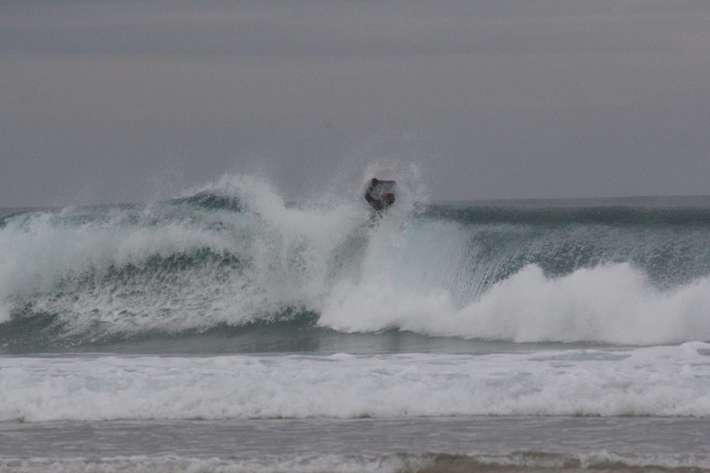

Playa de Baldayo - La Laguna surf Forecast / Galicia / Spain
- Map Icons:
 Break
Break Live Wave Height (m)
 Live Wind Speed (km/h)
 Surf Rating (10 Max)
 Ocean Swells (m)
- Wind Speed (km/h)
How big are the waves at Playa de Baldayo - La Laguna today?
The current surf forecast for Playa de Baldayo - La Laguna at 11PM is: 0.6m 8s primary swell from a West-northwest direction and 0.6m 6s secondary swell from a North direction (forecast issued at 07:00pm May 20). The wind direction is predicted to be glassy and the swell rating is 2.
| Time (CEST) & Date | Wave Height | Wave Period |
|---|---|---|
| Morning (20 May) | - | - |
| Afternoon (20 May) | 2ft (0.6m) | 9s |
| Evening (20 May) | 2ft (0.6m) | 8s |
Table - waves today at Playa de Baldayo - La Laguna. (Swell directed towards the surf break)
Monday 20 | Tuesday 21 | Wednesday 22 | Thursday 23 | Friday 24 | Saturday 25 | Sunday 26 | Monday 27 | Tue 28 | ||||||||||||||||||||||||||||||||||||||||||||||||||||
| 5 PM | 8 PM | 11 PM | 2 AM | 5 AM | 8 AM | 11 AM | 2 PM | 5 PM | 8 PM | 11 PM | 2 AM | 5 AM | 8 AM | 11 AM | 2 PM | 5 PM | 8 PM | 11 PM | 2 AM | 5 AM | 8 AM | 11 AM | 2 PM | 5 PM | 8 PM | 11 PM | 2 AM | 5 AM | 8 AM | 11 AM | 2 PM | 5 PM | 8 PM | 11 PM | 2 AM | 5 AM | 8 AM | 11 AM | 2 PM | 5 PM | 8 PM | 11 PM | 2 AM | 5 AM | 8 AM | 11 AM | 2 PM | 5 PM | 8 PM | 11 PM | 2 AM | 5 AM | 8 AM | 11 AM | 2 PM | 5 PM | 8 PM | 11 PM | 2 AM | |
Rating (10 max) | ||||||||||||||||||||||||||||||||||||||||||||||||||||||||||||
Swell Height Map |   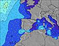 |  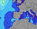 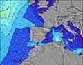 |  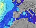 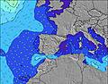 |  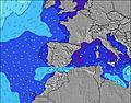 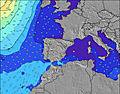 |    |    |    |    | 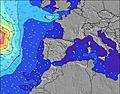 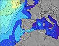 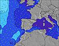 | |||||||||||||||||||||||||||||||||||||||||||||||||||
| Wave Height (m) & direction (?) | ||||||||||||||||||||||||||||||||||||||||||||||||||||||||||||
| Period(s) (?) | 8 | 8 | 8 | 5 | 5 | 5 | 5 | 5 | 5 | 4 | 4 | 5 | 6 | 8 | 8 | 8 | 11 | 11 | 11 | 11 | 11 | 11 | 11 | 10 | 10 | 10 | 9 | 9 | 9 | 9 | 9 | 8 | 8 | 8 | 10 | 10 | 9 | 12 | 11 | 11 | 10 | 10 | 10 | 9 | 9 | 9 | 9 | 8 | 8 | 8 | 15 | 14 | 13 | 12 | 12 | 12 | 12 | 12 | 12 | 12 |
Wave (?)Graph | ||||||||||||||||||||||||||||||||||||||||||||||||||||||||||||
| Energy (?) | 44 | 54 | 44 | 23 | 36 | 39 | 28 | 28 | 14 | 17 | 26 | 42 | 40 | 147 | 207 | 291 | 306 | 996 | 1060 | 1069 | 1107 | 1102 | 1102 | 850 | 838 | 574 | 506 | 456 | 465 | 356 | 290 | 187 | 196 | 165 | 226 | 188 | 138 | 144 | 205 | 329 | 338 | 318 | 301 | 276 | 225 | 220 | 177 | 143 | 116 | 90 | 720 | 1028 | 1198 | 1118 | 977 | 819 | 761 | 683 | 672 | 603 |
Wind (km/h) | ||||||||||||||||||||||||||||||||||||||||||||||||||||||||||||
| Wind State (?) onshore cross-onshore cross-shore cross-offshore offshore glassy | cross- on | cross- on | glass | glass | glass | cross- off | cross | cross | cross | cross- off | cross- off | cross- off | cross- off | cross- on | on | on | on | on | on | cross- on | cross- on | cross- on | cross- on | cross- on | cross- on | cross- on | cross- on | cross | cross | cross- off | cross | cross- on | cross- on | cross- on | glass | glass | cross- off | cross- off | cross | cross- on | cross- on | cross | cross | cross- on | on | on | cross- on | cross- on | cross- on | cross- on | cross- on | cross- on | cross- on | cross | cross- on | cross- on | cross- on | cross- on | cross | cross |
High Tide / height (m) | 3:20PM 3.26 | 3:39AM 3.11 | 3:55PM 3.40 | 4:12AM 3.17 | 4:29PM 3.51 | 4:45AM 3.21 | 5:04PM 3.58 | 5:19AM 3.22 | 5:40PM 3.60 | 5:54AM 3.19 | 6:19PM 3.57 | 6:32AM 3.14 | 7:01PM 3.50 | 7:14AM 3.06 | 7:48PM 3.40 | |||||||||||||||||||||||||||||||||||||||||||||
Low Tide / height (m) | 9:33PM 0.86 | 9:41AM 0.82 | 10:09PM 0.76 | 10:14AM 0.72 | 10:45PM 0.69 | 10:48AM 0.64 | 11:21PM 0.67 | 11:23AM 0.60 | 11:57PM 0.69 | 12:00PM 0.60 | 12:36AM 0.75 | 12:40PM 0.63 | 1:19AM 0.84 | 1:24PM 0.71 | ||||||||||||||||||||||||||||||||||||||||||||||
Monday 20 | Tuesday 21 | Wednesday 22 | Thursday 23 | Friday 24 | Saturday 25 | Sunday 26 | Monday 27 | Tue 28 | ||||||||||||||||||||||||||||||||||||||||||||||||||||
| Sunrise | - | - | - | - | - | 7:03 | - | - | - | - | - | - | - | 7:03 | - | - | - | - | - | - | - | 7:01 | - | - | - | - | - | - | - | 7:01 | - | - | - | - | - | - | - | 7:01 | - | - | - | - | - | - | - | 7:00 | - | - | - | - | - | - | - | 6:58 | - | - | - | - | - | - |
| Sunset | - | 9:57 | - | - | - | - | - | - | - | 9:58 | - | - | - | - | - | - | - | 9:59 | - | - | - | - | - | - | - | 10:00 | - | - | - | - | - | - | - | 10:00 | - | - | - | - | - | - | - | 10:01 | - | - | - | - | - | - | - | 10:02 | - | - | - | - | - | - | - | 10:04 | - | - |
Rain (mm) | 1 | 1 | - | 1 | 1 | 1 | 1 | - | - | - | - | - | - | - | 1 | 1 | - | - | - | - | - | - | - | - | - | - | - | - | - | - | - | - | - | - | - | - | - | - | - | - | - | - | - | - | - | - | - | - | - | - | - | - | - | - | - | - | - | - | - | - |
| Temp. °C | 15 | 14 | 12 | 12 | 12 | 12 | 14 | 16 | 16 | 15 | 13 | 12 | 13 | 12 | 13 | 13 | 15 | 13 | 12 | 12 | 11 | 12 | 13 | 14 | 13 | 13 | 11 | 10 | 9 | 9 | 14 | 17 | 17 | 16 | 12 | 11 | 11 | 11 | 16 | 20 | 20 | 18 | 16 | 14 | 14 | 13 | 14 | 15 | 15 | 14 | 12 | 12 | 12 | 11 | 13 | 15 | 14 | 13 | 12 | 11 |
| Feels °C (?) | 14 | 13 | 11 | 11 | 11 | 11 | 12 | 13 | 13 | 12 | 11 | 10 | 11 | 11 | 11 | 10 | 12 | 10 | 10 | 10 | 9 | 10 | 10 | 11 | 9 | 10 | 8 | 7 | 7 | 7 | 12 | 14 | 15 | 15 | 12 | 10 | 9 | 9 | 15 | 18 | 17 | 16 | 15 | 14 | 14 | 13 | 13 | 12 | 12 | 11 | 9 | 8 | 8 | 7 | 8 | 10 | 8 | 8 | 7 | 7 |
FREE! Surf-Forecast.com widget for your website
The surf report / weather widget below is available to embed on third party websites free of charge and provides a summary of our Playa de Baldayo - La Laguna surf forecast. Simply grab the html code snippet that we provide and paste it into your own site. You can choose your preferred language and metric/imperial units for the surf forecast feed to suit users of your site. Click here to get the code.


 Nearest