
Previsão:

Previsão de curto prazochuviscos (total 4mm), principalmente caindo na Qui à noite. Warm (máx. 24°C no Sábado à tarde, mín 21°C na Qui à noite). Ventos diminuem (ventos fortes de Sudeste na Sexta de noite, vento fraco de Este-Sudeste no Domingo à tarde). | |||||||||||||||||||
Quin 30 | Sexta-feira 31 | Sábado 1 | |||||||||||||||||
5 PM | 8 PM | 11 PM | 2 AM | 5 AM | 8 AM | 11 AM | 2 PM | 5 PM | 8 PM | 11 PM | 2 AM | 5 AM | 8 AM | 11 AM | 2 PM | 5 PM | 8 PM | 11 PM | |
Mapa da altura do Swell |  |  |  |  |  | 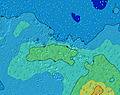 |  | ||||||||||||
Swell Altura (m) Direção Período (s) | SW 11 | SW 11 | SW 11 | SW 11 | SW 11 | SW 11 | S 12 | S 12 | S 12 | S 12 | S 12 | S 12 | S 11 | S 11 | S 11 | S 11 | SSW 16 | SSW 16 | SSW 16 |
Onda Gráfico | |||||||||||||||||||
866 | 821 | 676 | 553 | 515 | 475 | 437 | 488 | 464 | 461 | 446 | 508 | 416 | 476 | 536 | 526 | 545 | 539 | 525 | |
Vento (km/h) | |||||||||||||||||||
Estado do Vento maral cruzado-maral Cruzado cruzado-terral terral cristalino | cross-on | cross | cross | cross | cross | cross | cross | cross | cross | cross | cross-off | cross | cross | cross-off | cross-off | cross-off | cross-off | cross-off | cross-off |
Maré Alta | 1:17AM0.34m | 1:27PM0.37m | 1:37AM0.34m | 1:51PM0.36m | |||||||||||||||
Maré Baixa | 7:16PM0.02m | 7:20AM0.03m | 7:40PM0.03m | 7:44AM0.03m | 8:03PM0.05m | ||||||||||||||
— | — | — | — | 6:24 | — | — | — | — | — | — | — | 6:24 | — | — | — | — | — | — | |
5:43 | — | — | — | — | — | — | — | 5:44 | — | — | — | — | — | — | — | 5:44 | — | — | |
mm | 2 | 1 | 1 | 1 | 1 | — | — | — | — | — | — | — | — | — | — | — | — | — | — |
Temp. °C | 22 | 21 | 21 | 21 | 21 | 22 | 22 | 22 | 22 | 23 | 23 | 22 | 23 | 23 | 23 | 23 | 24 | 24 | 24 |
Ressent. °C | 20 | 18 | 18 | 18 | 17 | 19 | 18 | 18 | 17 | 18 | 19 | 18 | 20 | 20 | 20 | 20 | 21 | 21 | 22 |
Swell 1 Altura (m) Direção Período (s) | SW 11 | SW 11 | SW 11 | SW 11 | SW 11 | SW 11 | SW 11 | S 12 | S 12 | S 12 | S 12 | S 12 | S 11 | S 11 | S 11 | S 11 | S 11 | S 11 | S 10 |
866 | 821 | 676 | 553 | 515 | 475 | 437 | 488 | 464 | 461 | 446 | 508 | 416 | 476 | 536 | 526 | 457 | 457 | 374 | |
Swell 2 Altura (m) Direção Período (s) | ENE 8 | SSE 11 | S 14 | SSW 13 | S 13 | S 13 | S 12 | SW 12 | SW 12 | SW 11 | SW 12 | SW 11 | SW 10 | SW 11 | SW 10 | SSW 17 | SSW 16 | SSW 16 | SSW 16 |
11 | 40 | 142 | 299 | 350 | 395 | 423 | 427 | 338 | 326 | 259 | 237 | 177 | 159 | 133 | 448 | 545 | 539 | 525 | |
Swell 3 Altura (m) Direção Período (s) | SE 14 | SSW 15 | SSE 11 | SSE 11 | SSE 11 | SSE 11 | ENE 8 | ENE 8 | ENE 8 | SSW 20 | SSW 20 | SSW 19 | SSW 18 | SSW 18 | SSW 18 | SW 10 | SW 9 | SW 9 | SW 11 |
29 | 71 | 40 | 39 | 22 | 22 | 13 | 13 | 13 | 75 | 149 | 146 | 289 | 404 | 399 | 88 | 71 | 54 | 57 | |
Ondas de vento Altura (m) Direção Período (s) | SSE 5 | SSE 5 | SSE 6 | SSE 6 | SE 6 | SE 6 | SE 6 | SE 6 | SE 6 | SE 6 | SE 6 | ESE 6 | ESE 6 | ESE 6 | E 6 | E 6 | E 6 | E 7 | E 7 |
98 | 97 | 111 | 119 | 101 | 96 | 89 | 111 | 115 | 143 | 137 | 119 | 94 | 80 | 62 | 64 | 51 | 65 | 65 | |
Terral ou glassy mais perto | |||||||||||||||||||
Distância (km) | 30 | 3506 | 3506 | 2592 | 2583 | 2634 | 2726 | 2583 | 2279 | 2279 | 2279 | 2279 | 2279 | 2279 | 2300 | 1140 | 1140 | 1140 | 1140 |
Melhor previsões de ondas em Tahiti | |||||||||||||||||||
Melhor previsões de ondas em French Polynesia | |||||||||||||||||||
Buscador de Ondas Global | |||||||||||||||||||
- Map Icons:
 Break
Break Live Wave Height (m)
 Live Wind Speed (km/h)
 Surf Rating (10 Max)
 Ocean Swells (m)
- Wind Speed (km/h)
widget de graça do Surf-Forecast.com para o seu site
O relatório de surf / widget do tempo abaixo está disponível para incorporar em sites de terceiros gratuitamente e fornece um resumo das nossas Passe de Maraa surf tempo. Simplesmente pegar o trecho de código html que fornecemos e colá-lo em seu próprio site. Você pode escolher seu idioma preferido e unidades métrico/imperial para o surf tempo de alimentação para atender aos usuários do seu site.... Clique aqui para adquirir o código.
 Nearest