Previsão:

Surf em Maximus Point and Town LeftsPrevisão / Caribbean / Montserrat
Atualização das previsões em hora min s Forecast update imminent
Estas são ondas em águas abertas. Nas praias as ondas geralmente são menores, especialmente em picos mais abrigados.
A temperatura do mar em Maximus Point and Town Lefts hoje é
27.8° C
(O que é um pouco mais quente que o habitual)Actualizações em hora min s Forecast update imminent
Quarta-feira 17 | Quinta-feira 18 | Sexta-feira 19 | Sáb 20 | |||||||||||||||||||||
| 5 AM | 8 AM | 11 AM | 2 PM | 5 PM | 8 PM | 11 PM | 2 AM | 5 AM | 8 AM | 11 AM | 2 PM | 5 PM | 8 PM | 11 PM | 2 AM | 5 AM | 8 AM | 11 AM | 2 PM | 5 PM | 8 PM | 11 PM | 2 AM | |
Avaliação (10 max) | ||||||||||||||||||||||||
Mapa da altura do Swell |    |    |    |  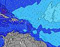 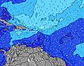 | ||||||||||||||||||||
| Maiores ondas (m) & direção (?) | ||||||||||||||||||||||||
| Período(s) (?) | 10 | 10 | 10 | 10 | 10 | 10 | 10 | 10 | 10 | 10 | 10 | 10 | 10 | 10 | 10 | 10 | 10 | 10 | 10 | 10 | 10 | 10 | 10 | 10 |
Onda (?)Gráfico | ||||||||||||||||||||||||
| 623 | 696 | 696 | 625 | 557 | 557 | 484 | 484 | 426 | 363 | 363 | 415 | 464 | 518 | 518 | 518 | 529 | 529 | 529 | 470 | 422 | 422 | 0 | 0 | |
Vento (km/h) | ||||||||||||||||||||||||
| Estado do Vento (?) onshore cruzado-maral Cruzado cruzado-terral terral cristalino | cross- off | cross- off | cross- off | cross- off | cross- off | cross- off | cross- off | cross- off | cross- off | cross- off | cross- off | cross- off | cross- off | cross- off | cross- off | cross- off | cross- off | cross- off | cross- off | cross- off | cross- off | cross- off | cross- off | cross- off |
Maré Alta / altura (m) | 10:58AM 0.30 | 11:38AM 0.30 | 12:30PM 0.31 | |||||||||||||||||||||
Maré Baixa / altura (m) | 9:36PM 0.01 | 10:10PM -0.01 | 10:47PM -0.01 | |||||||||||||||||||||
Quarta-feira 17 | Quinta-feira 18 | Sexta-feira 19 | Sáb 20 | |||||||||||||||||||||
| Nascer do sol | - | 6:30 | - | - | - | - | - | - | - | 6:31 | - | - | - | - | - | - | - | 6:31 | - | - | - | - | - | - |
| Pôr do sol | - | - | - | - | 5:37 | - | - | - | - | - | - | - | 5:38 | - | - | - | - | - | - | - | 5:38 | - | - | - |
Chuva (mm) | - | - | - | - | - | - | - | - | - | 1 | - | - | - | - | - | - | - | - | 1 | - | 1 | - | - | 1 |
| Temp. °C | 26 | 26 | 26 | 27 | 27 | 27 | 26 | 26 | 26 | 26 | 26 | 27 | 26 | 26 | 26 | 26 | 26 | 26 | 26 | 26 | 26 | 26 | 26 | 26 |
| Feels °C (?) | 23 | 23 | 23 | 25 | 25 | 25 | 25 | 25 | 25 | 25 | 25 | 25 | 25 | 23 | 23 | 24 | 23 | 24 | 24 | 25 | 25 | 25 | 25 | 26 |
- Map Icons:
 Break
Break Live Wave Height (m)
 Live Wind Speed (km/h)
 Surf Rating (10 Max)
 Ocean Swells (m)
- Wind Speed (km/h)
widget de graça do Surf-Forecast.com para o seu site
O relatório de surf / widget do tempo abaixo está disponível para incorporar em sites de terceiros gratuitamente e fornece um resumo das nossas Maximus Point and Town Lefts surf tempo. Simplesmente pegar o trecho de código html que fornecemos e colá-lo em seu próprio site. Você pode escolher seu idioma preferido e unidades métrico/imperial para o surf tempo de alimentação para atender aos usuários do seu site.... Clique aqui para adquirir o código.
 Nearest