
Previsão:

Previsão de curto prazoChuva intensa (total 48mm), mais intensa durante Segunda à noite. Warm (máx. 29°C no Sábado de manhã, mín 28°C no Sábado de manhã). Ventos aumentam (ventos moderados de Oeste no Sábado de manhã, ventos fortes de Oeste-Sudoeste na Seg à noite). | ||||||||||||||||||||||||
Sábado 1 | Domingo 2 | Segunda-feira 3 | ||||||||||||||||||||||
1 AM | 4 AM | 7 AM | 10 AM | 1 PM | 4 PM | 7 PM | 10 PM | 1 AM | 4 AM | 7 AM | 10 AM | 1 PM | 4 PM | 7 PM | 10 PM | 1 AM | 4 AM | 7 AM | 10 AM | 1 PM | 4 PM | 7 PM | 10 PM | |
Mapa da altura do Swell | 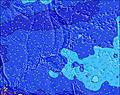 | 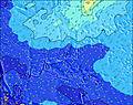 | 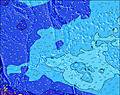 | 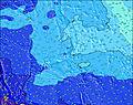 | 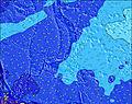 |  | 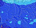 | 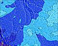 | 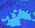 | |||||||||||||||
Swell Altura (m) Direção Período (s) | SW 7 | SW 7 | WSW 7 | WSW 7 | WSW 7 | WSW 7 | WSW 7 | WSW 7 | WSW 7 | WSW 7 | WSW 7 | WSW 7 | WSW 7 | WSW 7 | WSW 8 | WSW 8 | WSW 8 | WSW 8 | WSW 8 | NE 15 | WSW 8 | WSW 8 | WSW 8 | WSW 8 |
Onda Gráfico | ||||||||||||||||||||||||
121 | 139 | 185 | 209 | 235 | 256 | 244 | 263 | 251 | 281 | 281 | 278 | 330 | 415 | 587 | 727 | 705 | 669 | 636 | 695 | 704 | 744 | 864 | 998 | |
Vento (km/h) | ||||||||||||||||||||||||
Estado do Vento maral cruzado-maral Cruzado cruzado-terral terral cristalino | cross-on | cross-on | cross-on | cross-on | cross-on | cross-on | cross-on | cross-on | cross-on | cross-on | cross-on | cross-on | cross-on | cross-on | cross-on | cross-on | cross-on | cross-on | cross-on | cross-on | cross-on | cross-on | cross-on | cross-on |
Maré Alta | 8:30AM0.74m | 10:15PM0.77m | 9:17AM0.73m | 10:39PM0.78m | 10:10AM0.70m | |||||||||||||||||||
Maré Baixa | 3:23AM0.46m | 3:26PM0.06m | 4:03AM0.41m | 4:00PM0.12m | 4:45AM0.36m | 4:35PM0.20m | ||||||||||||||||||
— | 6:05 | — | — | — | — | — | — | — | 6:05 | — | — | — | — | — | — | — | 6:05 | — | — | — | — | — | — | |
— | — | — | — | — | 6:49 | — | — | — | — | — | — | — | 6:49 | — | — | — | — | — | — | — | 6:47 | — | — | |
mm | 2 | 1 | 1 | 1 | 3 | 2 | 2 | 1 | 2 | 1 | 2 | 2 | 1 | 2 | 2 | 2 | 1 | 1 | 2 | 2 | 2 | 3 | 3 | 2 |
Temp. °C | 28 | 28 | 28 | 28 | 29 | 29 | 29 | 29 | 28 | 29 | 28 | 29 | 29 | 29 | 28 | 28 | 28 | 29 | 29 | 29 | 29 | 29 | 28 | 28 |
Ressent. °C | 29 | 28 | 28 | 29 | 30 | 29 | 30 | 30 | 28 | 29 | 27 | 29 | 28 | 28 | 27 | 27 | 27 | 29 | 29 | 28 | 28 | 28 | 26 | 26 |
Swell 1 Altura (m) Direção Período (s) | SW 7 | ENE 15 | ENE 14 | E 15 | E 14 | E 14 | ENE 14 | ENE 17 | ENE 16 | ENE 16 | ENE 15 | ENE 14 | ENE 16 | ENE 15 | ENE 15 | ENE 14 | ENE 14 | ENE 14 | NE 15 | NE 15 | NE 15 | NE 15 | NE 15 | NE 15 |
121 | 284 | 350 | 435 | 423 | 417 | 331 | 625 | 644 | 654 | 629 | 565 | 706 | 679 | 619 | 647 | 638 | 701 | 623 | 695 | 704 | 623 | 606 | 685 | |
Swell 2 Altura (m) Direção Período (s) | E 15 | NNE 9 | NNE 9 | NNE 9 | NNE 9 | NNE 9 | ENE 18 | NNE 9 | NNE 9 | NNE 9 | ENE 20 | SE 9 | SSE 8 | SSE 8 | NE 20 | SSE 10 | SSE 10 | SSE 9 | NE 20 | SSE 9 | SSE 9 | NE 20 | SE 9 | SE 9 |
224 | 16 | 16 | 16 | 16 | 16 | 102 | 16 | 16 | 16 | 76 | 12 | 7 | 7 | 61 | 9 | 9 | 9 | 143 | 8 | 8 | 100 | 3 | 3 | |
Swell 3 Altura (m) Direção Período (s) | ENE 8 | SE 9 | SE 9 | SE 9 | SE 9 | SE 9 | NNE 9 | SE 9 | SSE 9 | SSE 9 | NNE 9 | NNE 9 | NNE 9 | NNE 9 | SSE 10 | NNE 8 | N 8 | N 8 | SSE 9 | N 8 | SE 15 | SSE 9 | SE 14 | SE 14 |
13 | 13 | 13 | 13 | 12 | 12 | 16 | 12 | 8 | 8 | 15 | 8 | 8 | 7 | 9 | 7 | 5 | 1 | 8 | 1 | 9 | 8 | 8 | 8 | |
Ondas de vento Altura (m) Direção Período (s) | — | SW 7 | WSW 7 | WSW 7 | WSW 7 | WSW 7 | WSW 7 | WSW 7 | WSW 7 | WSW 7 | WSW 7 | WSW 7 | WSW 7 | WSW 7 | WSW 8 | WSW 8 | WSW 8 | WSW 8 | WSW 8 | WSW 8 | WSW 8 | WSW 8 | WSW 8 | WSW 8 |
— | 139 | 185 | 209 | 235 | 256 | 244 | 263 | 251 | 281 | 281 | 278 | 330 | 415 | 587 | 727 | 705 | 669 | 636 | 637 | 691 | 744 | 864 | 998 | |
Terral ou glassy mais perto | ||||||||||||||||||||||||
Distância (km) | 18 | 18 | 18 | 18 | 1910 | 1910 | 1859 | 18 | 1830 | 1830 | 1830 | 1830 | 1910 | 1910 | 1277 | 1907 | 1831 | 1830 | 1830 | 1830 | 1910 | 1859 | 1277 | 1830 |
Melhor previsões de ondas em Guam | ||||||||||||||||||||||||
Melhor previsões de ondas em Guam | ||||||||||||||||||||||||
Buscador de Ondas Global | ||||||||||||||||||||||||
- Map Icons:
 Break
Break Live Wave Height (m)
 Live Wind Speed (km/h)
 Surf Rating (10 Max)
 Ocean Swells (m)
- Wind Speed (km/h)
widget de graça do Surf-Forecast.com para o seu site
O relatório de surf / widget do tempo abaixo está disponível para incorporar em sites de terceiros gratuitamente e fornece um resumo das nossas Mangandas surf tempo. Simplesmente pegar o trecho de código html que fornecemos e colá-lo em seu próprio site. Você pode escolher seu idioma preferido e unidades métrico/imperial para o surf tempo de alimentação para atender aos usuários do seu site.... Clique aqui para adquirir o código.
 Nearest