- Forecast
- Maps
- Live
- Weather State
- Spot Information
Le Mail Previsão para Surf
/ Mediterranean – Languedoc-Roussillon (17 surf breaks) /Previsão:

Surf em Le MailPrevisão / Mediterranean – Languedoc-Roussillon / France
Atualização das previsões em hora min s Forecast update imminent
Estas são ondas em águas abertas. Nas praias as ondas geralmente são menores, especialmente em picos mais abrigados.
A temperatura do mar em Le Mail hoje é
12.0° C
(O que é um pouco mais frio que o normal)Actualizações em hora min s Forecast update imminent
Domingo 01 | Segunda-feira 02 | Terça-feira 03 | Quarta-feira 04 | |||||||||||||||||||||
| 10 AM | 1 PM | 4 PM | 7 PM | 10 PM | 1 AM | 4 AM | 7 AM | 10 AM | 1 PM | 4 PM | 7 PM | 10 PM | 1 AM | 4 AM | 7 AM | 10 AM | 1 PM | 4 PM | 7 PM | 10 PM | 1 AM | 4 AM | 7 AM | |
Avaliação (10 max) | ||||||||||||||||||||||||
Mapa da altura do Swell |    |    |    |  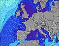 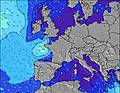 | ||||||||||||||||||||
| Maiores ondas (m) & direção (?) | ||||||||||||||||||||||||
| Período(s) (?) | 3 | 3 | 3 | 3 | 5 | 3 | 3 | 4 | 4 | 6 | 6 | 7 | 7 | 7 | 7 | 7 | 7 | 7 | 7 | 7 | 7 | 6 | 6 | 6 |
Onda (?)Gráfico | ||||||||||||||||||||||||
| 5 | 3 | 2 | 1 | 0 | 1 | 4 | 8 | 30 | 138 | 299 | 486 | 604 | 482 | 327 | 220 | 168 | 142 | 236 | 276 | 268 | 161 | 128 | 107 | |
Vento (km/h) | ||||||||||||||||||||||||
| Estado do Vento (?) onshore cruzado-maral Cruzado cruzado-terral terral cristalino | cross | cross | cross | cross | on | on | cross- on | cross | cross | cross | cross | cross- on | cross- on | cross- off | on | glass | off | cross | cross- on | cross- on | cross- on | cross- on | cross- on | cross |
Maré Alta / altura (m) | 8:33AM 0.28 | 8:06PM 0.16 | 9:14AM 0.29 | 8:47PM 0.17 | 9:52AM 0.29 | 9:28PM 0.17 | ||||||||||||||||||
Maré Baixa / altura (m) | 3:08PM 0.07 | 2:08AM -0.01 | 3:47PM 0.07 | 2:50AM -0.01 | 4:22PM 0.06 | 3:29AM 0.00 | ||||||||||||||||||
Domingo 01 | Segunda-feira 02 | Terça-feira 03 | Quarta-feira 04 | |||||||||||||||||||||
| Nascer do sol | - | - | - | - | - | - | - | - | 8:00 | - | - | - | - | - | - | - | 8:00 | - | - | - | - | - | - | - |
| Pôr do sol | - | - | 5:57 | - | - | - | - | - | - | - | 5:58 | - | - | - | - | - | - | - | 5:59 | - | - | - | - | - |
Chuva (mm) | - | - | - | - | - | - | - | - | - | - | - | 1 | 4 | 1 | 2 | - | - | - | - | - | - | 1 | 1 | 1 |
| Temp. °C | 11 | 12 | 12 | 12 | 12 | 12 | 12 | 12 | 13 | 13 | 13 | 13 | 14 | 9 | 10 | 11 | 10 | 11 | 12 | 12 | 12 | 12 | 12 | 12 |
| Feels °C (?) | 5 | 7 | 7 | 10 | 9 | 10 | 9 | 7 | 6 | 4 | 3 | 4 | 4 | 1 | 7 | 9 | 5 | 8 | 7 | 5 | 5 | 6 | 6 | 5 |
- Map Icons:
 Break
Break Live Wave Height (m)
 Live Wind Speed (km/h)
 Surf Rating (10 Max)
 Ocean Swells (m)
- Wind Speed (km/h)
widget de graça do Surf-Forecast.com para o seu site
O relatório de surf / widget do tempo abaixo está disponível para incorporar em sites de terceiros gratuitamente e fornece um resumo das nossas Le Mail surf tempo. Simplesmente pegar o trecho de código html que fornecemos e colá-lo em seu próprio site. Você pode escolher seu idioma preferido e unidades métrico/imperial para o surf tempo de alimentação para atender aos usuários do seu site.... Clique aqui para adquirir o código.
 Nearest