- Forecast
- Maps
- Live
- Weather State
- Spot Information
Lauli'i Tuai Rights Previsão para Surf
/ Tutuila (19 surf breaks) /Previsão:

Surf em Lauli'i Tuai RightsPrevisão / Tutuila / American Samoa
Atualização das previsões em hora min s Forecast update imminent
Estas são ondas em águas abertas. Nas praias as ondas geralmente são menores, especialmente em picos mais abrigados.
A temperatura do mar em Lauli'i Tuai Rights hoje é
29.5° C
(O que é normal para esta época do ano)Actualizações em hora min s Forecast update imminent
Quinta-feira 26 | Sexta-feira 27 | Sábado 28 | Domingo 01 | |||||||||||||||||||||
| 10 AM | 1 PM | 4 PM | 7 PM | 10 PM | 1 AM | 4 AM | 7 AM | 10 AM | 1 PM | 4 PM | 7 PM | 10 PM | 1 AM | 4 AM | 7 AM | 10 AM | 1 PM | 4 PM | 7 PM | 10 PM | 1 AM | 4 AM | 7 AM | |
Avaliação (10 max) | ||||||||||||||||||||||||
Mapa da altura do Swell |  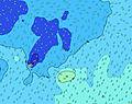  | 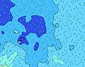  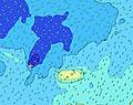 |   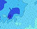 | |||||||||||||||||||||
| Maiores ondas (m) & direção (?) | ||||||||||||||||||||||||
| Período(s) (?) | 13 | 9 | 9 | 7 | 6 | 7 | 9 | 8 | 6 | 6 | 8 | 6 | 16 | 7 | 8 | 8 | 8 | 8 | 8 | 8 | 8 | 8 | 8 | 8 |
Onda (?)Gráfico | ||||||||||||||||||||||||
| 82 | 225 | 237 | 168 | 141 | 173 | 221 | 256 | 175 | 153 | 232 | 127 | 164 | 165 | 193 | 255 | 255 | 285 | 285 | 255 | 261 | 261 | 261 | 261 | |
Vento (km/h) | ||||||||||||||||||||||||
| Estado do Vento (?) onshore cruzado-maral Cruzado cruzado-terral terral cristalino | cross- on | cross | cross | cross | cross | cross | cross | cross | cross | cross | cross | cross | cross | cross | cross | cross | cross | cross | cross | cross | cross | cross | cross | cross- on |
Maré Alta / altura (m) | 3:38PM 0.91 | 4:10AM 0.76 | 4:33PM 0.94 | 5:01AM 0.80 | 5:23PM 0.96 | 5:48AM 0.84 | ||||||||||||||||||
Maré Baixa / altura (m) | 9:10AM 0.00 | 10:03PM -0.06 | 10:08AM -0.03 | 10:54PM -0.09 | 11:01AM -0.06 | 11:41PM -0.10 | ||||||||||||||||||
Quinta-feira 26 | Sexta-feira 27 | Sábado 28 | Domingo 01 | |||||||||||||||||||||
| Nascer do sol | - | - | - | - | - | - | - | 6:22 | - | - | - | - | - | - | - | 6:22 | - | - | - | - | - | - | - | 6:22 |
| Pôr do sol | - | - | 6:46 | - | - | - | - | - | - | - | 6:46 | - | - | - | - | - | - | - | 6:45 | - | - | - | - | - |
Chuva (mm) | 2 | 4 | 5 | 4 | - | 1 | 3 | 3 | 6 | 5 | 5 | 1 | 4 | 1 | - | - | - | - | - | - | - | - | 1 | - |
| Temp. °C | 27 | 27 | 27 | 27 | 27 | 27 | 27 | 28 | 26 | 26 | 26 | 27 | 27 | 28 | 28 | 28 | 28 | 28 | 28 | 28 | 28 | 28 | 28 | 28 |
| Feels °C (?) | 28 | 26 | 27 | 26 | 27 | 28 | 27 | 28 | 27 | 28 | 27 | 27 | 27 | 28 | 28 | 28 | 28 | 28 | 28 | 28 | 28 | 28 | 29 | 28 |
- Map Icons:
 Break
Break Live Wave Height (m)
 Live Wind Speed (km/h)
 Surf Rating (10 Max)
 Ocean Swells (m)
- Wind Speed (km/h)
widget de graça do Surf-Forecast.com para o seu site
O relatório de surf / widget do tempo abaixo está disponível para incorporar em sites de terceiros gratuitamente e fornece um resumo das nossas Lauli'i Tuai Rights surf tempo. Simplesmente pegar o trecho de código html que fornecemos e colá-lo em seu próprio site. Você pode escolher seu idioma preferido e unidades métrico/imperial para o surf tempo de alimentação para atender aos usuários do seu site.... Clique aqui para adquirir o código.
 Nearest