- Forecast
- Maps
- Live
- Weather State
- Spot Information
Previsão:

Surf em KetewelPrevisão / Bali – Sanur / Indonesia
Atualização das previsões em hora min s Forecast update imminent
Estas são ondas em águas abertas. Nas praias as ondas geralmente são menores, especialmente em picos mais abrigados.
A temperatura do mar em Ketewel hoje é
29.5° C
(O que é um pouco mais quente que o habitual)Actualizações em hora min s Forecast update imminent
Quarta-feira 05 | Quinta-feira 06 | Sexta-feira 07 | Sáb 08 | |||||||||||||||||||||
| 5 AM | 8 AM | 11 AM | 2 PM | 5 PM | 8 PM | 11 PM | 2 AM | 5 AM | 8 AM | 11 AM | 2 PM | 5 PM | 8 PM | 11 PM | 2 AM | 5 AM | 8 AM | 11 AM | 2 PM | 5 PM | 8 PM | 11 PM | 2 AM | |
Avaliação (10 max) | ||||||||||||||||||||||||
Mapa da altura do Swell |    |    |    |  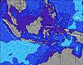 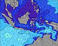 | ||||||||||||||||||||
| Maiores ondas (m) & direção (?) | ||||||||||||||||||||||||
| Período(s) (?) | 12 | 20 | 19 | 18 | 18 | 18 | 18 | 17 | 16 | 16 | 16 | 16 | 16 | 16 | 15 | 15 | 15 | 14 | 14 | 14 | 13 | 13 | 13 | 14 |
Onda (?)Gráfico | ||||||||||||||||||||||||
| 508 | 485 | 782 | 893 | 1118 | 1354 | 1488 | 1589 | 1463 | 1487 | 1606 | 1586 | 1415 | 1361 | 1716 | 1374 | 1475 | 1435 | 1318 | 1387 | 1366 | 1243 | 1243 | 874 | |
Vento (km/h) | ||||||||||||||||||||||||
| Estado do Vento (?) onshore cruzado-maral Cruzado cruzado-terral terral cristalino | glass | glass | cross- on | on | on | glass | glass | glass | glass | glass | glass | cross | cross- off | cross | cross | cross- off | glass | glass | cross- on | cross- on | glass | glass | glass | glass |
Maré Alta / altura (m) | 9:42AM 2.19 | 9:32PM 2.79 | 10:22AM 2.23 | 10:08PM 2.92 | 11:01AM 2.20 | 10:45PM 2.97 | ||||||||||||||||||
Maré Baixa / altura (m) | 3:30AM 0.14 | 3:19PM 0.56 | 4:09AM -0.09 | 3:54PM 0.51 | 4:48AM -0.20 | 4:30PM 0.49 | ||||||||||||||||||
Quarta-feira 05 | Quinta-feira 06 | Sexta-feira 07 | Sáb 08 | |||||||||||||||||||||
| Nascer do sol | - | 5:48 | - | - | - | - | - | - | - | 5:48 | - | - | - | - | - | - | - | 5:48 | - | - | - | - | - | - |
| Pôr do sol | - | - | - | - | 6:15 | - | - | - | - | - | - | - | 6:15 | - | - | - | - | - | - | - | 6:15 | - | - | - |
Chuva (mm) | - | - | - | 1 | 2 | 3 | - | 1 | - | - | 1 | 1 | 2 | 3 | 2 | - | - | - | - | 1 | 1 | 1 | - | - |
| Temp. °C | 25 | 26 | 28 | 28 | 27 | 26 | 26 | 25 | 25 | 26 | 27 | 28 | 26 | 25 | 25 | 24 | 24 | 25 | 28 | 27 | 27 | 26 | 26 | 25 |
| Feels °C (?) | 30 | 31 | 32 | 32 | 31 | 31 | 31 | 29 | 29 | 31 | 31 | 31 | 29 | 28 | 28 | 28 | 28 | 29 | 32 | 30 | 31 | 31 | 31 | 29 |
- Map Icons:
 Break
Break Live Wave Height (m)
 Live Wind Speed (km/h)
 Surf Rating (10 Max)
 Ocean Swells (m)
- Wind Speed (km/h)
widget de graça do Surf-Forecast.com para o seu site
O relatório de surf / widget do tempo abaixo está disponível para incorporar em sites de terceiros gratuitamente e fornece um resumo das nossas Ketewel surf tempo. Simplesmente pegar o trecho de código html que fornecemos e colá-lo em seu próprio site. Você pode escolher seu idioma preferido e unidades métrico/imperial para o surf tempo de alimentação para atender aos usuários do seu site.... Clique aqui para adquirir o código.
 Nearest