
Previsão:

Previsão de curto prazoprincipalmente seco. Warm (máx. 21°C no Sábado de manhã, mín 17°C no Sábado à noite). o vento será geralmente fraco. | |||||||||||||||||||
Sex 31 | Sábado 1 | Domingo 2 | |||||||||||||||||
5 PM | 8 PM | 11 PM | 2 AM | 5 AM | 8 AM | 11 AM | 2 PM | 5 PM | 8 PM | 11 PM | 2 AM | 5 AM | 8 AM | 11 AM | 2 PM | 5 PM | 8 PM | 11 PM | |
Mapa da altura do Swell |  |  | 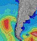 |  |  | 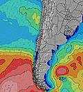 |  | ||||||||||||
Swell Altura (m) Direção Período (s) | SW 12 | SW 12 | SW 11 | SW 11 | SW 11 | SW 11 | SW 11 | SW 11 | SW 10 | SW 10 | SW 10 | SW 10 | SW 10 | SW 9 | SW 9 | SW 10 | SW 10 | SW 10 | SW 9 |
Onda Gráfico | |||||||||||||||||||
205 | 205 | 185 | 242 | 237 | 303 | 414 | 406 | 377 | 328 | 322 | 322 | 192 | 183 | 179 | 273 | 245 | 204 | 176 | |
Vento (km/h) | |||||||||||||||||||
Estado do Vento maral cruzado-maral Cruzado cruzado-terral terral cristalino | cross-on | cross-on | cross-on | cross-on | cross-on | cross | cross-on | on | glassy | glassy | glassy | glassy | glassy | cross-on | cross-on | on | glassy | glassy | glassy |
Maré Alta | 10:55PM0.94m | 10:59AM1.32m | 11:31PM0.97m | 11:31AM1.27m | |||||||||||||||
Maré Baixa | 5:14PM0.34m | 4:27AM0.41m | 5:42PM0.34m | 5:05AM0.44m | 6:11PM0.35m | ||||||||||||||
— | — | — | — | 7:09 | — | — | — | — | — | — | — | 7:09 | — | — | — | — | — | — | |
6:22 | — | — | — | — | — | — | — | 6:22 | — | — | — | — | — | — | — | 6:22 | — | — | |
mm | — | — | — | — | — | — | — | — | — | — | — | — | — | — | — | — | — | — | — |
Temp. °C | 18 | 19 | 19 | 18 | 18 | 18 | 21 | 19 | 18 | 17 | 17 | 18 | 18 | 18 | 19 | 20 | 18 | 17 | 17 |
Ressent. °C | 17 | 17 | 16 | 17 | 17 | 17 | 20 | 19 | 19 | 19 | 18 | 19 | 18 | 18 | 18 | 20 | 19 | 18 | 18 |
Swell 1 Altura (m) Direção Período (s) | SW 12 | SW 12 | SW 11 | SW 11 | SW 11 | SW 11 | SW 11 | SW 11 | SW 10 | SW 10 | SW 10 | SW 10 | SW 10 | SW 9 | SW 9 | SW 10 | SW 10 | SW 10 | SW 9 |
205 | 205 | 185 | 242 | 237 | 303 | 414 | 406 | 377 | 328 | 322 | 322 | 192 | 183 | 179 | 273 | 245 | 204 | 176 | |
Swell 2 Altura (m) Direção Período (s) | SSW 8 | SSW 8 | SSW 8 | SSW 8 | SW 5 | SW 6 | SW 16 | WSW 16 | WSW 16 | SW 16 | WSW 15 | WSW 15 | WSW 15 | WSW 14 | WSW 14 | WSW 14 | WSW 14 | WSW 13 | SW 12 |
14 | 13 | 12 | 6 | 28 | 42 | 66 | 100 | 99 | 62 | 87 | 85 | 142 | 140 | 136 | 129 | 105 | 154 | 144 | |
Swell 3 Altura (m) Direção Período (s) | SW 17 | SW 18 | WSW 18 | WSW 17 | WSW 16 | WSW 16 | W 12 | W 12 | — | — | — | WSW 15 | SW 10 | WSW 10 | WSW 10 | SSW 14 | SW 13 | SSW 13 | WSW 13 |
12 | 12 | 31 | 30 | 27 | 51 | 3 | 3 | — | — | — | 85 | 61 | 39 | 39 | 20 | 83 | 111 | 154 | |
Ondas de vento Altura (m) Direção Período (s) | SW 3 | SW 3 | SSW 4 | SW 5 | — | — | — | — | — | — | — | — | — | — | — | — | — | — | — |
2 | 3 | 12 | 23 | — | — | — | — | — | — | — | — | — | — | — | — | — | — | — | |
Terral ou glassy mais perto | |||||||||||||||||||
Distância (km) | 3 | 179 | 193 | 3 | 3 | 1 | 3 | 3 | 0 | 0 | 0 | 0 | 0 | 3 | 3 | 3 | 0 | 0 | 0 |
Melhor previsões de ondas em Tarapaca | |||||||||||||||||||
Melhor previsões de ondas em Chile | |||||||||||||||||||
Buscador de Ondas Global | |||||||||||||||||||
- Map Icons:
 Break
Break Live Wave Height (m)
 Live Wind Speed (km/h)
 Surf Rating (10 Max)
 Ocean Swells (m)
- Wind Speed (km/h)
widget de graça do Surf-Forecast.com para o seu site
O relatório de surf / widget do tempo abaixo está disponível para incorporar em sites de terceiros gratuitamente e fornece um resumo das nossas Huayquique surf tempo. Simplesmente pegar o trecho de código html que fornecemos e colá-lo em seu próprio site. Você pode escolher seu idioma preferido e unidades métrico/imperial para o surf tempo de alimentação para atender aos usuários do seu site.... Clique aqui para adquirir o código.
 Nearest