
Previsão:

Previsão de curto prazochuva moderada (total 10mm), mais intensa no Sábado à noite. Warm (máx. 30°C na Segunda à tarde, mín 26°C no Sábado à noite). o vento será geralmente fraco. | Dias 5-7 Resumo do Tempochuviscos (total 8mm), principalmente caindo na Qui à tarde. Warm (máx. 30°C na Quarta à tarde, mín 26°C na Quarta à noite). o vento será geralmente fraco. | ||||||||||||||||||
Domingo 2 | Segunda-feira 3 | Terça-feira 4 | Quarta-feira 5 | Quinta-feira 6 | Sexta-feira 7 | ||||||||||||||
noite | manhã | tarde | noite | manhã | tarde | noite | manhã | tarde | noite | manhã | tarde | noite | manhã | tarde | noite | manhã | tarde | noite | |
Mapa da altura do Swell |  | 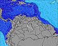 | 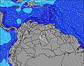 | 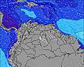 | 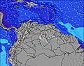 | 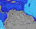 |  | ||||||||||||
Swell Altura (m) Direção Período (s) | ENE 8 | NE 8 | NE 8 | NE 7 | NE 7 | NE 7 | ENE 7 | ENE 7 | NE 6 | NE 6 | NE 6 | E 11 | NE 10 | ENE 6 | ENE 6 | ENE 7 | ENE 7 | NE 7 | ENE 7 |
Onda Gráfico | |||||||||||||||||||
46 | 33 | 93 | 102 | 112 | 102 | 88 | 57 | 51 | 40 | 38 | 2 | 4 | 58 | 103 | 91 | 81 | 88 | 78 | |
Vento (km/h) | |||||||||||||||||||
Estado do Vento maral cruzado-maral Cruzado cruzado-terral terral cristalino | cross | cross-on | cross | cross | cross-on | cross | cross-on | cross-on | cross | cross-on | cross-on | cross | cross-on | cross-on | cross | cross | cross | cross-off | cross |
Maré Alta | 5:10AM0.44m | 6:03PM0.42m | 5:57AM0.40m | 6:37PM0.44m | 6:50AM0.36m | 7:15PM0.45m | 7:49AM0.31m | 7:58PM0.46m | 8:57AM0.27m | 8:48PM0.46m | 10:18AM0.25m | 9:45PM0.47m | |||||||
Maré Baixa | 10:41PM0.21m | 11:11AM0.14m | 11:27PM0.20m | 11:30AM0.15m | 00:22AM0.19m | 11:51AM0.17m | 1:41AM0.17m | 12:16PM0.18m | 3:42AM0.14m | 12:46PM0.20m | 5:06AM0.10m | ||||||||
— | 5:56 | — | — | 5:56 | — | — | 5:58 | — | — | 5:58 | — | — | 5:58 | — | — | 5:58 | — | — | |
6:31 | — | 6:31 | — | — | 6:31 | — | — | 6:30 | — | — | 6:30 | — | — | 6:30 | — | — | 6:30 | — | |
mm | 1 | 2 | 1 | 1 | 1 | — | 1 | 2 | 1 | 1 | 2 | — | 1 | — | 3 | 1 | — | — | — |
Temp. °C | 29 | 28 | 28 | 27 | 29 | 30 | 28 | 28 | 29 | 28 | 28 | 30 | 28 | 28 | 29 | 28 | 29 | 29 | 28 |
Ressent. °C | 30 | 31 | 31 | 28 | 31 | 31 | 29 | 30 | 32 | 30 | 30 | 31 | 29 | 29 | 30 | 29 | 30 | 30 | 29 |
Swell 1 Altura (m) Direção Período (s) | ENE 5 | NE 8 | — | NE 7 | NE 7 | — | ENE 7 | ENE 7 | — | NE 6 | NE 6 | E 11 | NE 10 | NE 10 | N 11 | N 11 | N 11 | N 11 | NE 10 |
15 | 33 | — | 102 | 112 | — | 88 | 57 | — | 40 | 38 | 2 | 4 | 4 | 2 | 2 | 2 | 2 | 4 | |
Swell 2 Altura (m) Direção Período (s) | ENE 8 | NE 4 | — | — | — | — | — | — | — | — | E 11 | — | — | — | — | — | — | — | — |
46 | 7 | — | — | — | — | — | — | — | — | 2 | — | — | — | — | — | — | — | — | |
Swell 3 Altura (m) Direção Período (s) | — | — | — | — | — | — | — | — | — | — | — | — | — | — | — | — | — | — | — |
— | — | — | — | — | — | — | — | — | — | — | — | — | — | — | — | — | — | — | |
Ondas de vento Altura (m) Direção Período (s) | — | — | NE 8 | — | — | NE 7 | — | — | NE 6 | — | — | NE 6 | ENE 6 | ENE 6 | ENE 6 | ENE 7 | ENE 7 | NE 7 | ENE 7 |
— | — | 93 | — | — | 102 | — | — | 51 | — | — | 29 | 43 | 58 | 103 | 91 | 81 | 88 | 78 | |
Terral ou glassy mais perto | |||||||||||||||||||
Distância (km) | 431 | 162 | 167 | 431 | 91 | 491 | 91 | 431 | 491 | 431 | 431 | 491 | 431 | 520 | 520 | 431 | 520 | 167 | 111 |
Melhor previsões de ondas em Sucre | |||||||||||||||||||
Melhor previsões de ondas em Venezuela | |||||||||||||||||||
Buscador de Ondas Global | |||||||||||||||||||
- Map Icons:
 Break
Break Live Wave Height (m)
 Live Wind Speed (km/h)
 Surf Rating (10 Max)
 Ocean Swells (m)
- Wind Speed (km/h)
widget de graça do Surf-Forecast.com para o seu site
O relatório de surf / widget do tempo abaixo está disponível para incorporar em sites de terceiros gratuitamente e fornece um resumo das nossas Guiria surf tempo. Simplesmente pegar o trecho de código html que fornecemos e colá-lo em seu próprio site. Você pode escolher seu idioma preferido e unidades métrico/imperial para o surf tempo de alimentação para atender aos usuários do seu site.... Clique aqui para adquirir o código.
Informação sobre a previsão de Surf de Guiria
A previsão para surf acima mencionada para Guiria proporciona informações essenciais para determinar se as condições de surf serão boas nos próximos 16 dias. Um guia geral para surfar em Guiria pode ser encontrado selecionando a opção guia local para surf no menu cinza. Nossa previsão de surf em Guiria é sem igual, pois inclui a energia da onda (poder)que define a sensação real do surf, ao invés de incluir somente a altura ou o período das ondas. Se você surfa com regularidade no mesmo lugar (Guiria), então faça uma anotação mental da energia da onda indicada na tabela de previsão do surf a cada vez que você for lá. Em pouco tempo você talvez comece a escolher seus dias de surf baseado somente na energia da onda, combinado com nossa previsão de condições favoráveis de vento terral classificação por estrelas ajudará nisto e, com certeza, você também encontrará a altura usual de ondas e prognósticos do período das ondas em nossa previsão para o surf, assim como a quebra dos componentes do swell sob nossas opções de usuário avançadas (para revelar isto, clique no título caractere de Einstein em horários da maré).
Informações adicionais sobre perguntas frequentes a cerca nossa previsão do surf em Guiria podem ser encontradas embaixo da aba de ajuda no menú ao topo e também ao mover o mouse sobre as question marks na própria tabela de previsão do surf. Por favor, sempre tenha em mente que a previsão é para águas abertas próximas à costa e que fatores locais em cada surf break influenciam na real altura da onda, como o perfil da praia ou do recife, profundidades da água fora da costa e abrigo.
Are you planning a holiday in Sucre? If you are looking for accommodation near Guiria, camping, hotels and holiday cottages in Sucre, consider staying in Guiria which is 10 km (6 miles) away. Other places in and around Sucre where you can find information about places to rent, and car hire include Puerto de Hierro which is 15 km (9 miles) away, Chaguaramas, Port-Of-Spain and Point Fortin.
 Nearest