
Previsão:

Previsão de curto prazochuviscos (total 9mm), principalmente caindo na Seg à noite. Very mild (máx. 19°C na Segunda à tarde, mín 9°C no Sábado à noite). Ventos aumentam (vento fraco de Nordeste no Domingo à tarde, ventos frescos de Oeste-Noroeste na Seg à noite). | |||||||||||||||||||||
Sáb 1 | Domingo 2 | Segunda-feira 3 | |||||||||||||||||||
11 AM | 2 PM | 5 PM | 8 PM | 11 PM | 2 AM | 5 AM | 8 AM | 11 AM | 2 PM | 5 PM | 8 PM | 11 PM | 2 AM | 5 AM | 8 AM | 11 AM | 2 PM | 5 PM | 8 PM | 11 PM | |
Mapa da altura do Swell |  |  |  | 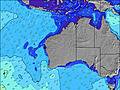 |  |  | 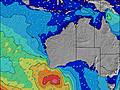 |  | |||||||||||||
Swell Altura (m) Direção Período (s) | WSW 15 | WSW 15 | WSW 14 | WSW 15 | WSW 15 | WSW 15 | WSW 14 | WSW 14 | WSW 14 | WSW 14 | WSW 13 | WSW 13 | WSW 13 | WSW 13 | WSW 14 | WSW 14 | WSW 14 | WSW 14 | WSW 15 | WSW 16 | WSW 16 |
Onda Gráfico | |||||||||||||||||||||
2305 | 2178 | 2148 | 2479 | 2446 | 2090 | 1874 | 1579 | 1362 | 1261 | 1127 | 1093 | 936 | 850 | 733 | 754 | 692 | 577 | 627 | 291 | 604 | |
Vento (km/h) | |||||||||||||||||||||
Estado do Vento maral cruzado-maral Cruzado cruzado-terral terral cristalino | cross-off | cross | cross | cross-off | off | off | off | off | cross-off | cross-off | cross-off | off | off | cross-off | cross-off | cross-off | cross | cross-on | cross-on | cross-on | on |
Maré Alta | 10:16AM0.59m | 00:59AM0.36m | 10:35AM0.53m | 1:08AM0.41m | 10:48AM0.45m | ||||||||||||||||
Maré Baixa | 5:57PM0.14m | 4:36AM0.31m | 6:05PM0.17m | 5:47AM0.32m | 6:10PM0.19m | ||||||||||||||||
— | — | — | — | — | — | 7:05 | — | — | — | — | — | — | — | 7:03 | — | — | — | — | — | — | |
— | — | 5:39 | — | — | — | — | — | — | — | 5:40 | — | — | — | — | — | — | — | 5:40 | — | — | |
mm | — | — | — | — | — | — | — | — | — | — | — | — | — | — | — | — | — | — | — | — | 4 |
Temp. °C | 14 | 16 | 15 | 14 | 12 | 11 | 9 | 9 | 13 | 17 | 18 | 16 | 14 | 14 | 14 | 13 | 18 | 19 | 19 | 19 | 17 |
Ressent. °C | 9 | 11 | 10 | 9 | 7 | 6 | 3 | 3 | 7 | 12 | 15 | 12 | 9 | 9 | 9 | 9 | 14 | 15 | 16 | 16 | 10 |
Swell 1 Altura (m) Direção Período (s) | WSW 15 | WSW 15 | WSW 14 | WSW 15 | WSW 15 | WSW 15 | WSW 14 | WSW 14 | WSW 14 | WSW 14 | WSW 13 | WSW 13 | WSW 13 | WSW 13 | WSW 14 | WSW 14 | WSW 14 | WSW 14 | WSW 15 | WSW 12 | WSW 16 |
2305 | 2178 | 2148 | 2479 | 2446 | 2090 | 1874 | 1579 | 1362 | 1261 | 1127 | 1093 | 936 | 850 | 733 | 754 | 692 | 577 | 627 | 230 | 604 | |
Swell 2 Altura (m) Direção Período (s) | — | — | — | — | — | — | — | — | — | — | — | — | — | — | — | — | — | — | — | WSW 16 | WSW 22 |
— | — | — | — | — | — | — | — | — | — | — | — | — | — | — | — | — | — | — | 291 | 47 | |
Swell 3 Altura (m) Direção Período (s) | — | — | — | — | — | — | — | — | — | — | — | — | — | — | — | — | — | — | — | — | — |
— | — | — | — | — | — | — | — | — | — | — | — | — | — | — | — | — | — | — | — | — | |
Ondas de vento Altura (m) Direção Período (s) | — | — | — | — | — | ESE 3 | E 3 | ENE 4 | NE 4 | NE 4 | — | — | ENE 3 | NE 3 | NNE 4 | N 4 | N 4 | NNW 4 | NNW 3 | NNW 3 | NW 4 |
— | — | — | — | — | 5 | 5 | 10 | 11 | 4 | — | — | 3 | 7 | 8 | 13 | 7 | 5 | 4 | 4 | 27 | |
Terral ou glassy mais perto | |||||||||||||||||||||
Distância (km) | 31 | 155 | 155 | 73 | 0 | 0 | 0 | 0 | 13 | 13 | 0 | 0 | 0 | 13 | 13 | 60 | 274 | 326 | 274 | 364 | 341 |
Melhor previsões de ondas em Perth City Coast | |||||||||||||||||||||
Melhor previsões de ondas em Australia | |||||||||||||||||||||
Buscador de Ondas Global | |||||||||||||||||||||
- Map Icons:
 Break
Break Live Wave Height (m)
 Live Wind Speed (km/h)
 Surf Rating (10 Max)
 Ocean Swells (m)
- Wind Speed (km/h)
widget de graça do Surf-Forecast.com para o seu site
O relatório de surf / widget do tempo abaixo está disponível para incorporar em sites de terceiros gratuitamente e fornece um resumo das nossas Floreat groyne surf tempo. Simplesmente pegar o trecho de código html que fornecemos e colá-lo em seu próprio site. Você pode escolher seu idioma preferido e unidades métrico/imperial para o surf tempo de alimentação para atender aos usuários do seu site.... Clique aqui para adquirir o código.
 Nearest