
Previsão:

Previsão de curto prazochuva moderada (total 10mm), mais intensa no Sábado à noite. Very mild (máx. 19°C na Sexta à tarde, mín 17°C na Sexta de noite). principalmente ventos frescos. | ||||||||||||||||||||
Sex 31 | Sábado 1 | Domingo 2 | ||||||||||||||||||
1 PM | 4 PM | 7 PM | 10 PM | 1 AM | 4 AM | 7 AM | 10 AM | 1 PM | 4 PM | 7 PM | 10 PM | 1 AM | 4 AM | 7 AM | 10 AM | 1 PM | 4 PM | 7 PM | 10 PM | |
Mapa da altura do Swell |  | 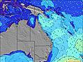 | 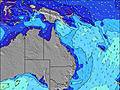 | 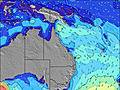 |  | 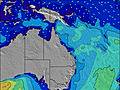 | 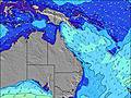 |  | ||||||||||||
Swell Altura (m) Direção Período (s) | ESE 13 | NE 8 | ESE 13 | SE 6 | SE 6 | SE 6 | SE 6 | SE 6 | SSE 6 | SE 6 | ESE 6 | ESE 6 | ESE 6 | ESE 7 | ESE 7 | ESE 7 | ESE 7 | ESE 7 | ESE 7 | ESE 7 |
Onda Gráfico | ||||||||||||||||||||
59 | 34 | 57 | 256 | 263 | 271 | 293 | 282 | 175 | 195 | 196 | 218 | 322 | 372 | 323 | 345 | 330 | 233 | 191 | 186 | |
Vento (km/h) | ||||||||||||||||||||
Estado do Vento maral cruzado-maral Cruzado cruzado-terral terral cristalino | off | off | off | off | off | off | off | cross-off | off | off | cross-off | cross-off | cross-off | cross-off | off | cross-off | off | off | cross-off | cross-off |
Maré Alta | 9:15PM1.76m | 9:36AM1.25m | 9:47PM1.72m | 10:14AM1.29m | ||||||||||||||||
Maré Baixa | 3:49AM0.13m | 3:23PM0.19m | 4:20AM0.13m | 4:02PM0.25m | ||||||||||||||||
— | — | — | — | — | 6:26 | — | — | — | — | — | — | — | 6:26 | — | — | — | — | — | — | |
— | 5:20 | — | — | — | — | — | — | — | 5:20 | — | — | — | — | — | — | — | 5:21 | — | — | |
mm | 3 | 1 | — | — | — | 1 | — | — | — | — | 1 | 2 | 1 | 1 | — | 1 | — | — | — | 1 |
Temp. °C | 18 | 19 | 19 | 19 | 18 | 17 | 18 | 19 | 19 | 17 | 18 | 18 | 18 | 18 | 17 | 18 | 18 | 18 | 17 | 17 |
Ressent. °C | 13 | 13 | 13 | 13 | 12 | 11 | 11 | 13 | 13 | 13 | 14 | 13 | 12 | 12 | 12 | 13 | 13 | 14 | 13 | 13 |
Swell 1 Altura (m) Direção Período (s) | E 7 | NE 8 | NE 8 | NE 8 | NE 8 | NE 8 | NE 7 | ESE 13 | E 6 | ESE 12 | ESE 12 | E 17 | E 17 | SSE 11 | ESE 12 | ESE 12 | SE 16 | SE 16 | SE 15 | SE 15 |
43 | 31 | 31 | 29 | 17 | 17 | 13 | 33 | 76 | 31 | 30 | 6 | 6 | 70 | 28 | 29 | 64 | 201 | 191 | 174 | |
Swell 2 Altura (m) Direção Período (s) | NE 8 | ESE 13 | ESE 13 | ESE 13 | ESE 13 | ESE 13 | ESE 13 | NE 7 | ESE 13 | ESE 12 | — | E 17 | — | ESE 12 | ESE 12 | SE 15 | ESE 12 | SSE 9 | SSE 9 | SSE 9 |
30 | 34 | 57 | 34 | 34 | 33 | 32 | 13 | 32 | 30 | — | 6 | — | 29 | 29 | 35 | 28 | 34 | 49 | 67 | |
Swell 3 Altura (m) Direção Período (s) | ESE 13 | SSE 10 | SE 13 | SSE 13 | SSE 12 | SSE 13 | SSE 12 | ESE 13 | — | — | — | — | — | E 17 | — | — | ESE 12 | ESE 12 | SE 12 | SSE 12 |
59 | 20 | 6 | 16 | 15 | 16 | 15 | 32 | — | — | — | — | — | 6 | — | — | 28 | 28 | 23 | 13 | |
Ondas de vento Altura (m) Direção Período (s) | SSE 5 | SE 6 | SE 6 | SE 6 | SE 6 | SE 6 | SE 6 | SE 6 | SSE 6 | SE 6 | ESE 6 | ESE 6 | ESE 6 | ESE 7 | ESE 7 | ESE 7 | ESE 7 | ESE 7 | ESE 7 | ESE 7 |
90 | 181 | 224 | 256 | 263 | 271 | 293 | 282 | 175 | 195 | 196 | 218 | 322 | 372 | 323 | 345 | 330 | 233 | 187 | 186 | |
Terral ou glassy mais perto | ||||||||||||||||||||
Distância (km) | 50 | 50 | 50 | 50 | 50 | 50 | 50 | 50 | 50 | 0 | 50 | 50 | 50 | 50 | 50 | 50 | 50 | 0 | 50 | 50 |
Melhor previsões de ondas em Queensland North Coast | ||||||||||||||||||||
Melhor previsões de ondas em Australia | ||||||||||||||||||||
Buscador de Ondas Global | ||||||||||||||||||||
- Map Icons:
 Break
Break Live Wave Height (m)
 Live Wind Speed (km/h)
 Surf Rating (10 Max)
 Ocean Swells (m)
- Wind Speed (km/h)
widget de graça do Surf-Forecast.com para o seu site
O relatório de surf / widget do tempo abaixo está disponível para incorporar em sites de terceiros gratuitamente e fornece um resumo das nossas Double Island Point - North Coast surf tempo. Simplesmente pegar o trecho de código html que fornecemos e colá-lo em seu próprio site. Você pode escolher seu idioma preferido e unidades métrico/imperial para o surf tempo de alimentação para atender aos usuários do seu site.... Clique aqui para adquirir o código.
 Nearest