
Previsão:

Previsão de curto prazoAlguns chuviscos, mais intensos durante Segunda à noite. Warm (máx. 27°C na Segunda de manhã, mín 27°C na Segunda de manhã). o vento será geralmente fraco. | ||||||||||||||||||||||||
Segunda-feira 3 | Terça-feira 4 | Quarta-feira 5 | ||||||||||||||||||||||
2 AM | 5 AM | 8 AM | 11 AM | 2 PM | 5 PM | 8 PM | 11 PM | 2 AM | 5 AM | 8 AM | 11 AM | 2 PM | 5 PM | 8 PM | 11 PM | 2 AM | 5 AM | 8 AM | 11 AM | 2 PM | 5 PM | 8 PM | 11 PM | |
Mapa da altura do Swell | 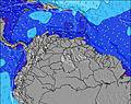 | 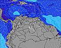 |  | 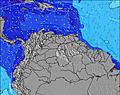 | 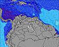 |  | 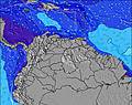 | 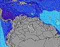 | 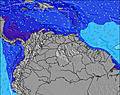 | |||||||||||||||
Swell Altura (m) Direção Período (s) | E 7 | E 7 | E 7 | E 7 | E 7 | E 7 | E 7 | E 7 | E 7 | E 7 | NE 7 | NE 7 | NE 7 | NE 6 | ENE 6 | ENE 6 | ENE 6 | ENE 7 | ENE 7 | ENE 7 | N 11 | N 11 | N 11 | NE 7 |
Onda Gráfico | ||||||||||||||||||||||||
0 | 0 | 0 | 0 | 0 | 0 | 0 | 0 | 0 | 0 | 35 | 36 | 36 | 0 | 0 | 0 | 0 | 0 | 0 | 0 | 3 | 2 | 2 | 35 | |
Vento (km/h) | ||||||||||||||||||||||||
Estado do Vento maral cruzado-maral Cruzado cruzado-terral terral cristalino | cross-off | cross-off | cross-off | cross-off | cross-off | cross-off | cross-off | cross-off | cross-off | cross-off | cross-off | cross-off | cross-off | cross-off | cross-off | cross-off | cross-off | cross-off | cross-off | cross-off | cross-off | cross-off | cross-off | cross-off |
Maré Alta | 11:45AM0.28m | 11:08PM0.29m | 12:51PM0.30m | 11:24PM0.26m | 1:56PM0.32m | |||||||||||||||||||
Maré Baixa | 5:05AM0.15m | 4:58PM0.19m | 5:32AM0.11m | 6:09PM0.22m | 6:07AM0.08m | 8:04PM0.23m | ||||||||||||||||||
— | 5:50 | — | — | — | — | — | — | — | 5:50 | — | — | — | — | — | — | — | 5:52 | — | — | — | — | — | — | |
— | — | — | — | — | 6:45 | — | — | — | — | — | — | — | 6:45 | — | — | — | — | — | — | — | 6:45 | — | — | |
mm | — | — | — | — | — | — | — | — | — | 1 | — | — | — | — | — | — | — | — | — | — | — | — | — | — |
Temp. °C | 27 | 27 | 27 | 27 | 27 | 27 | 27 | 27 | 27 | 27 | 27 | 27 | 27 | 27 | 27 | 27 | 27 | 27 | 27 | 27 | 27 | 27 | 27 | 27 |
Ressent. °C | 26 | 26 | 26 | 27 | 27 | 27 | 27 | 28 | 28 | 29 | 29 | 28 | 28 | 28 | 28 | 28 | 28 | 28 | 28 | 28 | 28 | 28 | 27 | 27 |
Swell 1 Altura (m) Direção Período (s) | — | — | — | — | — | — | — | S 5 | S 4 | E 7 | E 7 | ESE 7 | ESE 7 | ESE 7 | ESE 7 | ESE 7 | ESE 7 | ESE 7 | ESE 6 | ESE 6 | E 11 | E 11 | E 10 | NE 7 |
— | — | — | — | — | — | — | 2 | 2 | 61 | 59 | 26 | 26 | 16 | 16 | 9 | 9 | 9 | 8 | 8 | 2 | 9 | 8 | 35 | |
Swell 2 Altura (m) Direção Período (s) | — | — | — | — | — | — | — | — | — | S 5 | S 5 | S 5 | S 5 | S 5 | S 5 | S 5 | — | — | — | — | — | — | N 11 | E 10 |
— | — | — | — | — | — | — | — | — | 2 | 2 | 2 | 2 | 2 | 2 | 2 | — | — | — | — | — | — | 2 | 8 | |
Swell 3 Altura (m) Direção Período (s) | — | — | — | — | — | — | — | — | — | — | — | SSE 5 | — | — | E 11 | E 12 | E 12 | E 11 | E 11 | E 11 | N 11 | N 11 | E 10 | E 10 |
— | — | — | — | — | — | — | — | — | — | — | 2 | — | — | 2 | 3 | 3 | 3 | 2 | 2 | 3 | 2 | 2 | 2 | |
Ondas de vento Altura (m) Direção Período (s) | E 7 | E 7 | E 7 | E 7 | E 7 | E 7 | E 7 | E 7 | E 7 | — | NE 7 | NE 7 | NE 7 | NE 6 | ENE 6 | ENE 6 | ENE 6 | ENE 7 | ENE 7 | ENE 7 | ENE 7 | ENE 6 | ENE 7 | ESE 4 |
167 | 167 | 173 | 146 | 142 | 116 | 113 | 94 | 77 | — | 35 | 36 | 36 | 40 | 35 | 45 | 45 | 50 | 51 | 51 | 58 | 56 | 58 | 15 | |
Terral ou glassy mais perto | ||||||||||||||||||||||||
Distância (km) | 818 | 727 | 330 | 172 | 298 | 155 | 155 | 38 | 38 | 425 | 155 | 38 | 155 | 683 | 410 | 804 | 172 | 677 | 38 | 38 | 155 | 38 | 38 | 38 |
Melhor previsões de ondas em Netherlands-Antilles - Saint Martin | ||||||||||||||||||||||||
Melhor previsões de ondas em Netherlands Antilles | ||||||||||||||||||||||||
Buscador de Ondas Global | ||||||||||||||||||||||||
- Map Icons:
 Break
Break Live Wave Height (m)
 Live Wind Speed (km/h)
 Surf Rating (10 Max)
 Ocean Swells (m)
- Wind Speed (km/h)
widget de graça do Surf-Forecast.com para o seu site
O relatório de surf / widget do tempo abaixo está disponível para incorporar em sites de terceiros gratuitamente e fornece um resumo das nossas Cupecoy surf tempo. Simplesmente pegar o trecho de código html que fornecemos e colá-lo em seu próprio site. Você pode escolher seu idioma preferido e unidades métrico/imperial para o surf tempo de alimentação para atender aos usuários do seu site.... Clique aqui para adquirir o código.
 Nearest