
Previsão:

Previsão de curto prazochuviscos (total 2mm), principalmente caindo na Qui à noite. Warm (máx. 21°C na Terça à tarde, mín 19°C na Quarta de manhã). principalmente ventos frescos. | |||||||||||||||||||||
Ter 28 | Quarta-feira 29 | Quinta-feira 30 | |||||||||||||||||||
11 AM | 2 PM | 5 PM | 8 PM | 11 PM | 2 AM | 5 AM | 8 AM | 11 AM | 2 PM | 5 PM | 8 PM | 11 PM | 2 AM | 5 AM | 8 AM | 11 AM | 2 PM | 5 PM | 8 PM | 11 PM | |
Mapa da altura do Swell | 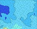 | 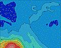 | 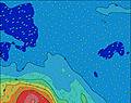 | 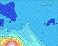 | 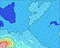 | 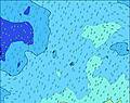 | 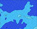 | 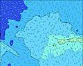 | |||||||||||||
Swell Altura (m) Direção Período (s) | SW 11 | SW 11 | SW 11 | NE 17 | NE 16 | SW 11 | SW 11 | NE 16 | NE 15 | NE 15 | NE 15 | SW 11 | SW 11 | NE 13 | NE 13 | NE 13 | SSW 11 | NE 12 | NE 12 | NE 12 | NE 12 |
Onda Gráfico | |||||||||||||||||||||
0 | 0 | 0 | 74 | 68 | 0 | 0 | 64 | 57 | 55 | 54 | 0 | 0 | 45 | 44 | 84 | 0 | 52 | 52 | 71 | 50 | |
Vento (km/h) | |||||||||||||||||||||
Estado do Vento maral cruzado-maral Cruzado cruzado-terral terral cristalino | off | cross-off | cross-off | cross-off | off | cross-off | cross-off | off | off | off | off | off | off | cross-off | cross-off | cross-off | cross-off | cross-off | cross-off | cross-off | cross-off |
Maré Alta | 8:27PM0.45m | 8:35AM0.61m | 9:01PM0.47m | 9:11AM0.61m | 9:37PM0.49m | ||||||||||||||||
Maré Baixa | 2:11PM-0.06m | 2:05AM0.01m | 2:43PM-0.06m | 2:40AM0.01m | 3:15PM-0.06m | ||||||||||||||||
— | — | — | — | — | — | 7:11 | — | — | — | — | — | — | — | 7:11 | — | — | — | — | — | — | |
— | — | 6:17 | — | — | — | — | — | — | — | 6:19 | — | — | — | — | — | — | — | 6:19 | — | — | |
mm | — | — | — | — | — | — | — | — | — | — | — | — | — | — | — | — | — | — | — | — | 1 |
Temp. °C | 21 | 21 | 21 | 21 | 21 | 20 | 20 | 19 | 20 | 20 | 20 | 20 | 20 | 20 | 20 | 20 | 20 | 20 | 20 | 20 | 20 |
Ressent. °C | 17 | 16 | 16 | 15 | 16 | 15 | 15 | 15 | 15 | 15 | 15 | 15 | 15 | 16 | 16 | 15 | 15 | 15 | 14 | 14 | 14 |
Swell 1 Altura (m) Direção Período (s) | SW 11 | SW 11 | SW 11 | SSW 14 | SSW 14 | SW 11 | SW 11 | SW 12 | SW 12 | SW 12 | SW 11 | SW 11 | SW 11 | SW 11 | SW 11 | SW 11 | SSW 11 | SSW 11 | SSW 11 | SSE 12 | S 12 |
1073 | 1035 | 1017 | 261 | 396 | 804 | 1106 | 1302 | 1229 | 1323 | 1167 | 915 | 949 | 949 | 894 | 894 | 845 | 713 | 711 | 579 | 650 | |
Swell 2 Altura (m) Direção Período (s) | SW 15 | SW 15 | SSW 14 | SSE 12 | SSE 12 | SSW 13 | WSW 12 | SSE 12 | SSE 12 | SSE 12 | SSE 12 | SW 13 | SSE 12 | SSE 12 | SSE 12 | SSE 12 | S 13 | S 13 | S 12 | SW 11 | SW 11 |
217 | 217 | 264 | 121 | 117 | 282 | 94 | 78 | 77 | 77 | 75 | 132 | 82 | 82 | 81 | 79 | 125 | 324 | 432 | 414 | 326 | |
Swell 3 Altura (m) Direção Período (s) | SSE 13 | SSE 13 | SSE 13 | NE 17 | NE 16 | SSE 12 | SSE 12 | NE 16 | NE 15 | NE 15 | NE 15 | SSE 12 | SW 13 | NE 13 | NE 13 | NE 13 | SSE 11 | NE 12 | NE 12 | NE 12 | NE 12 |
156 | 135 | 145 | 74 | 68 | 83 | 79 | 64 | 57 | 55 | 54 | 86 | 45 | 45 | 44 | 84 | 73 | 52 | 52 | 71 | 50 | |
Ondas de vento Altura (m) Direção Período (s) | — | — | — | SW 11 | SW 11 | — | — | — | — | — | — | — | — | — | — | — | — | — | — | SSE 5 | SSE 5 |
— | — | — | 963 | 804 | — | — | — | — | — | — | — | — | — | — | — | — | — | — | 69 | 110 | |
Terral ou glassy mais perto | |||||||||||||||||||||
Distância (km) | 1044 | 1044 | 997 | 997 | 997 | 4 | 4 | 1002 | 1044 | 997 | 997 | 997 | 1007 | 1007 | 999 | 1007 | 1043 | 1123 | 1148 | 1151 | 1148 |
Melhor previsões de ondas em Cook-Islands - Rarotonga | |||||||||||||||||||||
Melhor previsões de ondas em Cook Islands | |||||||||||||||||||||
Buscador de Ondas Global | |||||||||||||||||||||
- Map Icons:
 Break
Break Live Wave Height (m)
 Live Wind Speed (km/h)
 Surf Rating (10 Max)
 Ocean Swells (m)
- Wind Speed (km/h)
widget de graça do Surf-Forecast.com para o seu site
O relatório de surf / widget do tempo abaixo está disponível para incorporar em sites de terceiros gratuitamente e fornece um resumo das nossas Club Raro surf tempo. Simplesmente pegar o trecho de código html que fornecemos e colá-lo em seu próprio site. Você pode escolher seu idioma preferido e unidades métrico/imperial para o surf tempo de alimentação para atender aos usuários do seu site.... Clique aqui para adquirir o código.
 Nearest