Previsão:

Surf em Balneario Novo QuintaoPrevisão / Rio Grande Do Sul / Brazil
Atualização das previsões em hora min s Forecast update imminent
Estas são ondas em águas abertas. Nas praias as ondas geralmente são menores, especialmente em picos mais abrigados.
A temperatura do mar em Balneario Novo Quintao hoje é
22.1° C
(O que é normal para esta época do ano)Actualizações em hora min s Forecast update imminent
Sábado 06 | Domingo 07 | Segunda-feira 08 | Terça-feira 09 | |||||||||||||||||||||
| 12 PM | 3 PM | 6 PM | 9 PM | 0 AM | 3 AM | 6 AM | 9 AM | 12 PM | 3 PM | 6 PM | 9 PM | 0 AM | 3 AM | 6 AM | 9 AM | 12 PM | 3 PM | 6 PM | 9 PM | 0 AM | 3 AM | 6 AM | 9 AM | |
Avaliação (10 max) | ||||||||||||||||||||||||
Mapa da altura do Swell |    |    |    |   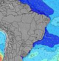 | ||||||||||||||||||||
| Maiores ondas (m) & direção (?) | ||||||||||||||||||||||||
| Período(s) (?) | 7 | 7 | 7 | 7 | 6 | 7 | 7 | 7 | 7 | 7 | 7 | 7 | 6 | 6 | 6 | 6 | 6 | 5 | 6 | 6 | 6 | 7 | 7 | 7 |
Onda (?)Gráfico | ||||||||||||||||||||||||
| 82 | 121 | 82 | 83 | 100 | 102 | 99 | 99 | 77 | 77 | 62 | 45 | 43 | 69 | 82 | 53 | 84 | 70 | 139 | 215 | 205 | 276 | 285 | 295 | |
Vento (km/h) | ||||||||||||||||||||||||
| Estado do Vento (?) onshore cruzado-maral Cruzado cruzado-terral terral cristalino | on | on | cross- on | cross- on | cross- on | cross- on | cross- on | glass | cross- on | cross- on | on | on | on | on | on | on | on | on | on | on | on | cross- on | on | on |
Maré Alta / altura (m) | 11:24AM 0.35 | 6:38PM 0.07 | 1:42AM 0.31 | 7:19AM 0.54 | 12:13PM 0.42 | 7:27PM 0.06 | 2:12AM 0.29 | 8:20AM 0.52 | 1:02PM 0.47 | 8:13PM 0.07 | 2:46AM 0.27 | |||||||||||||
Maré Baixa / altura (m) | 10:13AM 0.34 | 4:13PM 0.01 | 9:12PM 0.00 | 3:14AM 0.29 | 10:39AM 0.40 | 5:08PM 0.00 | 9:56PM -0.00 | 4:12AM 0.24 | 11:05AM 0.43 | 6:00PM 0.02 | 10:41PM 0.01 | 5:05AM 0.20 | ||||||||||||
Sábado 06 | Domingo 07 | Segunda-feira 08 | Terça-feira 09 | |||||||||||||||||||||
| Nascer do sol | - | - | - | - | - | - | 5:11 | - | - | - | - | - | - | - | 5:11 | - | - | - | - | - | - | - | 5:11 | - |
| Pôr do sol | - | - | 7:12 | - | - | - | - | - | - | - | 7:13 | - | - | - | - | - | - | - | 7:14 | - | - | - | - | - |
Chuva (mm) | - | - | - | - | - | - | - | - | - | - | - | - | - | - | - | - | - | - | - | - | - | - | - | 2 |
| Temp. °C | 24 | 23 | 22 | 22 | 21 | 21 | 21 | 25 | 25 | 24 | 23 | 22 | 21 | 21 | 21 | 22 | 22 | 22 | 22 | 22 | 22 | 22 | 22 | 21 |
| Feels °C (?) | 25 | 22 | 21 | 21 | 20 | 21 | 23 | 28 | 26 | 25 | 24 | 24 | 22 | 21 | 21 | 22 | 20 | 20 | 19 | 19 | 18 | 19 | 18 | 17 |
- Map Icons:
 Break
Break Live Wave Height (m)
 Live Wind Speed (km/h)
 Surf Rating (10 Max)
 Ocean Swells (m)
- Wind Speed (km/h)
widget de graça do Surf-Forecast.com para o seu site
O relatório de surf / widget do tempo abaixo está disponível para incorporar em sites de terceiros gratuitamente e fornece um resumo das nossas Balneario Novo Quintao surf tempo. Simplesmente pegar o trecho de código html que fornecemos e colá-lo em seu próprio site. Você pode escolher seu idioma preferido e unidades métrico/imperial para o surf tempo de alimentação para atender aos usuários do seu site.... Clique aqui para adquirir o código.
 Nearest