- Forecast
- Maps
- Live
- Weather State
- Spot Information
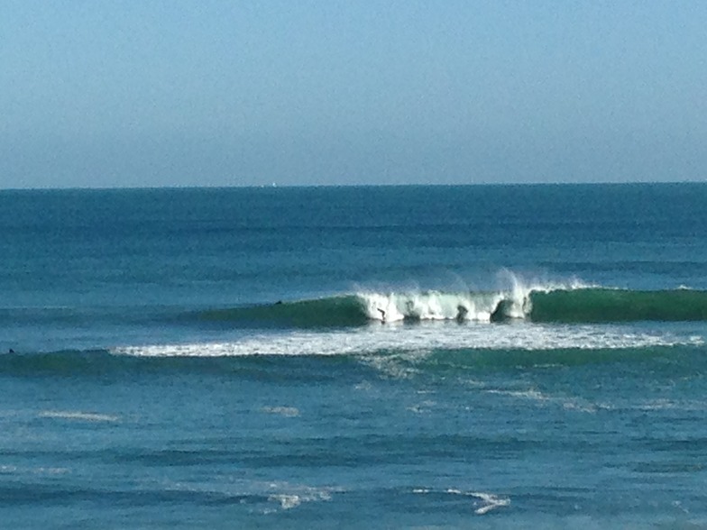
Artificial reef Previsão de Surf
/ WA – Perth City (29 breaks) / Western Australia (159 breaks) /
Surf em Artificial reefPrevisão / WA – Perth City / Australia
Domingo 06 | Segunda-feira 07 | Terça-feira 08 | Quarta-feira 09 | Quinta-feira 10 | Sexta-feira 11 | Sábado 12 | Domingo 13 | Segunda-feira 14 | Terça-feira 15 | Quarta-feira 16 | Quinta-feira 17 | |||||||||||||||||||||||||
| manhã | tarde | noite | manhã | tarde | noite | manhã | tarde | noite | manhã | tarde | noite | manhã | tarde | noite | manhã | tarde | noite | manhã | tarde | noite | manhã | tarde | noite | manhã | tarde | noite | manhã | tarde | noite | manhã | tarde | noite | manhã | tarde | noite | |
Avaliação (10 max) | ||||||||||||||||||||||||||||||||||||
Mapa da altura do Swell | 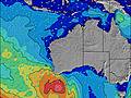 | 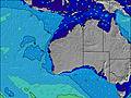 | 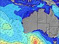 |  |  |  |  |  |  |  |  |  | ||||||||||||||||||||||||
| Maiores ondas (m) & direção (?) | ||||||||||||||||||||||||||||||||||||
| Período(s) (?) | 7 | 9 | 12 | 12 | 16 | 15 | 15 | 15 | 14 | 13 | 13 | 26 | 14 | 3 | 14 | 4 | 6 | 16 | 15 | 14 | 14 | 13 | 13 | 13 | 26 | 13 | 12 | 19 | 19 | 18 | 18 | 17 | 16 | 16 | 15 | 14 |
Onda (?)Gráfico | ||||||||||||||||||||||||||||||||||||
| Energia (?) | 766 | 2387 | 0 | 0 | 0 | 0 | 0 | 0 | 0 | 0 | 0 | 13 | 0 | 1 | 4 | 46 | 175 | 0 | 0 | 0 | 0 | 0 | 0 | 0 | 13 | 0 | 0 | 0 | 0 | 0 | 0 | 0 | 0 | 0 | 0 | 0 |
Vento (km/h) | ||||||||||||||||||||||||||||||||||||
| Estado do Vento (?) onshore cruzado-maral Cruzado cruzado-terral terral cristalino | cross | on | on | cross- on | cross- on | cross- on | cross- on | cross | cross- off | cross- off | cross | cross- off | cross | on | cross | cross | cross- on | cross- on | cross- off | cross- off | cross- off | cross- off | cross- on | cross- off | cross- off | cross | off | cross- off | cross- on | cross- on | cross- on | cross | cross | cross- off | cross | cross- off |
Maré Alta / altura (m) | 6:49AM 0.64 | 7:25AM 0.67 | 8:01AM 0.70 | 8:37AM 0.72 | 9:12AM 0.73 | 9:45AM 0.72 | 10:16AM 0.68 | 10:44AM 0.63 | 11:06AM 0.55 | 3:21AM 0.39 | 11:05AM 0.46 | 3:34AM 0.45 | 9:39AM 0.37 | 4:01AM 0.52 | ||||||||||||||||||||||
Maré Baixa / altura (m) | 4:31PM 0.11 | 4:49PM 0.08 | 5:10PM 0.05 | 5:33PM 0.03 | 5:57PM 0.03 | 6:19PM 0.03 | 6:38PM 0.05 | 6:55PM 0.08 | 7:07PM 0.12 | 7:14PM 0.16 | 6:07AM 0.37 | 7:13PM 0.20 | 8:46AM 0.37 | 6:58PM 0.23 | ||||||||||||||||||||||
Domingo 06 | Segunda-feira 07 | Terça-feira 08 | Quarta-feira 09 | Quinta-feira 10 | Sexta-feira 11 | Sábado 12 | Domingo 13 | Segunda-feira 14 | Terça-feira 15 | Quarta-feira 16 | Quinta-feira 17 | |||||||||||||||||||||||||
| Nascer do sol | 7:18 | - | - | 7:16 | - | - | 7:16 | - | - | 7:16 | - | - | 7:16 | - | - | 7:16 | - | - | 7:16 | - | - | 7:16 | - | - | 7:16 | - | - | 7:15 | - | - | 7:15 | - | - | 7:15 | - | - |
| Pôr do sol | - | 5:24 | - | - | 5:24 | - | - | 5:25 | - | - | 5:25 | - | - | 5:27 | - | - | 5:27 | - | - | 5:28 | - | - | 5:28 | - | - | 5:29 | - | - | 5:30 | - | - | 5:30 | - | - | 5:30 | - |
Chuva (mm) | - | 6 | 4 | 4 | 3 | 1 | 1 | 3 | - | - | - | - | - | - | - | - | - | 4 | - | - | - | - | - | - | - | - | - | - | - | - | 1 | 2 | - | - | - | - |
| Temp. °C | 17 | 20 | 18 | 16 | 13 | 14 | 15 | 17 | 15 | 12 | 14 | 14 | 14 | 16 | 16 | 13 | 19 | 19 | 14 | 15 | 14 | 14 | 15 | 15 | 12 | 16 | 14 | 12 | 15 | 16 | 17 | 15 | 14 | 13 | 14 | 13 |
| Feels °C (?) | 9 | 12 | 12 | 6 | 2 | 6 | 11 | 10 | 11 | 10 | 11 | 12 | 10 | 12 | 12 | 7 | 12 | 11 | 9 | 11 | 10 | 11 | 12 | 13 | 10 | 12 | 10 | 9 | 12 | 11 | 11 | 6 | 6 | 9 | 8 | 9 |
Previsão de curto prazo: Chuva intensa (total 22mm), mais intensa durante Domingo à tarde. Warm (máx. 20°C no Domingo à tarde, mín 12°C na Terça à noite). Ventos diminuem (near gales de Oeste na Segunda de manhã, vento fraco de Su-Sudeste na Terça à noite). | Dias 3-6 Resumo do Tempo chuviscos (total 4mm), principalmente caindo na Sexta de noite. Very mild (máx. 19°C na Sexta à tarde, mín 11°C na Quarta de manhã). Ventos aumentam (vento fraco de Este-Sudeste na Quarta à noite, ventos fortes de Oeste-Noroeste na Sex à noite). | Dias 6-9 Resumo do Tempo principalmente seco. Very mild (máx. 16°C na Segunda à tarde, mín 11°C no Domingo à noite). o vento será geralmente fraco. | Previsão de longo prazo: chuviscos (total 3mm), principalmente caindo na Quarta à tarde. Very mild (máx. 17°C na Quarta de manhã, mín 10°C na Terça de manhã). Ventos aumentam (calmo na Terça à noite, ventos fortes de Su-Sudoeste na Quarta à tarde). | |||||||||||||||||||||||||||||||||
- Map Icons:
 Break
Break Live Wave Height (m)
 Live Wind Speed (km/h)
 Surf Rating (10 Max)
 Ocean Swells (m)
- Wind Speed (km/h)
widget de graça do Surf-Forecast.com para o seu site
O relatório de surf / widget do tempo abaixo está disponível para incorporar em sites de terceiros gratuitamente e fornece um resumo das nossas Artificial reef surf tempo. Simplesmente pegar o trecho de código html que fornecemos e colá-lo em seu próprio site. Você pode escolher seu idioma preferido e unidades métrico/imperial para o surf tempo de alimentação para atender aos usuários do seu site.... Clique aqui para adquirir o código.
Informação sobre a previsão de Surf de Artificial reef
A previsão para surf acima mencionada para Artificial reef proporciona informações essenciais para determinar se as condições de surf serão boas nos próximos 12 dias. Um guia geral para surfar em Artificial reef pode ser encontrado selecionando a opção guia local para surf no menu cinza. Nossa previsão de surf em Artificial reef é sem igual, pois inclui a energia da onda (poder)que define a sensação real do surf, ao invés de incluir somente a altura ou o período das ondas. Se você surfa com regularidade no mesmo lugar (Artificial reef), então faça uma anotação mental da energia da onda indicada na tabela de previsão do surf a cada vez que você for lá. Em pouco tempo você talvez comece a escolher seus dias de surf baseado somente na energia da onda, combinado com nossa previsão de condições favoráveis de vento terral classificação por estrelas ajudará nisto e, com certeza, você também encontrará a altura usual de ondas e prognósticos do período das ondas em nossa previsão para o surf, assim como a quebra dos componentes do swell sob nossas opções de usuário avançadas (para revelar isto, clique no título caractere de Einstein em horários da maré).
Informações adicionais sobre perguntas frequentes a cerca nossa previsão do surf em Artificial reef podem ser encontradas embaixo da aba de ajuda no menú ao topo e também ao mover o mouse sobre as question marks na própria tabela de previsão do surf. Por favor, sempre tenha em mente que a previsão é para águas abertas próximas à costa e que fatores locais em cada surf break influenciam na real altura da onda, como o perfil da praia ou do recife, profundidades da água fora da costa e abrigo.
Artificial reef is 5 km (3 miles) from the very large city of Fremantle. If you plan a holiday in Perth City Coast, look for hotels and other accommodation in Fremantle. Fremantle has rooms for a wide range of budgets as well as cheap car hire and transport links.


 Nearest