
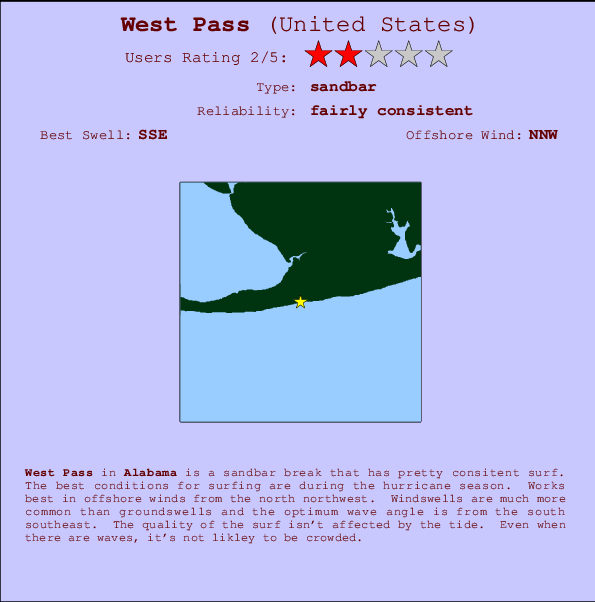
West Pass Surf Guide
West Pass in Alabama is an exposed sandbar break that has reasonably consistent surf. The favoured conditions for surfing are during the hurricane season. The best wind direction is from the north northwest. Most of the surf comes fis in the form of windswells and the best wave direction is from the south southeast. Good surf at all stages of the tide. Rarely crowded here.
West Pass Spot Info
| Type: | Rating: | Reliability: | Todays Sea Temp*: |
|---|---|---|---|
| fairly consistent | 30.1°C*ocean temperature recorded from satellite |
Surfing West Pass:
The best conditions reported for surf at West Pass occur when a South-southeast swell combines with an offshore wind direction from the North-northwest.
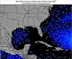
Previsão da Energia de Ondas (Força): 12hrs

West Pass Surf:
Thursday, 16 July 2026, 21:59 Local time| Quin | Sexta-feira 17 | |||
| 10PM | 1AM | 4AM | 7AM | |
| Wave (m) | ||||
| Período (s) | 3 | 6 | 6 | 6 |
| Vento (km/h) | ||||
| Estado do Vento | cross- off |
cross- off |
cross- off |
off |
- /breaks/West-Pass/forecasts/latest
West Pass Surf Guide
West Pass in Alabama is an exposed sandbar break that has reasonably consistent surf. The favoured conditions for surfing are during the hurricane season. The best wind direction is from the north northwest. Most of the surf comes fis in the form of windswells and the best wave direction is from the south southeast. Good surf at all stages of the tide. Rarely crowded here.
West Pass Spot Info
Type: Rating: Reliability: Todays Sea Temp*:  Sandbar
 2
2fairly consistent 30.1°C*ocean temperature recorded from satelliteSurfing West Pass:
The best conditions reported for surf at West Pass occur when a South-southeast swell combines with an offshore wind direction from the North-northwest.
Previsão da Energia de Ondas (Força): 12hrs
Use a aba navegação acima para ver temperatura do mar em West Pass, fotografias de West Pass, previsões detalhadas do swell em West Pass, previsões do vento e do tempo, webcams em West Pass , vento atual em Alabama com base em dados ao vivo fornecidos por estações de meteorologia e previsões da maré em West Pass. O link para os mapas do swell em United States abrirá uma imagem ampliada monstrando United States e os mares próximos. Estes mapas do swell podem ser animados para mostrar diferentes componentes do swell, energia das ondas, período das ondas, altura das ondas, assim como previsões do vento e do tempo, observações em tempo real do estado do tempo e do mar graças às bóias de United States, navios passantes e estações de meteorologia presentes na costa. Cada uma das páginas de previsão para este surf break apresenta as ferramentas do buscador global e regional para localizar as melores condições de surf na área ao redor de West Pass.
West Pass Surf:
Thursday, 16 July 2026, 21:59 Local timeQuin Sexta-feira 17 10PM 1AM 4AM 7AM Wave (m) Período (s) 3 6 6 6 Vento (km/h) Estado do Vento cross-
offcross-
offcross-
offoff - /breaks/West-Pass/forecasts/latest
- /breaks/West-Pass/forecasts/latest/six_day
West Pass Surf Guide
West Pass in Alabama is an exposed sandbar break that has reasonably consistent surf. The favoured conditions for surfing are during the hurricane season. The best wind direction is from the north northwest. Most of the surf comes fis in the form of windswells and the best wave direction is from the south southeast. Good surf at all stages of the tide. Rarely crowded here.
West Pass Spot Info
Type: Rating: Reliability: Todays Sea Temp*: Sandbar2fairly consistent 30.1°C*ocean temperature recorded from satelliteSurfing West Pass:
The best conditions reported for surf at West Pass occur when a South-southeast swell combines with an offshore wind direction from the North-northwest.
Previsão da Energia de Ondas (Força): 12hrs
Use a aba navegação acima para ver temperatura do mar em West Pass, fotografias de West Pass, previsões detalhadas do swell em West Pass, previsões do vento e do tempo, webcams em West Pass , vento atual em Alabama com base em dados ao vivo fornecidos por estações de meteorologia e previsões da maré em West Pass. O link para os mapas do swell em United States abrirá uma imagem ampliada monstrando United States e os mares próximos. Estes mapas do swell podem ser animados para mostrar diferentes componentes do swell, energia das ondas, período das ondas, altura das ondas, assim como previsões do vento e do tempo, observações em tempo real do estado do tempo e do mar graças às bóias de United States, navios passantes e estações de meteorologia presentes na costa. Cada uma das páginas de previsão para este surf break apresenta as ferramentas do buscador global e regional para localizar as melores condições de surf na área ao redor de West Pass.
West Pass Surf:
Thursday, 16 July 2026, 21:59 Local timeQuin Sexta-feira 17 10PM 1AM 4AM 7AM Wave (m) Período (s) 3 6 6 6 Vento (km/h) Estado do Vento cross-
offcross-
offcross-
offoff - /breaks/West-Pass/forecasts/latest
West Pass Surf Guide
West Pass in Alabama is an exposed sandbar break that has reasonably consistent surf. The favoured conditions for surfing are during the hurricane season. The best wind direction is from the north northwest. Most of the surf comes fis in the form of windswells and the best wave direction is from the south southeast. Good surf at all stages of the tide. Rarely crowded here.
West Pass Spot Info
Type: Rating: Reliability: Todays Sea Temp*: Sandbar2fairly consistent 30.1°C*ocean temperature recorded from satelliteSurfing West Pass:
The best conditions reported for surf at West Pass occur when a South-southeast swell combines with an offshore wind direction from the North-northwest.
Previsão da Energia de Ondas (Força): 12hrs
Use a aba navegação acima para ver temperatura do mar em West Pass, fotografias de West Pass, previsões detalhadas do swell em West Pass, previsões do vento e do tempo, webcams em West Pass , vento atual em Alabama com base em dados ao vivo fornecidos por estações de meteorologia e previsões da maré em West Pass. O link para os mapas do swell em United States abrirá uma imagem ampliada monstrando United States e os mares próximos. Estes mapas do swell podem ser animados para mostrar diferentes componentes do swell, energia das ondas, período das ondas, altura das ondas, assim como previsões do vento e do tempo, observações em tempo real do estado do tempo e do mar graças às bóias de United States, navios passantes e estações de meteorologia presentes na costa. Cada uma das páginas de previsão para este surf break apresenta as ferramentas do buscador global e regional para localizar as melores condições de surf na área ao redor de West Pass.
West Pass Surf:
Thursday, 16 July 2026, 21:59 Local timeQuin Sexta-feira 17 10PM 1AM 4AM 7AM Wave (m) Período (s) 3 6 6 6 Vento (km/h) Estado do Vento cross-
offcross-
offcross-
offoff Tide Times:
Para Bon Secour, Bon Secour River, Alabama %{dist} %{km} de %{location}
A PRÓXIMA É ÀS (hora local) faltam maré alta maré baixa West Pass Tide Times and Tide Chart
Live Weather:
At Jack Edwards National Airport Gulf Shores (Alabama), 8 km from West Pass.
light winds from the W
(km/h)
ClearAir temperature
29°CCurrent weather near West Pass
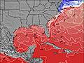
Buoy Data:
At Orange Beach Buoy, 16 miles from West Pass.
4PM 5PM 6PM 7PM Idade dos dados 4 hr 3 hr 2 hr 1 hr Altura de onda (m) 


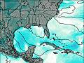
Período Médio (s) 3.2 - 3.4 3.4 Overall West Pass Surf Consistency and Wind Distribution in Julho
fotos da galeria
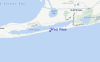
Contornos: Estradas & Rios: Escolha um spot de surf da lista 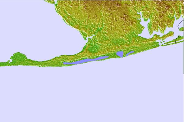

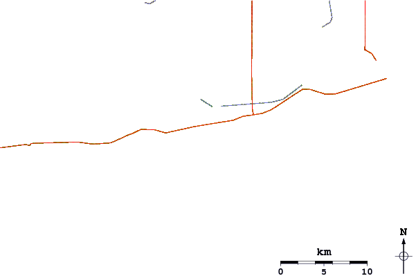
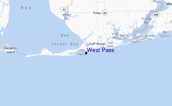
Use este mapa de relevo para navegar até Alabama surf quebras e estações que estão na área de maré West Pass
Outros Spots de Surf mais próximos de West Pass:
(Clique no nome do local para maiores detalhes)- Closest spot10 mi
- Second closest spot11 mi
- Third closest spot12 mi
- Fourth closest spot20 mi
- Fifth closest spot27 mi
Bóias ondográficas mais próxima de West Pass:
- Closest bóia ondográfica16 mi
- Second closest bóia ondográfica63 mi
- Third closest bóia ondográfica144 mi
- Fourth closest bóia ondográfica149 mi
- Fifth closest bóia ondográfica167 mi
Estações de maré mais próximo de West Pass:
- Closest estação de maréBon Secour, Bon Secour River4 mi
- Second closest estação de maréGulf Shores, ICWW4 mi
- Third closest estação de maréAlabama Point, Perdido Pass11 mi
- Fourth closest estação de maréWeeks Bay, Vermilion Bay13 mi
- Fifth closest estação de maréMobile Point (Fort Morgan)17 mi
Airports
- The closest passenger airport to West Pass is Pensacola Nas Airport (NPA) in USA, 42 km (26 miles) away (directly).
- The second nearest airport to West Pass is Mobile Downtown Airport (BFM), also in USA, 53 km (33 miles) away.
- Third is Pensacola Rgnl Airport (PNS) in USA, 59 km (37 miles) away.
- Mobile Rgnl Airport (MOB) in USA is 70 km (43 miles) away.
- Whiting Fld Nas North (Milton) Airport (NSE), also in USA is the fifth nearest airport to West Pass and is 87 km (54 miles) away.
- /breaks/West-Pass/forecasts/latest


 Nearest